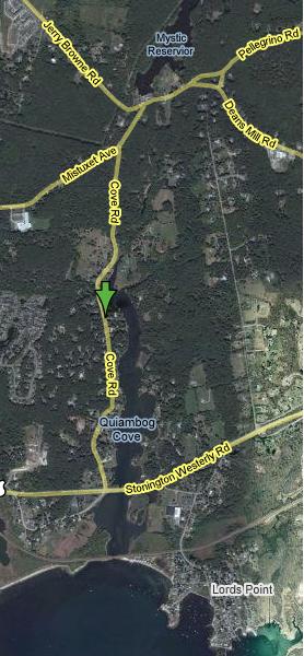
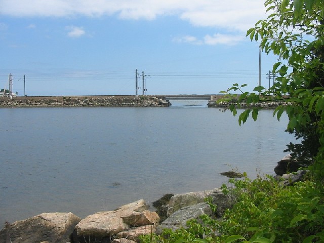
An aerial photo of the heart of the
Quiambaug
valley, marked up with street names.
|
|
|
An aerial photo of the heart of the
Quiambaug |
A History of a Valley and its Two Ridges
Bryan A. Bentz
While I've written the first round of this set of pages, I'd like it to become a wider project, involving anyone who is interested. Indeed, eventually I hope this project takes on a life of its own, and continues for many years to come, even after I can no longer be involved.
Here is a link to the slideshow page (also available below) - here to give you a taste of some of the beauty and historical tidbits in the Valley.
|
More recent tidbits:
|
|
Table of Contents |
|
| 1. What It Is and Where It Is | 15. Latimer Point (separate web page) |
| 2. Geologic Prehistory | 16. Ongoing Events |
| 3. Human Prehistory | 17. Businesses Past & Present |
| 4. The 16th Century | 18. Historic Structures (separate web page) |
| 5. The 17th Century | 19. Murders |
| 6. The 18th Century | 20. Notable People |
| 7. The 19th Century | 21. Schools |
| 8. The 20th Century | 22. Roads & Railroads |
| 9. The 21st Century | 23. Mentions in Literature |
| 10. Hurricanes | 24. Current Status |
| 11. Museums, Preserves, and other Organizations | 25. Slide Show (separate web page) |
| 12. Special Locations | 26. Oral Histories |
| 13. Cemeteries (separate web page) | 27. Concluding Remarks |
| 14. Lord's Point (separate web page) | 28. References |
The Quiambaug Valley, and "village of Quiambaug", is in southeastern Connecticut, in the town of Stonington. It runs along a north/south axis, as is typical of the glacially-carved landscape of this part of New England.
When trying to describe any valley, it is difficult to define precise borders. Does the valley include the ridges that define it? How about the "outer" flanks of those ridges, that drain elsewhere? As far as a formal definition, there is a Quiambaug Fire District, a legal entity with the power to tax, which includes most of the southern part of the valley and the ridges on either side. However, the northern part of the valley is excluded.
At the south end of the eastern ridge is a point, broken up into two sections: Lord's Point and Wamphassuc Point, though both are really finger-like extensions of the same ridge. I doubt people on Lord's Point, which has its own history and community, would consider themselves as Quiambauggers, though geographically and geologically they are - they just don't look across the wide bay to Dodges or Andrews Islands, or Latimer Point, and see that as an extension of the Quiambaug Valley. Wamphassuc Point seems to have much more to do with the water on its eastern flank, Stonington Harbor, than it does with Quiambaug Cove, as residents face the obvious accessible water; yet the ridge giving Wamphassuc Point its high ground is clearly just a little further north the eastern ridge of the Valley. Similarly, on the western side of the Valley, the defining ridge breaks into different and distinct mini-ridges, forming Latimer Point, some islands, and the peninsula leading out to Mason's Island.
My eastern boundary, going as far as Stonington harbor, has one precedent - in the book "Steamboat Days", by Fred Erving Dayton (1925) one character describes the Borough of Stonington as "bounded on the north by the red barn, on the east by Wequetoquock, on the west by Quiambaug..."
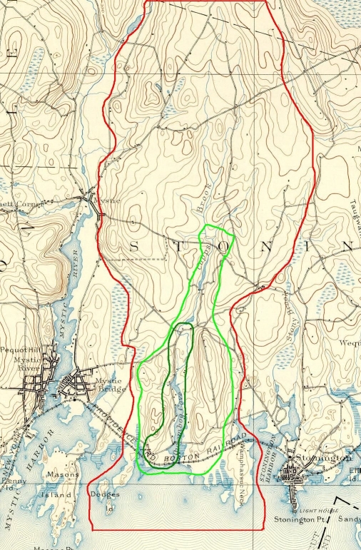 |
| The inner
dark green line is the "Quiambaug Village" The lighter green line is the obvious valley shape today The red line includes the surrounding ridges, and defines the subject (Click on the picture for a larger image). |
I intend to take the largest reasonable region as my subject, simply because it will be more interesting to do so. A marked-up topographical map may be found here:
My choice is to cover the valley and the ridges on either side of it, a region about 4 miles "tall" (north/south) and between 1 and 2 miles wide (east/west); a total of about 6 square miles, from roughly Pequotsepos Brook in the west to Collins Cove in the east.
Why write about such a small specific place?
Some physical places dramatically affect the lives of people who live there, or shape the communities that form. Consider the Nile Valley, the rhythms of which drove the formation of ancient Egyptian culture. Other spots gave rise to communities with attributes that would shape their societies; for instance, locations where trade routes crossed, or with good harbors, would grow to be cities rich in both goods and ideas - Athens, Constantinople, Rome, London. Geography established the possibilities, and placed its stamp on the communities that would arise in those locations. To understand history one has to be sensitive to geography.
So why write about an obscure and quite small valley? It's too small by far, both in area and population, to have anything like a unique or identifiable culture, or to give rise to any sort of new valuable viewpoint. It is historically insignificant by pretty much any measure. In this age of a mobile population which with few exceptions doesn't work the land or the sea, it's quite possible that there are residents who aren't even aware they're even in a valley, much less what attributes it might have.
And yet I think it does have an impact, though it's not easy to see. Lots of people here have or know a lot about boats, and are aware of the tides, storms, erosion, marine and bird life. The valley limits the size of fields and the visual landscape - one thinks in terms of hundreds of yards at most, instead of miles. Coming from the east, the town of Stonington is pretty flat until Lord's Hill (the eastern valley ridge), and the shape and texture of the land are more prominent because of that - driving over the hill one becomes aware of the view across the cove, and the sense that one is entering an area set apart. There is a logic to the placement of houses - unlike structures in flat terrain, they're not spread out all over, but are in more constrained areas, which were even more constrained when the modern bridges weren't yet in place. One is conscious of what one may see, and how it may have gotten that way.
Nature too is responsive to the shape of the valley - deer run along ridge trails, which lead to various fresh water spots. Foxes, coyote, rabbits, squirrels, raccoons all have established themselves in habitats and spaces that fit their needs, and which reflect a more immediate response to geographic features.
I've always responded to the shape and aesthetics of the world around me, to the point that if I drive through an uncared-for or artificial neighborhood I can feel slightly nauseous. I think this minor curse has also made me aware of some of the above attributes of the valley, and perhaps by assembling these materials using a geographic logic it might help clarify these points.
When I began, I thought this would be a fairly brief web page - but it has grown in a number of interesting directions, far more than I expected. As the span of the effort grew,I became concerned in a different way: was I writing too much about too little? That is, too much detail about places, events, and lives, without a unifying theme to justify the collection? One could imagine, for example, writing about the experiences of all the people whose last name begins with "A" in the state, and while there might be some fascinating anecdotes, it is unlikely that anything edifying would emerge from the work as a whole. It would remain a collection of unconnected elements.
I will leave you, the reader, to judge what the connections might be, as you read on; I have found many. Over the centuries the people here have intermarried to an extent that the ties of blood run almost completely through the area. They largely attended the same few churches and schools. They worked in the same industries: farming, net making, milling, or fishing being the major ones, and weathered droughts, bad crops, and hurricanes together. They helped create the town as a political entity. If anything, the fragmentation that I feared might doom the effort is a modern and recent phenomenon, the result of the suburbanization of a formerly rural area, so that the people who buy new homes here have little or no connection to those who first settled, cleared, farmed, or otherwise developed the land. Even so, I can't believe they are insensitive to the magnificence of a summer morning here, or the crystal clarity of a cold January sky, and though they may not have occasion to think it, I believe they know it is different than it would be in the villages of Mystic or Stonington, Old Mystic or Pawcatuck. It may take more time, but I think the spirit of the place does have an effect.
I will return to address this issue in my concluding remarks, but I should say that it has been one of the more interesting questions I've kept in mind.
Finally, it is relatively easy to find historical information centered on Mystic, Old Mystic, Stonington, or Pawcatuck - but, lacking such a well-known label, the Mistuxet/Quiambaug Valley has been no such magnet for authors, so events, people, and places are usually scattered about in histories of Stonington. I'd like to bring them together.
This is something of a work in progress. Now I know almost all webpage authors say that, but I mean it in a specific way - as people have read the site they've offered more information (much of which I haven't yet had time to include). If anyone has specific material to add, which I heartily encourage - I will publish it and credit it appropriately, or link to it if they wish to make it available via another channel.
I started out with the intent of making this a single, "flat file", so one could just read it and search in it, but as the number of topics has grown, I've had to split it across independent subpages - all of which are in the table of contents, along with what's in this file.
I've also tried to reference things as completely as I can. I can't say how frustrating I've found it reading someone assert (in, for instance, a newspaper article from a century ago) that, for instance, some person did something or other in 1680, with no further data about how this is known. Perhaps authors do this so that they must thereafter be used as the source, but the disservice seems out of all proportion to the damage done - this technique short-circuits any attempt to search out further information. As this document is progressing from a series of notes to a more complete text, it is possible that my own sources may not be quite as clear as I would like - don't hesitate to ask.
When I know of a precise location, I give the latitude and longitude to a fairly high precision, in part for those who use GPS. However, this isn't some hyper-finickyness on my part - more importantly, these values have hyperlinks to a KML (Keyhole Markup Language) file, usually ending in ".kmz" meaning that it is a compressed version, which will take you to an overhead view if you have an appropriate viewer installed on your computer, for example the free Google Earth, or Nasa's WorldWind.)
As an aside, I suggest that interested readers look into why the term "Keyhole" is used - it derives from spy satellites. One historical work that provides a fairly decent background is "The Wizards of Langley" by Jeffrey T. Richelson.
In part I include reasonably precise coordinates to avoid some of the ambiguity I find in early sources ("That was just south of where Ebenezer Smith's house used to be", with no way to ascertain who or where Ebenezer lived, particularly if there were more than one.) Also, again, the geography is key, and being able to see locations and their relationships with other features is probably the only way to really understand what was going on, or at a minimum to get a rough sense of place.
It may seem a little awkward to use at first. On my computer, which admittedly has fairly high security settings, I'm asked if I want to download the .kmz or .kml file, or to open it, or both; then, when I say "open", I get another dialogue confirming this. Even so, it is worth doing, and you should try it once or twice to become familiar with it. When it finally gets working it's great. I think as the use of these sorts of links becomes more common, the browser integration will be made smoother.

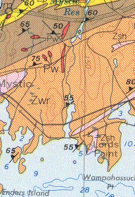
Our local rock is mainly African rock, going back to a time when the tectonic plates were pretty much together. I've put together a separate web page, Connecticut Geology, basically a mirror of a Wesleyan University site, that describes (with illustrations) how we came to be where and how we are. I strongly encourage you to look through it - just contemplating the time scale is a worthwhile mind-stretching exercise.
More recently, glaciers have carved the landscape, though the north-south valleys were to some extent already here; the glaciers rounded off hills in places, and when they melted they dropped the stone they were carrying wherever it happened to be. One other large effect of the glaciers (at times having more than a mile of ice thickness) was to plow up great masses of material in front of them. This happened several times; one such push left an east-west running mound (moraine) that became Long Island; a later glacial episode created the North Fork of Long Island, Fisher's Island, Napatree, and that more northerly east-west ridge.
Again from Wesleyan University's web site, the area of the Quiambaug valley is
Avalonian (Continental) terrane - Proterozoic Z age (600-700? million years old) metamorphosed sedimentary and igneous rocks and Middle Paleozoic age (~370 million years old) metamorphosed igneous rocks.
Gneiss (includes granite gneiss), schist and
quartzite - Hope
Valley belt, Proterozoic Z age.
 |
|
A glimpse of the Mystic Grid |
There are also some pockets of Westerly Granite, some of which have been quarried. From the BedrockGeological Map of Connecticut, you can view the Mystic Quadrangle (well worth the web detour) and see the details; it is interesting that there is a southwest-to-northeast sweep to many of the borders between bedrock types. For those of us who aren't geologists, click here (will open in a new window) for some further information on the above terms.
About 18,000 years ago, Connecticut, the Sound and much of Long Island were covered by a thick sheet of ice, part of the Late Wisconsin Glacier. About 1,000 meters thick in its interior and about 400 to 500 meters thick along its southern edge, it was the most recent of a series of glaciations covering the area over the past 10 million years. Sea level at that time was about 100 meters lower than today.12
The glacier scraped off an average of 20 meters of surface material from the New England landscape, then deposited the sediments, known as drift or terminal moraine, on Long Island, in the Sound and on the Connecticut coast. When the glacier stopped moving for a while 18,000 years ago (as movement of the glacier was in equilibrium with the melting at the southern edge), a large amount of drift was deposited, known as the Ronkonkoma Moraine, which stretches along much of southern Long Island. Later, another period of equilibrium resulted in the Harbor Hill Moraine along most of northern Long Island. The next moraines to the north were created just on and off the Connecticut coast. These moraines, created by much smaller deposits (probably from equilibrium states that were much shorter in time) are discontinuous and much smaller than those to the south (but you'll see them on a chart of Fisher's Island Sound - they'll be the interrupted horizontal (i.e., east-west) deposits, such as the clumps, and Noyes Shoal.)
Sandy plains and beaches resulted from the deposit of drift in these areas, and where the drift cover is thinnest, exposed bedrock creates rocky headlands, often with marshlands behind them.12
Another geological oddity in the area is the set of stones known as "Rocking Stones". According to information from the New London Day, there were 5 primary stones in the valley:
In the magazine "Stone", Vol. XI (June to November, 1895), there is an column section entitled "Quiambaug's Rocking Stones".
It isn't known when humans arrived in this area. After crossing the land bridge from Asia, people did reach the southern tip of South America about 12,000 BC, which is about the time the ice sheets uncovered land in this part of the world. It is possible that there were people living here as early as that time, though the evidence is scanty. The Hidden Creek site (north of the valley about 8 miles) has been carbon-dated to between 10,200 and 9,100 years ago.
What was life like? From an Overview of New England Prehistory:
One of the more classic, often-cited studies is that of Dean Snow (1980:223-232), wherein he presents a model of the Mast Forest Archaic, a widespread cultural adaptation (southern New England and beyond) that began to emerge more than 5,000 years ago in response to the appearance of mature deciduous forest habitats and coastal estuaries. The model is comprised of three critical elements: a settlement pattern of "central-based wandering," a diverse subsistence base founded upon hunting-gathering (or gathering-hunting where shellfish were available) and fishing, and a seasonal round.
4500 years ago, the sea level was about 33 feet lower than it is today; 1000 years ago, it was about 3 feet lower than it is today13. Connecticut’s climate then was similar to what it is now.
The Narragansetts, a large and well-organized tribe, were in eastern Connecticut and Rhode Island. At some point before the arrival of Europeans, the Pequots (which translated means "invaders" or "destroyers") moved in from somewhere to the north and west, and conquered much of the territory in southeastern Connecticut, possibly splitting the Niantic tribe in the process. Then the ancestors of the Mohegans separated from the Pequots; it is possible that a dispute over a sachem (a political leader similar to a chief) led to hostilities between the two tribes. Thus, their distinct cultures can trace their history back to the some of the same ancestors. The Narragansetts, Mohegans, and Pequots have been separate and distinct nations for hundreds of years, since well before 1609. The last Niantic apparently died in the 1930's.
Perhaps a little farther afield, though it's not clear how far legends extended, according to a Siwanoy (or Minnefords) Indian legend, the tribe used warriers, medicine, and magic to chase the devil out of present-day Westchester County; the devil picked up huge boulders lying there and tossed them into Long Island Sound, using them as stepping stones to make his escape. The natives named the rocks "The Devil's Stepping Stones", and Long Island Sound was known as "The Devil's Belt".
The Quiambaug valley was Pequot territory, after the Narragansetts were expelled (which occurred before the first Europeans arrived). At the south of the western ridge was a village; when construction began on the Connecticut Light & Power building in the early 1960's, the land was cleared, and many fire pits were found (this is at latitude 41°20'28.80"N, longitude71°56'23.33"W).
(In old newspaper accounts I've seen mention of wandering groups of people "camping" "in the Quiambaug", so without carbon dating one can't be sure those were indian sites, though I'd expect the land use to have been the same. The fields across the Cove to the east could just as easily have been used for more modern groups camping.)
Higher up on the western ridge, not far from running fresh water and several deer paths, a number of artifacts have been found for years, and at the coast to the south are shell middens - piles of discarded clam and scallop shells. This was likely a significant summer settlement. Being on a peninsula, it would have been relatively safe from attack, as well as having fresh water and available food. Even today people search for, and find, arrowheads and other artifacts in the nearby fields.
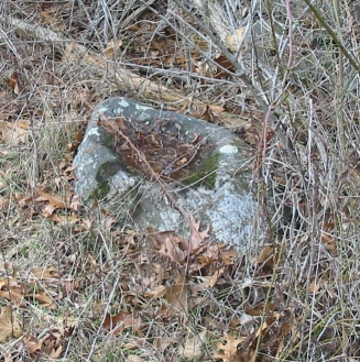 |
|
A rock hollowed out by grinding by |
A second village was on Wamphassuc point, just south of the Whiting house (latitude 41°20'25.83"N, longitude 71°55'3.45"W). One of the families that lived in that house collected a number of artifacts from that site.
It is known that top of Quoketaug Hill (on the west side of the valley, towards the north - basically just to the east of Old Mystic) was under cultivation by the indians before the colonists arrived. [insert source] From "Houses and Gardens of the New England Indians", by Charles C. Willoughby, 1906, we have this description of what it might have been like - he describes the "three sisters" technique of planting corn, beans, and squash. The general idea is that the corn will provide vertical support for the beans to climb, which the large leaves of the squash shade the ground, keeping weeds down and preventing the earth from drying out in the sun. Typically this planting was done in small hills,
.. The hills were three feet apart, and in each one were placed three or four kernels of corn and as many beans, and the earth heaped up with the shell of the horseshoe crab. Hoes of wood and clam-shell are also recorded, and Williams says stone hoes were formerly used. The Stockbridge Indians employed for this purpose an implement made of the shoulder-blade of a bear, mouse, or deer, fastened to a wooden handle. Sometimes two or three heering or shad (alewives?) were placed in the hill as fertilizer. It was the women's work to plant and cultivate the gardens and gather the crops, "yet sometimes the man himself (either out of love for his Wife or care for his Children, or being an old man)" will assist.
Great care was exercised to keep the ground free from weeds and to protect the young plants from the depredations of birds. As before noted, watch-houses were erected for the latter purpose. Williams says that hawks were kept tame about the cabins to keep small birds from the fields, and although the crows did the corn some injury, not one native in a hundred would kill one because of the tradition that a crow brought them their first grain of corn in one of its ears and a bean in the other from the field of the great god Kautantouwit in the southwest.
The corn (Zea Mays) grown in the gardens of the New England Indians was of several varieties, the colors being red, blue, yellow, and white. The modern improved varieties differ but little from these earlier kinds. The bean (Phaseolus vulgaris) was also of different colors and varieties. Josselyn writes: "They are variegated much, some being bigger a great deal than others; some white, black, red, yellow, blew [sic], spotted." This is the common field and garden bean of the New England farmer.
The pumpkin (Cucurbita maxima) and the squash (asqutasquash or isquontersquash; Cucurbita polymorphia were ... [also cultivated]
I had a note from Detective Cody Floyd of the Stonington Police Department about Quoketaug, specifically it's name; he'd been looking into it in the course of genealogical research:
It certainly would be possible that Quoketaug Hill was used as an encampment prior to the attack of the Pequot Fort. Prior to writing this I never had heard of an accurate meaning for the word, Quoketaug. In Rudy’s book he explains that it may mean, “big hill”. I have seen it spelled several different ways on numerous old documents. Some of the different spellings I have seen are, Quaquataug, Quaquetoye, and Quakatuk, Qwaquatack, among others. Icontacted Jason R. Mancini who is a Senior Researcher for the Mashantucket Pequot Museum and Research Center. Jason contacted Jessie “Little Doe” Baird, who is the Director of the Wopanaak (Wampanoag) Language Reclamation Project. Jason asked Jessie my question and she said that this phrase must mean (the inanimate thing) that measures or is used for measurement. She said that it could be spatial too. In other words, it can refer to a place that is used as a reference point on the landscape. She said that there must be something very prominent about the place that was fairly stable and apt to survive over a long period of time. She said that if I was seeing it in deeds especially, she is convinced it refers to a point of geographic reference or a standard by which other things are measured against. Jessie said that she would ideally spell it: qaqátuhak, using the orthographic system she developed for the Pequot Indians. The Wampanoag Language is one of more than three dozen languages classified as belonging to the Algonquian language family. It was the first American Indian language to develop and use an alphabetic writing system. The primary reason for the development of an alphabet was the goal of the missionaries, arriving from England in the early 1600s, to convert the Wampanoag to Christianity. Religious documents began being put to press in the 1640s and the first complete bible printed in the ‘New World’ was published in 1663 in the Wampanoag language. It would not be long before the Wampanoag would use this medium as the principal means of communication with European newcomers throughout New England. The Wampanoag also used the written document to record personal letters, wills, deeds, and land transfers amongst each other and between communities. Wampanoag literacy would rival that of English during the 18th century. The language enjoys the largest corpus of Native written documents on the continent.
An interesting note is that the god Kautantouwit mentioned above was located in the southwest; I have heard that this was because that's the prevailing direction of the warm summer wind. For this reason burials were faced in that direction as well.
 |
|
|
The indian languages spoken in this area (Pequot, Mohegan, Narragansett, etc.) were all in the Algonquian (Algic) family. Algonquian is distinct from Algonquin, a specific language in the family. The term "Algonquin" derives from the Maliseet word elakómkwik, "they are our relatives/allies"15. Algonquian languages are apparently descendants of Proto Algonquian, which may have been spoken in the area between Georgian Bay and Lake Ontario, though recently claims have been made that it originated in Montana or Alberta, and has ties to languages in California (Wiyot and Yurok).
Algonquian languages have some interesting features - for instance, nouns have two genders (for lack of a better word), animate and inanimate. Animate nouns are generally used for people, animals, some plants, objects which might contain spirits (e.g. the sun or moon); everything else is inanimate, though sometimes this breakdown isn't as rational as it sounds. Animate nouns have plurals ending in /-ag/, inanimate ones take /-an/ (the vowel may not always be an "a", though.) Nouns may take prefixes and suffixes to indicate possession.
Verbs are central to the languages, and may indicate qualities and aspects of things (essentially replacing adjectives and adverbs). Verbs take prefixes and suffixes based on who is performing the action, whom the action affects, tense, etc. This is one of the more striking features of the languages - longer, virtually compound forms of verb convey a lot of the meaning of a sentence.
In some dialects there is an "obviative" category, which applies to both nouns and verbs. It distinguishes between two third persons in a sentence, e.g., "Sam found Fred". One of these will be considered the main person (called the "proximate", as if nearer the speaker), and the other is secondary and "obviative". This not only may convey some subtlety of meaning, but it helps if word order isn't enforced; for instance, if the previous example where given in this order: "found Fred Sam", the category and the necessary inflections it introduces would clarify the action of the verb.
Verbs may occur in one of several forms, indicating straightforward action, a question (or a subordinate clause), subjective (hypothetical), or participle, as well as in one of several imperative forms. Yes/No questions may be in a special form.
This is just a very brief mention of some of the elements of Algonquian languages (particles are also a key element, for instance); indeed the grammatical richness is likely fully equivalent to what is found in English or other Indo-European languages. I would like to work out as comprehensive grammar and vocabulary of the local Pequot/Mohegan, based upon solid historical sources - but that's another project, one I've had on the back burner for years. If you are interested in the subject, I would recommend as starting places Roger Williams' "A Key Into the Language of America", which concerns itself with the languages he knew from Massachusetts to Rhode Island (though primarily around the Providence, RI area), and also John Eliot's Bible, which he wrote in the Natick dialect (Massachusett and Wampanoag); his Indian Grammar is also worthwhile (and has been reprinted from time to time). In both there is the shadow of an underlying idea that perhaps the Indians were descended from the lost tribes of Israel, and similarities in grammar and vocabulary between the local languages and Hebrew were sought for; in light of modern knowledge of migrations and languages this is not at all realistic, so one wonders if it colored these works in any unfortunate way.
The pronunciation of various words is also difficult to be certain of; for example, the colonial transcription problem was as if an American were trying to write down what a Chinese speaker were saying. Not only is the writing system not quite right for the sounds in the language, but the listener hasn't been brought up or trained to hear a number of the phonetic elements (phonemes, tonemes, use of duration, etc.) of the foreign tongue, so no matter how careful in documentation, there will be some error.
When born, the human child can distinguish all of the 600 or so human lingual sounds. In a monolingual home, by the time they are four, they are down to the 50 or 60 used in their language.
One minor advantage we have in this regard is that the Algonquian speakers had contact with the British, French, and Dutch, so we have evidence about pronunciations from writers (and more importantly, listeners) in those three modestly distinct languages. How much of the differences are due to the differing abilities of the listeners, and how much are due to variation in dialect, we may not be able to determine. (For an example of how one would encode the phonetic information, take a look at the International Phonetic Alphabet.; by itself this problem is an interesting subject - it is amazing how wide a variety of sounds human speech has used, such as the Khoisan clicking languages. There have been papers that suggest that the first human languages were clicking languages, but I can find none accessible without subscription to link to - see for instance this Complexity Digest reference.)
I gave a short talk in early 2012 on Indo European and Algonquian, the Indo European part being intended as a more familiar introduction to the kinds of things that might be deduced from a language. A .pdf of the talk is here. It has a bit more detail on the linguistic structure of Algonquian.
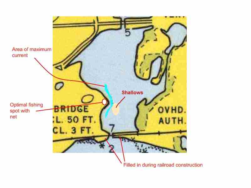
From Stonington's Native American Names, by John Hinshaw, the name "Quiambaug"'s origin is:
Qui'ambog: "Place to take fish with draw nets." Quanabog or Quaiombog (Manasseh Minor, 1704). Name of cove on Rte 1.
I think this probably referred to a location where large rocks jut out to the deeper, fast current in the lower cove, which would be an excellent place to net fish. This is now between the railroad bridge and the Route 1 bridge, which of course have changed the cove quite a bit.
 |
 |
 |
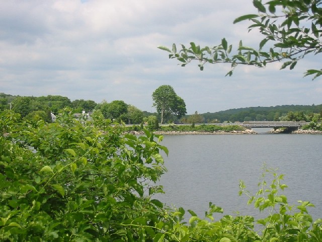
| Looking North from the rocky point labeled as 'Optimal fishing spot' on the map above - the site of the original Miner farm is where the house in the photo is. Part of the cove wraps around to the west (left), making this point a bit of a promontory - a great place to fish from. | Looking South from the same
location - the main channel passes right near this point, a few feet to the left. |
from the same source is another place name associated with the valley, at least with its eastern ridge:
Waumphas'suc or Wamphas'set: "Swamps, marsh, bog or wet meadows." Neck of land on the west side of Stonington Harbor.
On the west side of the valley, there is a plain (largely overgrown), from the Brustolon auto dealer to Hewitt Rd (at the Mason's Island light), and extending northwards almost to Mistuxet Ave. One source (Wheeler) says the original name of this was "Que-an-te-quahood". I have no idea (yet) what that means, and to me at least the ending is a bit suspect. I include it here because it seems to be an almost entirely forgotten name.
Finally, the northern brook that ran down through what is now the reservoir in the northern part of the valley was known as the Mistuxet Brook:
Mistucksuck: "Mistick brook" or "At little Mistick." A brook about two miles east of Mystic River, running to the head of Quiambaug Cove.
Unfortunately, "Quiambaug" is not the most melodious of names - perhaps nothing suggestive of "bog" is. I don't like this place because of its name, but it would seem a shame to change it after a few hundred years. I have one naming convention I sometimes use, which I sort of stumbled upon growing up on Cove Road. Our house there is (well, was) at the base of the western ridge, and looks across the cove to the eastern ridge - and when the sun comes up in the morning, that eastern ridge is dark and in shadow, while the western ridge is all aglow with golden early morning light. I just called our ridge the "morning ridge", and, as the same effect occurs in reverse in the evening, the eastern ridge became the "evening ridge" (in a few older sources, this is known as "Palmer Hill"). This is the sort of thing that is really obvious if you're here, but might not be if you're not used to north-south valleys. I may use these terms elsewhere in this page, as writing "the eastern ridge of the Quiambaug Valley" gets a little tiresome, both for writer and reader.
There have been a few names for the valley, and/or the stream that flows into it from the North. The current name of the stream is Copp's Brook, but as above was originally known as Mistuxet Brook; indeed when Thomas Minor moved to the area he "moved to Mistuxet" (Wheeler, pg. ). I've also found references to it as "Caulkin's Brook", notably in a paper by Richard C. Wheeler, which he read to the Westerly Business Men's Association on January 21, 1886, entitled "Historical Sketch of Stonington & Westerly". This is why I've changed the title from "Quiambaug Valley" to "Quiambaug/Mistuxet Valley".
I was told that a family (the Olmsteads) at the head of the Cove had found a stone with symbols carved on it. They donated it to a professor at Connecticut College, who died not long afterwards. No one there knows what happened to it. I could not locate an image of it either.
The intriguing thing is that, given that the local indians didn't do pictographs, or have written language, it might be foreign in origin - I would think most likely Viking. As I note elsewhere in this document, the stream at the head of the Cove is one of the most accessible sources of fresh water for seafarers, which might explain why Vikings may have visited. Viking artifacts have reportedly been discovered further south in Niantic Bay.
There were sporadic contacts between Europeans and Indians in New England in the 16th Century, though the documentation is sparse.
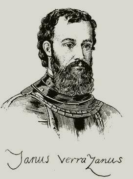 |
|
Giovanni Verrazano |
In 1524 the Florentine explorer Giovanni da Verrazzano explored the east coast in the ship La Dauphine, entering New York harbor.
Sailing further east, Verrazano and his men then encountered Block Island and Narragansett Bay. The local Wampanoag people (New England Algonquians) were also friendly, welcoming them with food and escorting La Dauphine to the more sheltered Newport Harbor. Here, the ship anchored for two weeks, where the crew traded with the Wampanoag while awaiting
better weather.6
It's hard to believe he wouldn't have looked in a bit at the eastern end of Long Island while sailing to Block Island.
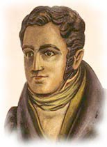 |
|
Bartholomew Gosnold |
Exploring the Gulf of Maine in 1602, Bartholomew Gosnold (who later named Cape Cod, and remained for a time on Cuttyhunk Island) met Indians who used leather square sails in their canoes, which could be raised and lowered as those on square-rigged European sailing ships. Gosnold found the people living there were already using European goods. John Brereton, a member of Bartholomew Gosnold's 1602 expedition to the Maine coast reported:
"...six Indians in a baske shallop with a mast and saile, an iron grapple, and a kettle of copper [who] came boldly aboard us, one of them apparrelled with a waistcoat and breeches of black serge, made after our sea fashion, hose and shoes on his feet... from some words and signs they made [we concluded] that some baske or [other vessel] of St. John do Luz [had] fished or traded in this place."5
It could be that the Indians had traded with the Basque fishermen (who spent time on the Grand Banks) for their goods, or had interacted with Europeans settling in the St. Lawrence Valley - which had been explored as early as 1499. It is also possible that the occasional shipwreck introduced Europeans to Indians as well. Or it could have been some mixture of these reasons. Gosnold was a prominent figure in the establishment of Jamestown, Virginia, where he died; his grave may now have been found.
Some of the Europeans who visited New England in the 16th century had heard tales of a great Indian city and region called Norumbega, and some of the early explorers searched here for the mythical city of that name. This involved interacting with the tribes as much as exploring the coastline.
I think that this fragmentary history disguises an important point: by the time serious settlers arrived in New England, the Indians had had experiences with Europeans for perhaps 100 years or so - and this experience was that Europeans visited in small numbers, perhaps traded a bit, and then left. As more Europeans gradually entered the area, the nature of the settlement going on probably seemed like more of the same sort of interaction, not as the beginning of an influx of permanent settlers.
In 1614, Adriaen Block made his fourth voyage to the lower Hudson in the Tyger, accompanied by several other ships equipped for trading. While moored near southern Manhattan, the Tyger was accidentally destroyed by fire.
In 1916, workmen uncovered the prow and keel of the Tyger excavating a new station for the New York City subway near the intersection of Greenwich and Dey streets - the area having been since filled in with landfill). Portions of the ship were removed and are (or were) preserved in the Museum of the City of New York. The remainder of the ship still rests approximately 20 feet (6 m) below ground, due east of the former site of the North Tower of the World Trade Center.)
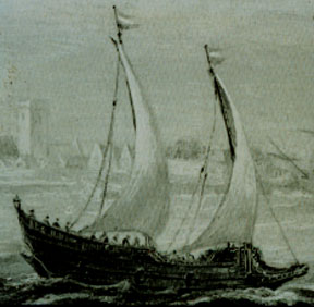 |
|
The Tyger |
 |
|
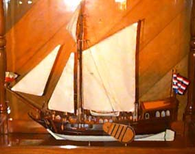
A model of the Onrust |
Over the winter, he and his men, possibly with help from the Lenape Indians, built the 42-foot 16-ton ship, the Onrust (meaning Trouble, or Restless).
From the History of the City of New York:
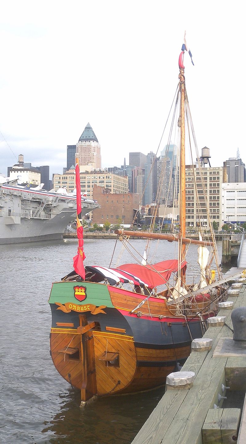
In this Block explored the East River and was the first European to navigate the Hellegat (now "Hell Gate") to enter Long Island Sound. He visited the Housatonic River and the Connecticut River, which he traveled at least as far as present-day Hartford, sixty miles upstream. He then went on to chart Block Island and Narragansett Bay; he may be the one who named the area "Roode Eylandt" after the red (Dutch roode) color of its soil. He met one of the other expedition ships at Cape Cod, and left the Onrust behind before returning to Europe. (New Netherland Routes, Inc., a non profit organization in Schenectady, NY, is currently building a replica of the Onrust using authentic 17th Century Dutch ship building techniques, recently rediscovered by the organization's master shipwright.) As of now it looks like they've succeeded:
 |
|
Onrust replica docked in Manhattan |
In the course of this trip he did explore Fisher's Island, which he named "Vischer's Island" after his first mate. That island was called "Munnawtawkit" by the Pequots, possibly meaning "planting fields" - a name which also seems to be the root of "Montauk". Coming around to the north side of the island, where the harbors are, would have put him within sight of the (relatively large) extended mouth of Quiambaug Cove, the bay from Dodges and Andrews islands to the fingers of Lord's Point. This map by Block shows that he was inshore enough to round Sandy Point and explore the Pawcatuck River - so it is likely that he was the first European to visit the area.
 |
| The red points illustrate the general sweep of the coast
that creates a welcoming and quite large apparent bay at the mouth of Quiambaug Cove. While it's noticeable on the map above, it is even more striking when approaching from the water. |
He may have even spent a little time in the valley - it is one of the more convenient places to acquire fresh water. One could do that at the head of the Mystic River, but that's quite a ways inland, and shallow enough that much of the trip would have to have been by small boat; or possibly at the northwestern part of Stonington Harbor, coming in along Wamphassuc Point to where Sylvia's Pond drains in via Quanaduck - but this is much less obvious a location when viewed from the water. The Quiambaug Valley sort of draws one in with a large apparent bay, leading in to a promising north/south tidal cove - at the head of which is fresh water. It'd be great if some archaeological evidence turned up as to the early visitors who might have watered there, but it is very unlikely.
A map based upon Block's chart was published by Willem Janszoon Blaeu, entitled "Nova Belgica et Anglia Nova", in 1935; you may view it here (394 KB) . It covers the coast from Virginia up to New France; if you look closely, you can see Fisher's Island, and the distinctive hook of Sandy Point; the Quiambaug Valley appears on it distinctly as a green valley to the left of the word "Poqusio o", which word I can't make out clearly. The easiest way to find it on the map is to identify the Thames River (one river "down" from the Connecticut River), then find the Mystic River (which has a notation I can't make out; possibly in part "Sicanemus" the Indian name for the Mystic River10, page 5), and then move further down to the Quiambaug Valley. Below that is Stonington Harbor, pretty much in line with Sandy Point.
The Mashantucket Pequot Museum and Research Center has a re-creation of a 16th century coastal Pequot village - it's probably very much like what the life at the Quiambaug summer village was like in both the 16th and 17th centuries, if you ignore the Potemkin Village aspects of their reconstruction.
In 1605 Captain George Waymouth of England observed indians whaling off of Massachusetts and/or further north, saying:
One special thing is their manner of killing the whale ... they go in company of their kings with a multitide of their boats, and strike him with a bone made in fashion of a harping iron fastened to a rope... then all their boats come about him, and as he risith above the water, with their arrows they shoot him to death"
Manasseh Minor records whaling in the area, with boats being damaged by whales, and "whale at wadawanuk" on the 10th of March, 1702/3. The amount of meat and fat provided by a single whale must have been a major boon to the indians.
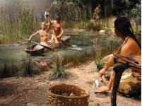 |
| Click on the picture for more information on the Pequot Village reconstruction |
From about 1620 onwards the Pequots were involved in trade with Europeans (primarily the Dutch and English), involving both fur and wampum. The Dutch began settling as far east as the Connecticut River, and there seems to have been a bit of contention between the Dutch and English over both territory and trade.
A smallpox epidemic in 1633/1634 killed thousands of Indians in southern New England.
The Pequot War (1636-1638) vastly diminished the Pequot tribe's strength and influence. The origins and conduct of the war are too substantial to go into here; a good summary may be found in Wikipedia's entry on it or www.pequotwar.com. One of the key events was the attack and destruction of the Pequot fort in Mystic (about 2 miles west of the Quiambaug valley) by John Mason on May 26, 1637. Surviving members of the tribe later scattered, some joining other indigenous settlements. A remnant continued to live in Connecticut.
Not long after these events, settlers began to arrive in the area. One of them was Thomas Minor, who is considered one of the four founders of the Town of Stonington. In 1653 he bought the land in the Quiambaug from Cary Latham of New London. He lived in his house there (latitude 41°20'33.11"N, longitude 71°56'15.83"W ) with his wife Grace Palmer, along with 6 sons and 1 daughter: John, age 16, Clement, age 14, Thomas Jr., age 12, Ephraim, age 10, Josiah, age 8, Manasseh, age 5, and Ann, age 3.3
He had intended to live in Wequetequock, where he moved to in 1652 and built a house on the east side of the cove. At about this time Walter Palmer bought 300 acres of land on the east side of the cove from Governor Haynes, and this was found to include Thomas Minor's house. They arrived at an agreement - Palmer moved into Minor's house, and Minor built his new house in Quiambaug. If it hadn't been for the mixup over ownership of the land, the Quiambaug Valley might not have been settled for some time.
From the Stonington Historical Society's web page about the founders of Stonington (one of whom was Thomas Minor):
Thomas Minor was born in 1608 in Chew Magna, Somersetshire, the son of Clement Minor. As a young man he sailed on the Lyons Whelp and landed at Salem. After several moves he settled in Charlestown, where he became a founding member of the First Church in 1632. He married Grace Palmer, daughter of Walter Palmer, and they soon moved to Hingham, where they raised five children. After 14 years in Massachusetts the family joined John Winthrop, Jr., in the settlement of Pequot (New London) in 1646. There he held important offices, most for several terms: assistant magistrate, sergeant in the New London Train Band, New London deputy to the Connecticut Court, and judge.
The diary of Thomas Minor is a lasting memorial. Although the entries are terse and never give details, they do give us a glimpse into his daily life and community activities. He records many births, marriages, and deaths among his neighbors. He meticulously records the day of the week, the number of days in the month and the year, for no doubt this served as his only calendar. He entered the date when a field was planted and its yield, for this would guide him in his planting the following year; unusual weather conditions such as "a great snow" or "bitter cold" made his diary truly his farmer's almanac. The death of his 21-year-old son is reported in simple and unemotional language, though it must have caused him considerable pain. He makes brief notes of some of his financial transactions. It is a great treasure.
He was elected Stonington deputy to the General
Court four times, town clerk twice, and selectman nine times. He was often asked to participate in Indian negotiations and was constantly required to lay out boundaries for land grants. In his diary he wrote:
The 24th of Aprill, 1669, I Thomas Minor am by my accounts sixtie one yeares ould I was by the towne and this year Chosen to be a select man the Townes Treasurer The Townes Recorder The brander of horses by the General Courte Recorded the head officer of the Traine band by the same Courte one the ffoure that have the charge of the milishcia of the whole Countie and Chosen and the sworne Commissioner and one to assist in keeping the Countie Courte.
He was the chief military officer and in 1676, when King Philip's War started, Lieutenant Thomas Minor, then 68 years old, picked up his musket and marched off to battle accompanied by several of his sons.
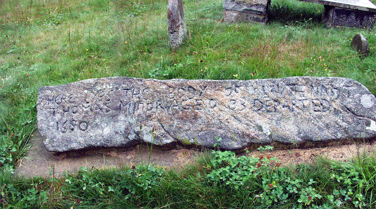
Minor lived in Stonington thirty-eight years, much longer than any other early settler, dying in 1690 at the age of 83. Two hundred years after his death Grace Wheeler visited the site of the Minor homestead and found a little hollow in the ground, a few old stone steps, and a row of lilacs which could have been planted by Thomas himself. Those lilacs would be a fitting memorial for a man who dearly loved his orchard and his plantings.
(There is another house in roughly the same location now, at the corner of Cove Rd. and Route 1).
He likely was a Puritan, as John Winthrop was, as well as his fellow settlers in New London. He must have been a tough old bird to march of to war when nearly 70.
Perhaps the only direct source of information about the Quiambaug Valley in the 1600's is the Diary of Thomas Minor. From the introduction to the 1899 edition (reprinted in 1993), pages 3, 4:
The Diary has been handed down through successive generations remaining on the old Thomas Minor homestead property at Quiambaug, in the town of Stonington...
The writer of the Diary, Thomas Minor, came from Somersett County, England, on the good ship Arabella [a matter of dispute - Ed.], which landed at Salem, Massachusetts, the 14th day of June, 1630. He sterling qualities placed him in the position to at once become a prominent figure in the affairs of the Colony...
But it is after he has determined to settle permanently at "Quiambaug", on lands which he has acquired partly by grant, because of valuable services with the Indians, during the year 1653 or 1654 that he takes up the Diary and carries it on faithfully till July 26, 1684.
To give you a flavor of the diary, here is an entry for 1654 (spelling, punctuation as in the original):
The first month is march .1654 and hath .31 days wensday the first friday the third John went to Coneticut & tusday the .7. I made an End of hewing of timber at the mill brooke watch came backe from Coneticut and wensday the eight I begun to plow the wheat land and monday the .13. I made an End of sowing pasnepes and monday the .22. I looked for the swine and wensday .29. I vewed Cary lathams farm and friday .31
The above entry represents one month. It is somewhat difficult to track in detail what is happening in the diary - places aren't identified in a recoverable way, and it is in many ways a listing of agricultural highlights, with occasional visitors or other events mentioned. It does give some picture of local life in places, though; for instance:, from pages 8-9:
Sabiantwosucke promised the .30. of desember befor mr stanton and tomus shaw to make Watch a canoow for that which I had and to bring me six pecks of nunup (Indian word for beans).
Some extended quotes may be found here, which provides a complete text. There is an interesting analysis of his diary in "By Nature and by Custom Cursed: Transatlantic Civil Discourse and New England Cultural Production, 1620-1660", by Phillip H. Round, Tufts University, starting on page 99. If this link is still valid, you may find this here.
One thing I found a little surprising in the diary was the prickly nature of the relationships between the settlers; at some points they were suing each other over matters, at others supporting each other in various ways, or cooperating in politics.
From a Carol Kimball article "The mysterious Indian conspiracy of 1669 started with rumors":
..Disquieting rumors of a supposed Indian uprising led by Ninigret, the sachem of the Rhode Island Nehantics, worried the settlers in eastern Connecticut. Friends in Rhode Island and others from Montauk on Long Island warned them there was trouble in the air...
Apparently the unrest began in 1669 in early winter at Robin's Fort Hill in Groton, when Robin Cassasinamon, the Pequot sachem, held a great dance in the Indian fashion. Guests included Uncas, sachem of the Mohegans, and Ningret, with their followers.
Cassasinamon had explained that the indians intended to do no harm to the English, but Thomas Stanton showed up and demanded Ninigret. Cassasinamon paid Stanton a great deal (20 lbs) of wampum to leave.
... but in late spring and summer the rumors began. One Thomas Edwards testified before Thomas Minor of Stonington and James Avery of Groton that Ningret was about to build three wigwams to host a great meeting of local Indians, including those from Block Island, the Pequots, Mohegans, Wampanoags, and Mohawks, "and they were minded to fight."
The colonists made preparations; one of them was
.. at a Stonington town meeting held on Jlu 9, it was voted that "Thomas Minor shall receive all the arms and ammunition that Quaquatage Indians do or shall bring to his house." He was to keep them until the Town saw fit to restore them to the Indians. ... Minor later reported that he collected 18 guns from various Indians along with powder horns and bags, but "no pistols".
No report of Capt. Wait Winthrop's session with Ninigret has yet been found, but their meeting must have been successful, for the feared uprising never took place. In fact, a few years later, the Connecticut Indians became strong allies of the English during King Philip's War in 1676.
(At the end of that war the Narragansett chief Canonchet was taken prisoner, brought to Anguilla in Stonington, and executed.)
Thomas fought in the Indian wars in 1675 and 1676, (being a "lieutenant or captain" in King Philip's War) when he was 68 years old; he continued to farm into his 76th year. From an article by James Cortese, he was a Puritan, and a book about the Miner family states that "he was a friend of John Winthrop Jr., and joined Winthrop's colony of Puritans in the settlement of New London.
On October 22, 1667 Thomas Minor set off driving a mixed herd of cattle via Narragansett and Providence to Boston. They spent a night at "Wilxon's near the lead mine," where a thunderstorm killed 3 pigs. At this time by order of the General Court all Stonington cattle were branded with the letter "K", as there was much trouble with rustlers.
|
Thomas Minor and his wife
Grace Palmer's wolfstone in Wequetequock cemetery |
|
 |
 |
|
Thomas Minor's wolfstone marker: |
The other side: Grace Palmer: |
| |
|
According to a Carol Kimball article, one of his descendants was William C. Minor, the madman of "The Professor and the Madman: A Tale of Murder, Insanity, and the Making of the Oxford English Dictionary", by Simon Winchester (Harper Collins 1998). This Minor was a resident of the Broadmoor Asylum for the Criminally Insane (in 2019 a movie was made about him, "The Professor and the Madman").
William had been born on the island now known as Sri Lanka, the son of missionaries from New England. At age 14 he was sent back to the US, and he finished his education as a surgeon at Yale University in 1863. At this point he joined the Union Army as a surgeon and served at the Battle of the Wilderness in May 1864. One of his duties was to punish runaway soldiers by branding them with a "D" for "deserter". At the end of the war Minor had duty in New York City, and spent a lot of time with prostitutes. This behavior earned him a transfer to the Florida Panhandle; by 1868 his mental state was such that he was in a lunatic asylum in Washington, DC.
In 1871 he moved to the slum of Lambeth in London, where he fatally shot George Merrett, whom he'd thought had broken into his room. He was tried and found not guilty by reason of insanity, and sent to Broadmoor. He wasn't considered dangerous, and could acquire books. Upon hearing of the need for volunteers, he devoted much of his remaining life to systematically working through his library and compiling lists of words and their frequencies. The editor of the OED visited him and they became friends.
He returned to the US, and was diagnoses with schizophrenia. He died in 1920 in New Haven.
 |
|
The Denison Homestead, now a museum, on the site of the "grate manor house" at Pequotsepos |
In 1654 Captain George Denison moved from New London to "a lean-to surrounded by a palisade at Pequotsepos, bringing his wife, Ann Borodell, and his children, Sarah, age 13; Hannah, 11; (daughters of his first wife); John, 8; Ann, 5; Borodell, 3; and the infant George Jr."3. While much of his land may be said to be in the Pequotsepos valley, his later house is certainly on the east side of that, and thereby is within our area of interest. About the same time he was fined 24s. for selling rum to one of his Indian friends. Also in 1654 "A pyne neck by the broad cove" (Lord's Point) was granted to Isaac Willey, who sold it within the year to Amos Richardson. Wampassock (550 acres) was granted to Hugh Caulkins, who later sold it to John Winthrop, Jr.
On October 15, George Denison took a petition by horseback to the Governor and Magistrates of Massachusetts "that you would please to accupt us under your Government & grant unto us the liberty and priveledges of a Townshipp.", as Connecticut was balking at allowing the creation of an independent town. He was warmly welcomed, not only because he'd fought with Cromwell in the English Revolution, but he was also the brother of the husband of Gov. Dudley's daughter, and Massachusetts was eager to expand its claims. On October 21, Massachusetts made formal claim at Hartford to the land east of the (now) Thames River.
On June 30 the population of Stonington drew up a sort of "Declaration of Independence" ("History of the First Congregational Church, Stonington, Conn., 1674-1874, by Richard Anson Wheeler, page 32, available at books.google.com):
|
Asotiation of Poquatuck Peple: Whereas thear is a difference between the 2 Collonyes of the Matachusetts and Conecticoate about the government of this plac, whearby we are deprived of Expectation of protection from either, but in ways of Curecy, & whereas we had a command from the generall Court of the Matachusetts to order our own business in peac with common consent till further provition be made for us, in obedyience to which commuand we have addresses or selvs thearunto, but cannot atain it in regard of soomm distractions among ourselves, and thear hath bene injurious isolencys done unto soom persons, - the cattell of others threatened to be taken away, - and the chattell of soom others already taiken away by violent. We haveing taken into consideration that in tymes so full of danger as theas are, unyon of our harts and percons is most conducing to the publick tood & safety of the place - thearfore in pursuance of the same, the better to confirm a mutual confydence in one another & that we may be perservedin righteousness and peac with such as do commenc with us, & that misdemeanors may be corrected and incorrygable persons punished: - We hose names are hereunto subscribed to hearby promis, testify & declare to maintain and deffend with our persons and estait the peac of the plac and to aid and assist one another acoarding to law & rules of righteousnessacoarding to the true intent & meaning of our association tull such other provition be maide ffor us as may atain our end above written, whereunto we willingly give our assent, & nether ffor ffear, hoape or other respects shall ever relinquish this promis till other provition be maide ffor us. And we do not this out of anny disrespec unto either of the aforesaid governments which we are bound ever to honnor, but in the vacancy of any other aforesaid. George Denison Moses Palmer Thomas Shaw Walter Palmer Nathaniel Chesebrough Tho. Stanton Elihu Palmer Willm Chesebrough Thomas Stanton Samuel Chesebrough Elisha Chesebrough
|
George Denison and William Chesebrough were elected commissioners to conduct the affairs of the town. So, for a brief time in 1654, the area was in word and deed independent, led by George Denison. However, in October Massachusetts accepted the area as a town ("Southertown"), and George "ruled with a high hand"3, pg. 14, granting lands to friends without any respect for Connecticut deeds - 800 acres was even deeded to Harvard College (I have no information if this included any land in the Quiambaug valley, though that seems likely). This was all nullified in 1662 when John Winthrop, as agent for Connecticut, received a new charter setting the Pawcatuck River as the eastern boundary of Connecticut, restoring Stonington to its current state. George Denison never seemed to quite give up - in 1664 he was brought into court for marrying a couple under his Massachusetts commission.
In 1663 George Denison built his "grate manor house" at Pequotsepos (latitude 41°21'47.29"N, longitude 71°56'51.08"W). His grandson would build a grander house on the same site, after the earlier structure burned to the ground. This newer house still stands - it is a museum, operated by the Denison Society. You may even take a virtual tour.
From the Genealogy of Will & Sandi Pearson web page :
The authorities in Connecticut welcomed back all the inhabitants except Captain Denison. He had been the ringleader in Massachusetts, so they not only refused him civil rights but fined him £20 for “illegally” performing marriages. These odious distinctions made the Captain boiling mad. He refused to pay the fine and brazenly performed two marriages, one of them of his own daughter. They then raised his fine to £100, a vast sum in those days. The Captain was an important figure, with many friends, and accordingly after two years the Connecticut General Court remitted its un-collectable fine, and forgave him.
...Almost continuously he was elected to represent [Stonington] at the General Court, until the second session of 1694 during which he died on active duty in Hartford and was buried there. In his will, written on January 24, 1693/94, the land was given to his children and grandchildren, thus it split up much of the homestead. The old home called Pequotsepos Manor burned in 1717 on the eve of the wedding of George Denison 3rd , the grandson who had inherited it and the adjoining 200 acres of the original land grant. He rebuilt west of the original site, salvaging some of the big charred oak beams from the frame of the older building.
George Denison died in Hartford on October 23, 1694, and was buried there.
|
|
|
"Hear lies the body of Captain George |
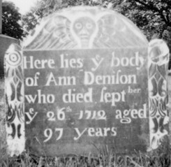
The grave of his wife is in Elm Grove Cemetery, where it was moved from near the homestead (#48, Oliver Denison cemetery).
 |
|
"Here lies y body of Ann Denison |
A note on "ye"; no one ever really said "ye". The "y" was a printer's shorthand for the old English rune "thorn", þ, that wasn't in the imported German or Italian typefaces (if you imagine dropping the lower right half of the circle, thorn looks very much like a distorted "y".. Thorn is pronounced as "th", so "ye" should be read as "the". A bit more on this topic is available at Wikipedia's entry for thorn.
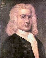 |
| An 18th century painting of Captain William Kidd |
William "Captain" Kidd (c.1645 – May 23, 1701) is remembered for his trial and execution for piracy; his privateering career had often bordered on piracy, and at times he crossed the line. He might have gotten away with it 50 years earlier, when the law was less rigorously enforced, and trade concerns had not risen in prominence. From "Under the Black Flag"2:
Kidd was a victim of circumstance, but he was also the victim of defects in his character. He seems to have had some of the same traits as Captain Bligh of the Bounty. He was a good seaman, but he had a violent temper and a fatal inability to earn the respect of his crew. Unlike Bligh, who was a small man, Kidd was large and powerful and bullied his men. He was constantly engaged in arguments and quarrels. A local agent who met him at the Indian port of Carwar described him as a 'very lusty man, fighting with his men on any occasion, often calling for his pistols and threatening any one that durst speak anything contrary to his mind to knock out their braines, causing them to dread him...' He annoyed dockworkers and sea captains by his arrogant manner and his habit of boasting about his grand connections. He deluded himself about his motives and his actions when he turned pirate in the Indian Ocean, and no doubt deserved the biting comment which was made by a Member of Parliament at the time of his trial: 'I thought him only a knave. I now know him to be a fool as well.' [page 180]
I should say I recently read an excellent book with a very different point of view: "Captain Kidd: A True Story of Treasure and Betrayal", by Samuel Marquis (I believe one of his descendents). It lays out a compelling alternative to the above narrative. Yet another very interesting book is "The Pirate's Wife: The Remarkable True Story of Sarah Kidd - A Swashbuckling Historical Nonfiction Account of Survival and Reinvention". The viewpoint is a little different than that of Marquis' book, but complementary in many ways. If you're truly interested in who the man was, I'd recomment both.
He was also one of the few pirates known to have actually buried treasure.
He had a wife, Sarah Oort, a wealthy widow whom he'd married on May 16, 1691, and two daughters who lived in New York [in a house on Pearl St. built by one of my ancestors - Ed.]. He arrived back in New York in 1699, after pretty much all of his exploits, to see them after an absence of three years. He began negotiations with his former supporter Lord Bellomont (Richard Coote, the Royal Governor of both New England and New York) in Boston to try to get some sort of pardon. During this time, Captain Kidd moved his ship to the eastern end of Long Island Sound, moving from Block Island to Gardiner's Island to the Connecticut coast. At some point during these two months, three sloops came alongside to take off some of Kidd's crew with their belongings and share of the booty. Kidd sent Lady Bellomont an enameled box with four jewels in it; also Mrs. Kidd sent a six-pound bag of pieces of eight to Thomas Way, and Kidd sent several pounds of gold, believed to be worth £10,000, to Major Selleck in Connecticut. He also buried a significant amount of treasure, mainly from the Quedah Merchant, on Gardiner's Island. (ibid, pg. 190)
His career ended with his arrest in Boston on July 6, 1699. After his transfer to England, Lord Bellomont made strenuous efforts to locate and retrieve the treasure. In the end 1,111 ounces of gold, 2,353 ounces of silver, forty-one bales of goods, bags of silver pieces, and various jewels were recovered (As listed in Bellomont's summary), representing a value of £14,000 - nothing like the £40,000 Kidd had led Bellomont to expect, and a tiny fraction of the £400,000 Kidd was rumored to have plundered in the Indian Ocean. The auction of this treasure raised £6,472, to found the Hospital for Seamen at Greenwich. So there is quite possibly some unlocated treasure.
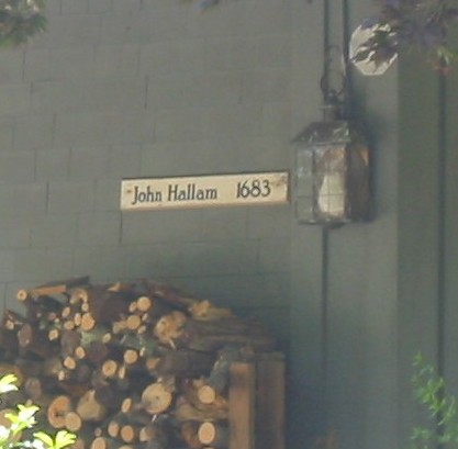
What does this have to do with the Valley, at least with my extended definition of it? According to my Stonington High School classmate Nathan Leonard, who grew up on Wamphassuc Point, treasure hunters have been nosing around that area for years. John Hallam owned much of Lamberts Grove ("cove" now), and was reputedly one of Captain Kidd's fences, selling material he provided to merchants in Boston. He may have buried some materials near his house that were 'in transit' to sales elsewhere, or, as a somewhat trusted partner, may have been relied on to safeguard it.
From Nathan Leonard:
John Hallam, owned most of Lamberts Grove (Cove now). There are a few Hallam graves from the 1700s in the grave yard on Wamphassuc Pt (go to rail road crossing, park on either side; walk East along tracks toward Borough, when you are running out of land on the North side there is a grave yard. Be prepared for some wicked poison ivy). There are some more gravestones missing, sadly. I recall a couple earlier Hallam graves that I don't see now. A few have eroded into the cove. Hallam house is on Collins Rd. Going north from Rte 1, go over little bridge/hump in the road that is fun to jump motorcycles off and another few hundred yard on right is an old gambrel roof house as I recall (not the barn home north of it which might have been a later addition to their farm. John Hallam was not liked in Stonington in the end. He supposedly brought back some nasty disease like small pox or influenza from Boston. He survived but many in the area did not.
John Hallam was born in 1661 or 1662 in Barbados, and died on November 20, 1700, at age 39. He came to Stonington in 1676 or 1677 from Barbados when he was 16, with his younger brother Nicholas16, page 411, his mother Alice, who died in 1698, and his stepfather John Liveen of New London, CT, where they lived, until he came to Stonington about 1680.
There were a number of Hallams in Barbados, and I expect there was some connection through there that formed the basis of Hallam & Kidd's acquaintanceship.
John married Prudence (b. 1661 in Boston, daughter of Amos Richardson) on March 15, 1683. After he died, she would marry Elnathan Miner; she died in 1716, and is buried in the Thomas Miner cemetery.9 I would think that if anyone knew anything about treasure buried locally it would have been John's wife, but as far as I can ascertain nothing notable turned up in later years.
 |
 |
 |
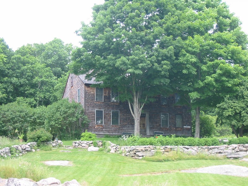
| Captain John Hallam's house | A close-up of the sign | A view of the cove, now mostly marsh, below the house |
From the Stonington Chronology, pg. 28, in 1699:
Captain John Hallam, who lived at Wamphasset Pt. west of Stonington Harbor, gave a bond to the Governor and Council to make restoration to the colony for having stored goods stolen by the pirate, Capt. Kidd, and for harboring two of his men.
also, on the same page for November 5, 1700:
Capt. John Hallam returned from Boston, bringing with him the smallpox so that during the succeeding months he, himself and many others in Stonington, both Indians and whites, died of this disease.
which indeed would not have made him a popular person. Another source has a slight variant of this, but the import is in substance the same.
Wheeler's "History of Stonington"16, page 411 has a bit more about John Hallam:
Mr. Hallam [after his wedding - Ed.] at once engaged in the mercantile business, which was the employment of his stepfather, in the West Indies, and at New London, after they had taken up their residence there. Mr. Hallam enlarged his business here and opened commercial relations with merchants at Barbadoes, which he very successfully prosecuted for several years.
There was a problem with his mother's will - she had said her estate was to go to her two children, but Liveen gave it to the ministry of New London. This caused a legal controversy both here and in England; the appeal of the children did not succeed.
Mr. Hallam, in prosecuting his commercial relations with Barbadoes and the West Indies, acted as super-cargo of the vessels conveying his goods to these islands, and in person superintended the sale thereof, and exchange of the same for goods of the islands, which he brought home and sold to the merchants in this region round about. During the year 1700 Mr. Hallam purchased and fitted out one of his vessels with the products of neighboring farms and went with the same to the West Indies as super-cargo. Somewhere on his return he caught the smallpox, with which he died Nov. 20, 1700.
Mr. Hallam, after his marriage with Miss Prudence Richardson, purchased a large and valuable tract of land of her brother, the Rev. John Richardson, whose father, Mr. Amos Richardson, had given him as a wedding present, on his marriage. The land embraced in said purchase, included the land lying between Stonington Harbor, Lambert's Cove and Stony Brook on the east, Fisher's Island Sound on the south and Quiambaug Cove on the west up to a point, from which a direct line easterly passing about thirty rods south of the residence of Mr. Henry M. Palmer to Stony Brook, constituted the north boundary line of said tract of land.
According to Grace Wheeler's book, the John Hallam house is the oldest house in Stonington. The Stanton/Davis house (now museum) in Pawcatuck may have been built earlier; apparently it was built circa 1670 by Thomas Stanton.
From Caulkin's History of New London, concerning Amos Richardson; the boldface items (mine) highlight elements of the local geography or interest - e.g., as mentioned above, the 'pyne neck' is Lord's Point:
He also obtained a number of grants of land, very
early in settlement at Pequot. The New London town records show the following: "Memorandum for town meeting Sept. 20, 1651, Amos Richardson is to have a lot." Caulkin's History states that he was from Boston and had commercial dealings with the planters and that instead of taking up a new lot he purchased that of Richard Post on Post Hill. "Aug. 9, 1653. House lot to Amos Richardson brother, the millwright (afterwards called brother-in-law)." "He had ubsequently a grant of a large farm east of the river under the same vague denomination: he has not been identified."
"Two necks of land extending into the Sound, one called 'a pyne neck,' with a broad cove between them, was granted to Isaac Willey and by him sold to Amos Richardson." "Still another containing several hundred acres of land and separated from Hugh Caulkin's land by a brook called Mistuxet, was laid out to Amos Richardson and his brother in 1653." Part of this division was known by the Indian name of "Quonaduck."
There is a reference that Isaac Willey's deed may have it's roots in a deed granted by the "Indian sachem Nealewort", but I haven't been able to verify it. A good but confusing place to start is Stephen Richardson's Ancestors, which touches on the Sachem's deed but is dated 1658.
In October, 1661, Antipas Newman, of Wenham, sold
him a large tract of land, called Caulkin's Neck, bounded by the above Quonaduck farm on the East, Caulkin's brook West, Capt. George Denison's North, and South by the Sea. Pequot, now New London, embraced the present town of Stonington, where the last
three of the above described grants were located.
The next part is likely the first reference to Lord's Point land:
The deed of the Indian sachem Nealewort for a part of this land was dated August 26, 1658, and is recorded at Stonington. It is described as "a tract of land called Quinabogue lying and being near to the country of the Late Pequed Indians for and in consideration of the great Love and affection I beare unto Amos Richardson of Boston in the Mass. Colony, Englishman. * * * contain by measure one English mile and half square on each
side of that River called Quinabogue River next Adjoining to ye land or farme granted to John Winthrop Esq. Governor of the English Colony on Connecticut River northward of the said farme and is called by the name of Nayumscut and Quaduecatuck."
Wheeler's "History of Stonington" locates this
property as "the land lying between Stonington Harbor, Lambert's Cove and Stony Brook on the east, Fisher's Island Sound on the south, and Quiambaug Cove on the west up to a point, from which a direct line easterly passing about thirty rods south of the residence of Mr. Henry M. Palmer to Stony Brook, constituted the north boundary line of said tract of land."
The family name of Mary, wife of Amos Richardson, is unknown; he did not, however, have a second wife, as stated in the "Richardson Memorial." It is probable that they were married in 1642, the year that be purchased his house and garden. It is conjectured that the brother-in-law referred to above was Richard Smith, of Lancaster, a "mill-wright," whose first wife Mary died with her infant March 27, 1654, and who married, on the 10th of the following August, Joanna Quarles at Boston. It is quite certain that John and Mary Smith, who are claimed to have been the parents of Richard were not the parents of Amos Richardson's wife.
They had a daughter Alice, however, who probably
became second wife of John Tinker, a man very closely associated Amos Richardson.
He named one of his sons Amos and the inventory of John's estate shows that a farm of 240 acres and other property had been deeded to Mr. Richardson for the use of John, Mary and Amos, children of John Tinker.
In 1656 the eight proprietors of Groton included
this Richard Smith, with Dean Winthrop, John Tinker and Amos Richardson. Soon after this he moved to Lyme, Conn., where he was a deputy in 1678-9.
His children were Richard (probably by his first
wife), John, born 1655, Francis, 1657, James, Elizabeth, who married John Lee. He had a grandson named Quarles Smith, and the Lyme records mention two Roland grandsons.
Mary Smith died in 1659 and her husband in July 1669. In May prior to his death John Smith gave all of his estate to son-in-law, John Moore, in consideration for his support; his will mentions only four children - John, Richard, Ann and Alice. There were -so many John and Richard Smiths that it if; very difficult to untangle their history. The Diary of Thomas Minor, of Stonington, refers to Amos Richardson and his family more than eighty times. On October 29, 1660, he says, "carried the firkin of butter to Mr. Smith's for Amos." November 2, 1660, "I weighed Amos his firkin of butter at Mr. Smith's." The following receipt for a horse delivered in the presence of Thomas Minor, Jr., and Ephriam Minor is also found in the Diary: "Delivered unto poor man mine (torn) A horse that he bout of a mister Richinsoone and by his appointment and order a horse a chestnut Culer with a blase in his face." * * * "I Say by mee delivered this 14 day of aguste 1661 with my hand Richard Smith." Mr. Richardson at this time lived in Boston.
From Wheeler's "History of Stonington"16, page 18:
In 1667 the planters convened in town-meeting and decided to set apart and lay out five hundred acres of land, to be styled the ministry land, the avails of which were to be applied to the support of the gospel ministry. In July of the same year the town established what they called a town plot, and appointed a committee to lay out as many lots as there were inhabitants then living in the town. Their home-lots contained twelve acres each, and were so arranged that each lot had a street front. Two hundred acres of this ministry-land was [sic] laid out around the place where the Road meeting-house now stands, the eastern line of which extended along a few feet east of said meeting house, running nearly north and south. The western boundary was Mistuxet Brook [the stream in the upper Quiambaug Valley - Ed.]. The northern and southern lines cannot now be traced, but the form of the plot can nearly be seen when we look at the distance between the east and west lines and the number of acres that were laid out. The home-lots were laid out around and upon each side of the ministry land. They extended as far east as Stony Brook, and south as far as Smith's Mill; one tier was located north, and the remainder west and south of said land. In 1668, a census of the inhabitants of the town was ordered to be taken, embracing those only who were inhabitants or heads of families. February 2d there were found to be forty-three inhabitants, viz., Thomas Stanton, George Denison, Thomas Miner, John Gallup, Amos Richardson, Samuel Cheesebrough, James Noyes, Elisha Cheesebrough, Thomas Stanton, Jr., Thomas Wheeler, Samuel Mason, Joseph Miner, John Bennett, Isaac Wheeler, John Denison, Josiah Witter, Benjamin Palmer, Gershom Palmer, Thomas Bell, Joseph Stanton, John Fish, Thomas Shaw, John Gallup, Jr., John Frink, Edmund Fanning, James York, Jr., Nathaniel Beebe, John Reynolds, Robert Sterry, John Shaw, John Searls, Robert Fleming, Robert Holmes, Nathaniel Chesebrough, for Mrs. Anna Chesebrough, his mother, Gershom Palmer for Mrs. Rebecca Palmer, his mother, Henry Stevens, and Ezekial Main. A home-lot was laid out for each inhabitant, and the title was obtained by lottery on the following conditions, namely : If built upon within six months and inhabited, the title would be complete, except that each proprietor must reside on his lot two years before he could sell it, and then he must first offer it to the town and be refused, before he could sell the same to any person and give good title. How many of these home-lots were built upon by the then inhabitants cannot now be ascertained.
The establishment of what would become the Road Church was formed on June 3, 1674. A meeting house was built in 1672-316, page 87. From the same source, on page 88:
In 1661, "the town erected a meeting-house which stood a short distance west of Mistuxet avenue [likely an error; see note below - Ed.], southwest of the residence of Mr. Henry M. Palmer. This house was used for religious and town meetings until 1672-4 when the town voted to build, and did build a large edifice for religious and town service and located it on Agreement Hill, so named by the town as a compromise settlement between the (then) inhabitants of the town. This meeting house stood until 1729, when it was taken down and another house was built on its enlarged site. These two meeting-houses stood a few rods west of the present church edifice at the road on the original Agreement Hill.
Agreement Hill is at latitude 41°22'22.20"N, longitude 71°54'48.30"W . The Mistuxet reference above is contradicted in the same source: on page 485 Wheeler says this was "a short distance southerwesterly of the present residence of Mr. Henry M. Palmer, west of Montauk Avenue". As this is consistent with other sources, I will take this as an error in the original text. (Or it is possible that "Mistuxet Avenue" was then defined differently.)
I find this description of meeting houses somewhat confusing. Let me attempt a complete list:
The first meeting house somewhere on Montauk Avenue, built in 1661. This was
a short distance west of Montauk avenue, southwest of the residence of Mr. Henry M. Palmer". On page 13, Wheeler says "It is not known how large it was or what its shape or style, but from some facts that may be gleaned from the old town records, it is probable that it was a small building and but partially finished, for as early as 1667, six years after it was raised, a vote was passed in town meeting to repair it and make it more comfortable; and even after it was repaired the people did not use it in cold weather, but held their meetings at the house of Amos Richardson, which was situated a little way east of the meeting house."
The house built in 1672-4 on Agreement hill, which stood until 1729. It was then replaced in-situ with an enlarged building. This site is a
few rods west of the present church edifice at the road on the original Agreement Hill.
The "present church edifice", or the Road Church. A more detailed history of the Road Church is available here.
Just for reference, here are some of the length units used at the time, with their modern equivalents:
| Archaic Unit | Modern Equivalent |
| 1 rod | 5.5 yards (16.5 feet) |
| 1 chain | 66 feet |
| 1 furlong | 660 feet (1/8 mile); an acre is an area 1 furlong by 1 chain |
| 1 league | 3 to 3.5 miles |
| 1 fortnight | two weeks (a contraction of "fourteen night") |
On February 2 or 28, 167616, pages 139, 140, James Dean of Taunton was offered 2 lots at Quiambaug to set up as a blacksmith, and for further encouragement and support Thos. Stanton, Amos Richardson and his son Stephen, pledged $35 each; Henry Stevens, Edmund Fanning, Joshua Holmes, Exekial Main, Adam Gallup, and John Searle $5 each; Rev. James Noyes, $2.50; Thos. Reynolds, $1 - payable in pork, butter, or wheat. On September 6 the town granted Dean 100 additional acres, and Adam Gallup, Thos. Edwards, and Thos. Fanning offered to cut thatch for his roof while Amos Richardson agreed to cart it. Lt. Mason and Gershom Palmer volunteered each a day's work and Thos. Wheeler, Sr., promised 200 laths. (Note: I have heard recently that his original house was incorporated into an existing house on the site, maybe going through several renovations).
The two twenty-four acre lots, or double lots, as they were sometimes called, set apart and designed for the use of a blacksmith, were situated a little way easterly of the quarry ledge at Quiambaug. Here Mr. James Dean erected his home and shop, and commenced business in 1676. Subsequently he received other grants of land, and became a prominent man in the affairs of the town.
James Dean Sr. was a selectman in 1691. He and his wife Sarah had twelve children, one of which, James Jr., would continue the business. He relocated to Plainfield, CT in 1698, and his son remained in town. He (the son) built a house at Dean's Mills, about the year 1700, which burned down in 1848. Again, from Wheeler's "History", page 140:
James Dean, Jr., did not confine himself to blacksmithing, but learned the business of fulling and dressing woolen cloth, and for that purpose erected a fulling-mill on Mistuxet Brook, afterwards known as Dean's Brook, about one-third of the way from the old post road down to the Dean's Mills. There he continued both branches of business until his son, John Dean, reached manhood, when he and his father built a new dam and erected another fulling-mill near his dwelling-house, where the dam now crosses the brook. After this arrangement was effected they devoted their time and attention to cloth-dressing, wool carding, and for the manufacture of cotton and woolen goods were obtained. ... James Dean continued in business until 1830, when he retired.
The property was subsequently purchased by Capt. Charles H. Smith, who improved the premises by raising the dam, increasing the pondage, and deepening the raceway, and leasing it to parties for cloth-dressing, wool-carding, and for manufacturing generally.
Here is a recent photo of the original dam, taken when the reservoir its now under was extremely dry (click on it for a larger image):
More photos are available on the Dean's Mill page.
James Dean Jr.'s son John became a selectman in 1764. John went on to be named to the Committee of Correspondence at the outset of the American Revolution19, page 27.
Having some experience with blacksmithing and metallurgy, it occurred to me that it might be interesting to identify specific artifacts that James Dean Sr. may have made, and further to analyze one or more of those objects to determine where he acquired his raw material, and the type of fuel he used in his forge. One resource I found while researching what has been published on New England colonial metallurgy sheds a quite a bit of light on the industry at the time, and may provide some explanation for why James Dean came from Taunton. Here are a number of excerpts from "The Ferrous Metallurgy of New England Shipsmiths and Edge Toolmakers From the Construction of Maine’s First Ship, the Pinnace Virginia (1607), to 1882", "Volume 7: Art of the Edge Tool", and well worth a read if you have the time (the link I had here evaporated, and any new one I include may well too, so a dynamic search is likely best).
New England shipsmiths had access to a unique natural resource that facilitated their tasks and this helps explain the sudden flowering of New England’s shipbuilding industry in the 17th century. This resource was the vast bog iron deposits of southeastern Massachusetts in Plymouth, Norfolk, and Bristol counties south of Boston and northwest of Cape Cod. These bog iron deposits were an important supplement to imported English, Swedish, Spanish, and Russian bar iron after the first blast furnaces and bloomeries were built in the Boston area (Furnace Brook and Hammersmith) in the 1640s and 1650s and soon played a key role in helping local shipsmiths “iron” the many ships being built in New England. [page 13]
In 1652 James Leonard establishes the first of a series of southeastern Massachusetts colonial era bog iron forges on Two Mile River at Taunton, Massachusetts. [page 8] The vast network of forges and blast furnaces established by the Leonard family at Taunton, after they left the Saugus and Braintree ironworks, flourished for almost two centuries. [page 30]
An interesting tidbit: this James Leonard is an ancestor of my classmate Nathan Leonard, who gave me the initial lead into Capt. Kidd's connection to the area. The family had a lot of involvement with this technology.
Bog iron is formed when iron oxides in standing and running water are precipitated by bacterial action after contact with oxygen. In part due to the presence of glacial runoff and glacial soils, including granite gneiss, the southeastern coastal plain of Massachusetts was the location of the largest hydrated bog iron deposits known to exist in the colonies until the discovery of the deposits of the New Jersey Pine Barrens. [page 87]
When James Leonard left the Saugus Ironworks to establish a forge at the Two Mile River, he brought more than the knowledge of modern smelting techniques he had learned in England. He brought a whole family of ironworkers to establish a series of forges and furnaces that operated as recently as 1876 (Mulholland 1981). His brother Henry had managed the short-lived Quincy ironworks, and his son Thomas was soon a manager at the Taunton (Rayham) works (1683). Henry later moved to New Jersey (1674) to establish the Shrewsbury Furnace. Before going there, he also established iron works at Rowley Village (Boxford, MA) with his son Nathaniel. Edmund Bridges had already established a forge nearby as early as 1636, which would have been a likely source for iron fittings for ships soon to be built at Newbury (Mulholland 1981, 29). It is not known which Leonard established the forge at Sippican Mills on the Sippican River in Old Rochester (+/- 1690) (Ryder 1975). [page 91]
Many of the small quantity of hand tools used by shipwrights and other artisans that survive from the colonial era and almost all the heavy duty shipbuilding tools used in America after the American Revolution appear to be domestically produced, not imported, edge tools. [page 13]
By 1776, over one third of the English merchant fleet had been constructed in the American colonies (Goldenberg 1976), and America was producing 1/7 of the world’s supply of iron (Bining 1933). [page 14]
Contrary to the conventional opinion on the incompetence of America’s often anonymous steelmakers working after the Revolutionary War, expressed by Gordon (1996) in his chapter on steel in American Iron and derived from echoing 19th century sources (Swank 1891, etc.), the numerous domestically made edge tools of exceptional quality and durability that survive from this period tell the alternative tale of the existence of many accomplished toolmakers adept at a variety of steelmaking techniques. [page 134]
Eric Sloane (1964) in A Museum of Early
American Tools, has the following intriguing comment, which also a
so many other tools that survive in old tool chests in workshops long after the ships and houses they built decayed or burned:
"The 1775 gouge in the illustration has an interesting story. It was found in a stone fence. Bright and silverish, its edge is keen; it has no rust. How farm-bound bog iron, privately smelted, hammered together at a farm forge, could be better in any way than today’s steel is a mystery. I have compared the best chisels (the most expensive, that is) by leaving them in the rain alongside this ancient tool. The new tool’s edge was dulled, and rust appeared within a few days. "
The legend is that early surface ore contained much manganese and was purer in iron content. It is also believed that the use of charcoal gave purer carbon content and made a superior iron. (Sloane 1964, 54) The bog iron used to fashion the edge tool noted by Sloane as being found in a stone fence in Connecticut was probably made near where it was found and from locally smelted bog iron. [page 135]
The huge shipbuilding output of Mystic, Connecticut, may have close links with the Taunton River smelters, especially in the colonial era, but that chapter on shipsmithing has yet to be written. [page 127]
There is an interesting overview of bog iron on Wikipedia; it may to some extent be self-replacing over time. Wikipedia Bog Iron Article.
In the "Little Ice Age" (~1650 through ~1850), Fisher's Island Sound used to freeze over completely, allowing one to walk from the Connecticut shore to Fisher's Island (the narrowest gap being about 3 miles); this happened several times (e.g. January 24, 1698, the winter of 1740), the last being in the late 1800's.
Fisher's Island Sound frequently had large numbers of whales in it. I've found little evidence, other than that mentioned above, that the indians captured them, but some of the earlier settlers did - the first record of that is in 1701.
On August 28, 1654 the bounty on wolves was raised from 5s. to 20s.
In 1673 Holland and England were again at war; the Dutch recaptured Manhattan, and their fleet blockaded towns along the Connecticut coast. I think this might have been more important than is generally realized. From a recent book, "Watch Hill Through Time", by Chaplin Bradford Barnes, 2005 (Watch Hill Conservancy):
"In discussing the Dutch commerce along the coast, Frederic Denison22 indicates that at least one of the region's salt ponds was of sufficient depth to accommodate coastal sailing vessels. He notes that Ninigret had formed a temporary compact with the Dutch which was still in effect in 1650, and that "Dutch keels entered a harbor that anciently existed on the shore east of Watch Hill, and which is now known as Quonocontaug (sic) Pond." 23, Page 33
This means that the Dutch had established relationships with the local indians, and probably frequented the area. It would have been relatively easy to sail up the protected waters of Long Island Sound from New York, whether one's concern was weather or hostile ships.
In August of 1654, Ninigret and the Narragansetts attacked the Indians on Long Island (see for instance this Wikipedia article, and Major Mason was sent with Connecticut Militia to help them fend off any later attack. On October 10, Major Mason with 40 horsemen and 270 infantry rendezvoused at Stanton's trading post on the Pawcatuck River to awe Ninigret, who was threatening war on Uncas. Mason was beginning to clear the land to the north of Mason's Island, in our area of interest.
"Watch Hill Through Time" mentions that Ninigret's house was on the exact site of the Ocean House Hotel [23, page 37]. Ninigret was quite active:
"On a still, moonlight night of Indian Summer, 1654, warriors from the two tribes [Ninigret's Niantics and the Wyandance, of Montauk: Ed] set forth on raids against each other across Block Island Sound, presumably in dugout canoes. The position of the moon and its reflection on the paddles of the Montauks allowed the Niantics to see the approaching raiders before they themselves could be seen. The Niantics returned to the shore near Watch Hill, where they concealed themselves and ambushed the invading force. They wiped out the Montauk raiders almost to a man." 23, page 31
(One might wonder, knowing where the town of Niantic is, why Ninigret, in Watch Hill, was part of that tribe. It's a longer story - in brief the arrival of the Pequots split the tribe into eastern and western parts.)
Fisher's Island was in the middle of all of this, and therefore might have been of strategic value, though it would have taken many men to hold it. Given that the Pequots were in Mystic (at least until the battle there in 1637), these tribes were essentially within sight of each other and had changing relationships of various levels of hostility.
On October 29, 1675, all homes in Stonington were ordered fortified by the General Court. King Philip's War was escalating, and the area was likely to be attacked.
The story of King Philip's War is too long to be told here, but it is certainly worth understanding. One article is, again, from Wikipedia: King Philip's War. Unified tribes attacked settlers, burning Providence, RI, and something like 20 other towns, provoking a coordinated response, which ended at the Great Swamp Fight in Kingston, RI.
As described above, James Dean and his son had established a mill on Mistuxet brook. (Many of these photos/comments were before I had direct access, but are interesting in and of themselves. I'm keeping them in because they're largely aerial photography-based, and while the dam location itself may be now well-known, the surrounding buildings and access roads are a complete mystery).
The usual location assumed for "Dean's Mill" is at the upper dam (latitude 41°22'23.25"N, longitude 71°55'49.38"W). One resident I spoke with (Bruce Wineberg) said that during a draught, the original mill site was visible, and was quite a bit north of there, perhaps 150 yards south of Pequot Trail. There are accounts of later improved mills, and it makes some sense that someone building a new mill would move south: the northern water dam would mean the land to the south was already exposed to build on, and the mill pond would be larger.
Some more recent photos of the area were made during a draught, and may be seen on the Dean's Mill Page.
There is a structure further north that may be the site of the first dam - here is what it looks like in Google Earth:
This certainly looks like a dam; the picture must have been taken when the water level in the upper reservoir was very low. The location is latitude
41°22'44.99"N, longitude 71°55'42.02"W. If I can get
permission to explore the water company's land [Which I eventually did - Ed.], I would very much like to see what other
evidence may lie nearby on either shore.
There is also this "V" like structure further south, the straight lines of which look suggestive. It is also at a narrow area of the valley, and seems to have had a central channel at some point. This is at longitude 41°22'35.81"N, latitude 71°55'46.29"W:
There are a number of interesting traces to see, particularly in the Google Earth imagery, which I would strongly recommend using to explore this area from above. Apparently the Keyhole satellite photographed this area during a drought, which is very fortunate. Notice in the dam photo to the left that towards the bottom of the photo is a kind of white diagonal line, running at about a 45 degree angle up from the bottom of the photo - this extends quite a bit further, and looks like either a stone wall or the edge of a terrace, that is possibly a previous shoreline.
I have higher-resolution images that were taken from an airplane, but the dam had filled at this point; here is the same
area in the winter, when there were no leaves on the trees:
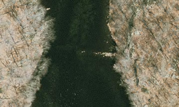
You can still see the dam, and some possibly interesting structures on the right bank, but it is much less of a compelling photo - something one might not even notice if one were looking.
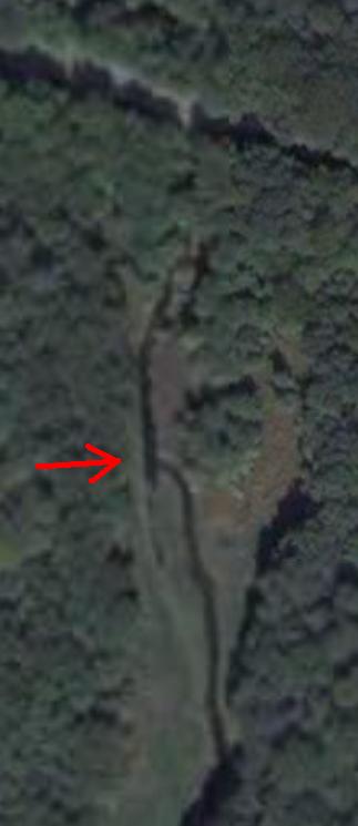
Finally, at the north end of the upper reservoir, fairly close to where Pequot Trail crosses Copp's Brook, is this odd structure - the stream takes a 90° branch, then runs parallel to itself again. The road at the top in the photo, running across it and slightly down to the right, is Pequot Trail. About halfway down the photo is the branch that I'm referring to.
Now this could have been just a higher part of the land, a sort of island in the middle of the stream, which accidentally has a nearly right-angle face on its northern end. Or it was some man-made structure, which looks quite possible, given the uniform width of the stream heading further to the south.
One key element is how much of a vertical drop there is at this point in the terrain - there would be little point in any structure of this sort if the land were basically flat. In the fall when driving by on Pequot Trail and looking south it does look very flat, but of course that's an illusion - what you see is the water surface, not what is underneath.
Also note that there seems to be a whitish outline to the north side (top) of the 90° branch. This might be a stone structure of some sort, but only direct investigation will tell.
If it is really a manmade structure, it is likely part of a spillway - one of the channel branches would be higher than the other, and would be used to allow excess water to run off without running through any mill on the other.
Two images of "Dean's Mills" - it's not clear which location the first actually refers to. You would think the aerial imagery would help sort this out, but if it's the first, northernmost dam, all of this would have been underwater for some time:

This next is what we usually now refer to as the "upper dam" (though it was the 2nd of 3), basically at I-95. It's clear there were some structures and water flow management here, but now what. Much of the dam structure is new, but the old stone walls are not, and the general layout doesn't match with the above photo at all - the above one may well have been an image of the first dam.
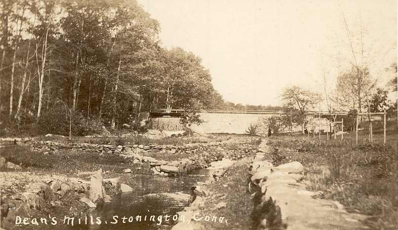
The Stonington Mirror of Tuesday August 17, 1897 has an article on a party in Quiambaug; I quote some of it here because of one element which I found quite surprising:
GREAT EVENT IN QUIAMBAUG
On the evening of August 14th a sociable was enjoyed by forty-five in number through the hospitality of Capt. Elias F. Wilcox in inviting the families of Wilcoxville, the capital [sic] of Quiambaug, to his home. The occasion was the opening of his summer house which, just completed, proved to be an ornament to his beautiful home on Massasoit avenue. It is located on rising ground in the rear of his residence, overlooking the Sound and its tributaries, and far beyond, in full view, spreads
the broad bosom of the Atlantic. It also proves to be quite an historic spot, a gun having been mounted there during the seige of Stonington in the year 1812 [sic].
I must admit I don't understand the reference to Massasoit avenue (perhaps a second home elsewhere), but I'm intrigued that a cannon might have been mounted here (much more about Elias and his house occurs further on in this document).. I've seen one other reference to "Fort Quiambaug", so perhaps indeed there was a gun located here at some point in the War of 1812. As is noted below, Elias's house is " on a grassy knoll south of the highway", now Wilcox Rd, at latitude 41°20'21.90"N, longitude 71°56'34.68"W. This is what the view from the spot is like, looking ESE towards Stonington Borough:
 |
|
The view to the southeast from might have been "fort Quiambaug", the site of one cannon during the War of 1812. The visibility to the south and southwest is as good. On a clear day one can see Block Island easily, and much of Long Island as well. Lord's Point is to the left. |
I would think that a gun on this site might have been something in the neighborhood of a 6- or 8- pounder, typical of small artillery of the time - for instance, Fort Rachel in Mystic initially had a 4-pounder; there was a 9-pounder and two brass 6-pounders at Pistol Point across the river. By "6-pounder" I mean a cannon that shoots a 6 pound shot.
Adye in his “Little Bombardier and Pocket Gunner” of 1802 gives the following details on range and recoil of slightly larger guns:
Ranges of Brass Guns, with one shot, 179312-Pr Medium, to the first graze, charge 4, 705 ydsRange from Brass Field Guns, with small Charges, 1798
12-Pr Light, to the first graze, charge 3, 601 yds12 pr 10 oz charge, first graze at 199 yds, extreme range was from 800 to 1000 yds
12 pr 1 lb charge, first graze at 280 yds, extreme range from 1200 to 1800 yds.
A 6 pounder in 1841 had a range of "1523 yards"; so it's reasonable to assume that a small smoothbore, probably brass, would have a range of around 1500 yards, or a little less than a mile. A gun in this position would have been able to cover the coastline of Lord's Point, hit targets in the water about as far south as White Rock, and cover the eastern flank of Latimer Point as well as Dodges' Island.
The other notable aspect of this site is its height, and with fewer trees (the area being farmed at the time) the view would have been even more vast than it is today. My guess is that the primary purpose of this gun was as a signal gun, to warn either Stonington or Mystic of approaching British naval units. As there was no bridge across Quiambaug Cove where Route 1 runs today, the only other alternative means of communication to Stonington Borough would have been by horseback via a significant northern detour, to cross via what is now Mistuxet Ave by the Aquarion Water Company. It wouldn't have been much better trying to get to Mystic (then Mystic Bridge), as the old road went north to roughly where Mistuxet Ave. meets PequotSepos Road. A signal gun would have made very good sense, as this is the highest land on the coast for quite a few miles.
The lack of any sort of military or maritime targets under the coverage of this gun would also suggest that signalling was its primary purpose. However, the British were quite adept at amphibious operations, and it often made sense to attack a port city not straight on into its prepared defenses, but to land nearby and approach overland from an unexpected (and usually undefended) location - so it might have made sense to position a gun here to discourage such a step. This seems a weaker rationale to me, but perhaps given the uncertainties the British were already facing about the nature of the resistance they might face, the detailed lay of the land, and so forth, the presence of any obvious defensive measure may have been something of a deterrent. Though they did try.
During the War of 1812 the British made an attempt to attack Mystic. There are two competing locations identified - but the basic story is the same. Longboats carrying troops headed into the area and picked up a local pilot, who deliberately led them astray.
Grace Wheeler says this was in the cove alongside the western edge of Latimer Point (from "A Trolley Ride, From Westerly to Groton"):
Opposite the house is the path to the Old Riding Way, which was the fording place between Mason’s Island and the mainland; then past Williams cove, where, in 1814, the English soldiers, attempting to destroy the village of Mystic, entered by mistake east of Mason’s Island and ran their vessels, in the thick darkness, into this cove. The soldiers scrambled overboard to get their barge into better water, but only sank their red coats and royal gilt buttons to their waists in mud.
This makes sense to me, as if you head in that way by boat now, that is between Mason's Island and Latimer Point, you can see the village of Mystic ahead of you - though the channel (now under the Mason's Island bridge) is even now small, and was possibly untraversable in 1814.
The other candidate for this event is Bebee Cove, on the west side of the Mystic River inside Sixpenny Island. I heard this from Bill Peterson of Mystic Seaport; he referenced an article in a Mystic newspaper (not a contemporary account). When I find the original article I will include a link and/or a summary.
The first record of whaling in Stonington (and in our area of interest) was in 1701, when whales captured in Long Island Sound were brought to "Wamphassett Point" to be tried out (rendering of fat), with the oil sold in Boston or the West Indies.
When the War of 1812 broke out, at least one Quiambaug resident was heavily involved. For a background of Stonington's role in the war, I'd highly recommend Tertius DeKay's Book, The Battle of Stonington: Torpedoes, Submariens, and Rockets in the War of 1812".
In brief, in the summer of 1814 a British fleet, commanded by Sir Thomas Hardy (who had been with Nelson at Trafalgar) attacked Stonington over several days. Stonington had two 18 pound long guns (cast at the West Point Foundry in the 1780's, now in Cannon Square) and one 6 pound gun. The gun crews were led by Jeremiah Holmes, who had been impressed by the British Navy and had learned gunnery well.
One of the crew was 19 year old John Miner, from the family farm in Quiambaug. One of the crops on the farm was flax, and his mother, Hannah, spun, dyed, and wove flax into a hardy linen. Using this, she had stitched a double-breasted "tailcoat, with a short front and a high, stand up padded collar". John was a volunteer in the 5th Company of the 30 Regiment of the Connecticut Militia.
Whilest serving the gun, the crew saw the British ships trying to move out of range, so they tried to increase their rate of fire. This led them to loading a charge before cleaning out the hot barrel from the last shot, which caused a premature explosion. This injured John Miner, burned his face and side of his head that he lost sight in one eye and the other was damaged. It also burned and scarred his jacket, which has been found and is in the possession of Historic Stonington. I can find no published image of it, but a photo is on the cover of "Historical Footnotes", Vol. XLIII No. 3, of August 2006.
On July 5, 1828, Capt. Jesse Wilcox and his son, Jesse Wilcox Jr, were drowned in a thunder squall on their way back to Quiambaug from Stonington. When I first read this it hit me strongly, as my brother and I, and a guest, were sailing back (from Napatree Pt, via Stonington) to Quiambaug and ran into an intense thunderstorm. Initially when we heard the thunder, on a fairly clear summer day, my brother asked "Who's firing artillery?" (It might have been such from the Coast Guard Academy, or some other drill). Halfway back everything got intense. My older brother (I was maybe 9) was skipper, chose to drive the Lightning sailboat directly on to the beach ("Trestle Beach") rather than risk trying to capture a mooring, given the weather. I don't recall the date, but likely wasn't far off - so when I read the story of the Wilcoxes, it did carry some weight. And they are buried in the Thomas Miner Cemetery, about 100 yards away.
A letter from Miss Grace Stanton to a friend, written in 1852, described life as recalled in Stonington; the author of the letter was born in 1800, so much of this description is probably based on experiences circa 1810-1820. Here are some excerpts; after some initial remarks the author describes a route from Old Mystic, over Pequot Trail into the Quiambaug Valley, out east to the Road Church:10, page 14
My Dear Julia,
A letter from your father informs me that you have fled from the heat, dust, and turmoil of city life to make your Saratoga sojourn in the Stoney land of Stonington, and so there in that fairy region of rich men, pretty girls and early marriages, smooth fields, stone walls, and rural dwellings, brown bread, baked beans, whortleberries, fresh fish and honey, you, for a time are luxuriating, perhaps in the shade of some of those noble old Buttonballs, Oaks and Chestnuts, the very trees under which I used to sit in days of yore, and build those airy castles of future happiness unalloyed, which in the rosy days of youth, untaught by time's changeful hand, have in all ages, been wont to build, but which in no age will ever be fully realized. Stonington is indeed a happy land, the land of my birth, a pleasant land that I shall always love, and the idea of your being there has carried my thoughts back into the past, and brought vividly to mind the events of my early days, that it seems but yesterday that I was a wild, romping schoolgirl, the very personification of mischief. ...
How much I wish I might have been there with you to point out the many points of interest, which you would pass by unheeded. Take, if you please, the road from your boarding place to the head of Mystic. Observe first the view either side from the top of the hill, at the head of the Point road [the top of the hill above Old Mystic, on Pequot Trail - Ed.] . Then as you descend the hill, see those fancifully shaped rocks and stones of various shapes and sizes, some oval, some oblong, other triangular and pyramidal, often enclosed by a thickly set hedge of whortle-berry bushes laden with that delicious fruit, or the fragrant bayberry or tallow bush (for you must know that tallow grows on bushes in that prolific region), again you may see the tall, prim looking, sweet-scented, sweet fern, or maybe one of nature's most beautiful wild beauties, the little four leaved pink rose, so abundant in fairy lands.
At the base of the hill see that rude old bridge over that little stream of clear water [Copps Brook - Ed.] which lags so lazily along among its glistening pebbles, then hiding itself away in the bushy lot beyond. Then there is the numerous stalked shaped barberry, clad in its own beautiful green, its long slender stems bending gracefully beneath, the weight of their bright, crimson clusters, and then in groups, hedges, or perhaps singly, see the feathery formed blackberry, so closely set with dark, curly, hard-surfaced leaves and profusion of thimble-shaped berries, so sweet, so delicious, while ever and anon, the unaspiring dewberry, creeps over dilapidated fences, fills up gaps in stone walls, trails around illshapen hard stones, which ought not to be so near the wayside, thus trying to conceal the seeming negligence of man as well as the danger to which the careless rider is ever exposed. ...
[farther on] On each side are corn patches, cow pastures interspersed with great rocks and stones, about which the wild morning glory has woven itself into beautiful net work, while here and there are various little arbors formed of cast-off brushwood and decayed bushes, overrun by the splendid ivy which by its brilliant green in summer and varying shades in autumn, ever adds so much beauty to the landscape. And yonder, in sullen dwarfishness, stand numerous shrub oaks peeping crabbishly down upon the sterile earth as if to reproach their miserly mother for their uncouth deformity. Then hither and thither are countless heaps of loose stones, placed either to commemorate the wealth and industry of the owner, or as proper and convenient abodes for reptiles. A little further on is the line of decaying old poplars, stretching their bare, stiff limbs heavenward with here and there little tufts of bright, fresh leaves, which remind one of pleasant, youthful feelings in the hearts of aged friends, and over the wall are divers young ones growing rankly at random, their little supple limbs dancing in the slight breeze, and looking saucily up at their aged sires seeming to say, "Old gray beards, don't you wish you could get over here and trip the light fantastic toe as we do?" Then on the opposite side is a square, neat looking, little white house, fronted with a few handsome trees, some nicely trimmed shrubs and a carefully trained woodbine, and occupied by several maiden ladies, all very tall, very prim, very good and if still living must be very old.
Next is that celebrated Tavern [across from the Road Church - Ed.], where all classes, ages and sexes used to stop on Sunday mornings to "fix" before entering church and these were novel scenes. This crazy old hostelry sets flat upon the north side of the road, stretching its broad, shingled sides towards the four parts of the compass as far as its stiff old timbers would permit, looking for all the world as if trying to grasp as much of terra firma as possible. Then the earth all around apparently striving to get uppermost (as dirt will sometimes) had climbed several inches up the decaying shingles, giving the house an appearance of sometime making a final exit into the cellar.
In the newsletter of the Avalonia Land Conservancy, "Avalonia Trails", I found a brief article (by RB Jones) on the "Dean's Mill Preserve" (I believe this wa from 2011, but I only have one page of the newsletter, without date. A letter from Grace Wheeler of February 1943 is quoted:
Dear Mr. Jones,
I have finally found this article about the tree, "The Hitching Post Tree". The history of one of the trees that helped furnish the frame to the ship Altura, launched last Saturday from the Stonington Shipyard is worthy of notice.
The tree stood on the farm now owned by Mrs. Marcia P. Stanton and occupied by her and Mr. and Mrs. Horace Frink. This tree had been a family landmark for about one hundred years and only for this patriotic purpose would Mrs. Stanton allow it to be sold, and when cut by Frederick Barnes it required his four horse team to haul the stick to Stonington. It was three and a half feet in diameter at the butt twenty feet long and contained about fifteen hundred feet besides three cords of four feet wood in the top.
About one hundred years ago Benjamin F. Stanton made use of a strong oak stick to break the ice in the winter time for his cattle to drink at the spring in the south-west part of his farm, which is the ancestral home of the late Stanton brothers. Each day that Mr. Stanton used the stick, he would leave it standing in the mud and water where he could easily find it the next time he needed it. At the close of the season the stick was left in its accustomed place and when he later observed it, it had taken root and the leaves had begun to appear. Gradually the sapling got larger and stronger as the years went by and when Mr. Stanton, in his declining years, rode horseback to this same spring in the winter, he would fasten his horse to this same little tree while he broke the ice for his stock to drink. Years passed on and the small oak became a large and handsome tree which adorned the path and shaded the spring. Now it's usefulness is turned into new channels and leaving the little spring it rides upon the ocean blue. The tree was cut during the First World War, about 1918.
I came across another document from the mid to late 1800's; it is
incomplete. What I have is a 3-page photocopy (possibly not
first-generation) of a typewritten essay, with commentary at the end - suggesting that the typist was working from an earlier copy, perhaps handwritten. Some of the errors may well have been made by the typist, particularly if this were a school essay. Let
me first quote the end of the document which describes it:
THE ENDING OF ABOVE MUST HAVE BEEN LOST OR DESTROYED. IT WAS NOT DATED.
It is copied from sheets of paper which may have come to my father via Col Moore some years before he died at the hospital in Rocky Hill, Conn.
Mr.s Ellen Kavanaugh probably inherited the property where Mary and Joe last lived and also their mother Ellen. Believe the three of them were buried in their family graveyard next to what was my father's place.
I remember Mary's funeral - she rolled out of her coffin before it reached bottom of the grave.
(David Rathbun, owner of Wehpittituck farm and relative of "Mary", said everyone thought she was a witch, and the rolling out kind of proved it to people).
Ellen may have written the Composition - I don't know. Anyhow whoever wrote it was very familiar with Quiambaug and the Cove.
*NOTE where words "fast name" are used, he or she
must have meant quick witted.
Think on Page 1 - the writer must have been confused
as to points of the
COMPASS.
Morro Bay, Calif.
After reviewing the Quiambaug Cemeteries Page it seems that this family group is buried in the William Minor Cemetery, #49. Ellen was born August 9, 1818, and died on September 5, 1902, at age 84. Below is the text of this document, with a few comments of mine; I'd heard of a number of the items she raises (if indeed Ellen were the author), but this is the first document that I've found that mentions them. (This was written as a Composition for the School two years previously):
This secluded valley called Quiambaug on account of a tradition which descended to us from our ancestors that two Indian children left their homes and went down to the creek at the lower end of the valley and while engaged in their innocent sports and unconscious of the approaching danger were at length overtaken by the tide which had slowly been rising the while and were drowned. From which
originated the name "Quiambaug".
[I live at the site of this creek, and it seems very unlikely anyone could have drowned in this manner unless pinned to the ground. Also, no rationale is given for why the word "Quiambaug"
signifies this event.]
It is situated about equi-distant from the two villages of Stonington and Mystic on the banks of a small stream which cannot properly be called a river but which is designated by the inhabitants as the "Cove" which winds slowly through the valley and terminates in Fishers Island Sound. It is shut in upon either side by lofty hills.
Beginning at the lower end of the place the
houses are mostly situated on the East side of Quiambaug Road, which at the time we write terminated at the graveyard. [Not sure which graveyard she means, very likely the Thomas Miner cemetery.]
The hills are mostly covered with juniper. From an
elevated spot called the "Threshing Rock" [A location I describe in section 12.4] may be seen the Ocean with its islands, from which the Lighthouses like
glittering stars light the mariner on his way and warn him against
dangers which he would not otherwise shun.
There is a sequestered lane called the
"Devil's Lane" on account of a dispute which arose between its possessors and it is currently reported that on the level surface of a rock the outline of the old "Gentleman's Foot" is Distinctly visible. Farther on is the "Handkerchief" lot, so called on account of its tri-cornered position and also Nigger Hill, which helps to form the Western boundary [sic;
this stone I think was also known as Blackamoor Rock, near where
Major Mason's Road met Flanders Road. I've not been able to locate any candidate, which I imagine to be a large blackish stone. If it is the same as Blackamoor Rock it would be part of the Eastern boundary of the valley; this is likely the compass onfusion alluded to in the source note] of the valley and from which may be seen some very picturesque views in the surrounding scenery. In the vicinity are many places of interest. There is a cedar tree considered as the oldest tree in the place and beneath its shade several years ago an artist sketched this retired place. The picture was soon after purchased and
carried to England.
On the right of the Cove is "Cold Spring" situated near the residence of the late Indian Queen "Ester Benedict" whose remains like a few rods East of the schoolhouse.
This place is not very thickly settled at
the present time but it appears to be slowly advancing in civilization, as we suppose some who deride the inhabitants of "Bog" would say. This place is designated by the sobriquet of "Bog" by some who reside in the two adjacent villages, which were not being partial to nicknames, resented and think they had better confine their remarks to themselves.
Are they better than their Ancestors, who perhaps unknown to them, were born in this place and were contented to toil day after day earning their bread by the sweat of their brows?
At the time and subsequently to its first
settlement the inhabitants consisted principally of plain unassuming farmers who attended to their own concerns and
whose neighbord [sic]
affairs were nothing to them. Would that as much could be said of the present inhabitants lying off from any great thoroughfare.
This place is quiet and secluded and its inhabitants living
remote from large towns are characterized by a primitive cast of
thought and manners, more rarely to be witnessed but thought simple in their tastes and habits, are not altogether an asset to the community. On the contrary the system of education has long revailed in our land and has given to nearly all a degree of intelligence and what is better still they got what retains that reverence for religion and its institutions which belonged to the
olden time and which amid the laxaties of modern society is fast
disappearing.
A line of the Providence and Stonington railroad crosses the
mouth of the Cove but is not much improvement to the place.
In the vicinity is an Indian Burying Ground where the red men of the forest sleep that knows no waking.
A little farther on is what was once the schoolhouse where the scholars had to sit on benches without any backs and whose feet would scarcelly [sic] touch the floor and were discomoded in various ways [This is likely the chapel, which was
used as a school until a schoolhouse could be built. This first school was quite close to the stream, and was moved or rebuilt in its new location, where it remains (today as a private home). I have no way to tell which she means, but from context likely the first.] It has since been converted into a Meeting House
and is the center of nearly all the proceedings that transpire within the limits.
A new schoolhouse recently built is an honor and credit to
the people and the school consisting of fifty scholors [sic] is taught by a name of a fast name, who is universally liked. (see note at end [which I put before this text]) He also created some sensation by introducing into school an instrument of music called a melodeon, which was universally hailed with delight by the scholars, though there were some persons in the district who predicted no good by its acquisition.
The school at the present time consists of nearly the same number of scholars who are all on the main road to knowledge.
These two texts describe respectively the north and south ends of the valley, and provide some sense of the times.
A postcard of the head of the Quiambaug Cove valley:
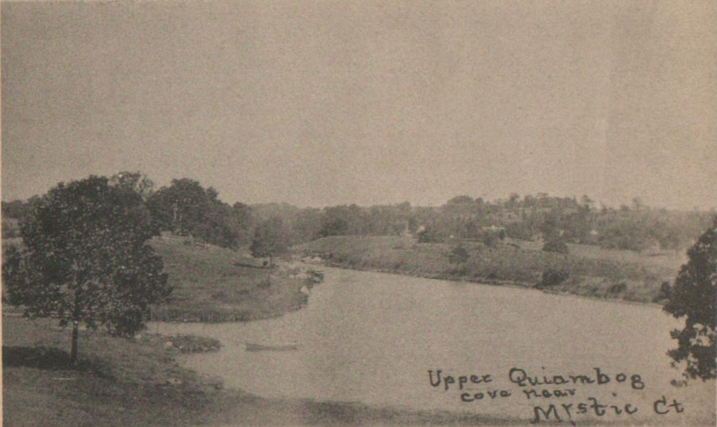
|
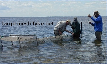 |
| Fyke nets are large hoop nets that act as funnels to trap swimming fish. They are often set in pairs, facing each other, with one among shallow vegetation and the other in more open water, so that both habitats are covered. |
At the turn of the century (1900), Quiambaug Cove was one of the greatest oyster producers on the coast. It produced 4,000 pounds of oysters (meat only, not including shell weight), and the number of fyke nets (for flounder) in the cove in 1892 was 110 - it was the largest fyke net flounder fishery in the world.
From the Mystic Press, Friday October 27, 1893:
The Quiambaug oyster season has opened. Mr. Geo. I. Wilcox has been serving his customers for some time with the real thing by the quart, pint, or on the half shell. Mr. Chas. H. Price will commence serving his customers from house to house as soon as the menhaden season closes, so that he can be released from his position on the steamer Anne L. Wilcox.
and, from the same paper on Friday, April 30, 1897:
The Quiambaug oyster men are planting seed oysters for next winter's market. The Church Brothers, Mr. Charles H. Price, and Mr. Wm. G. Crumb, have already planted a good many bushels - Messrs. Pemberton and Geo. I. Wilcox have ordered a cargo, and there are others we presume to follow. Last year the Quiambaug oysters did well and were very good.
Since the construction of the (now) Amtrak rail line, which reduced circulation in the southern part of the cove substantially, and the causeway for Route 1, the cove has produced little. ccording to Tom Visel (in 1988), in the past half-century the area has been choked with "black mayonnaise", a residue build-up of mostly oak leaves that chokes off the oxygen to the oyster beds. When the beds were worked regularly, the oystermen cleaned the bottom each Spring; that, along with the formerly increased water circulation, allowed the beds to thrive.
Individuals who own certain properties along the cove apparently still have deeded rights to certain oyster grounds.

In 1988 Thad D. King wrote a summary of individuals and organizations having an interest in Quiambaug Cove. These included
A May, 1988 project found that the currents and salinity in the lower cove could support a clam population. The "Quiambaug Cove Improvement Association" requested $4,550 from the Town of Stonington to do a study aimed at restoring 'it's former bounty'. A graduate student with the department of marine sciences at UCONN, Heather W. Crawford, was lined up to do the work.
Tim Visel did attempt to seed Quiambaug Cove with oysters, but it failed, likely due to the effects of the Amtrak causeway which has limited the Cove mouth to about 30 feet, thereby greatly reducing the circulation of water in and out of the Cove.
Due to PCB's released from the Kellems factory, for some years the lower cove was only a scallop fishery, as we eat just the "muscle" part of the scallop (in other places in the world the entire scallop is consumed, and it tastes pretty much like a clam). Recent testing has showed this form of chemical pollution just isn't present, so the area has been opened up for clamming.
Oystering might again at some time be possible, but due to runoff from fertilizers and such, oysters would need to be moved to clean water for some time before sale or consumption, a process known as depuration.
Gypsy Camp
From the Stonington Mirror, August 18, 1898:
The Gypsy camp has been moved from Quiambaug to Westerly.
I've often wondered if the firepits found when what is now the Quiambaug Cove office building was being built were from transient groups of this sort, or were (as Jeff Wilcox stated) much older, going back to summer Indian encampments. There are enough indian artifacts to lend some weight to his view, but both might be true - a good camping location is still one later on. I have seen no evidence of where the Gypsy camp was (it might well have been on the land of Kellems/Zachry Nuclear), and only found the reference when reading through old newspapers.
Guano Co. Fire
September 1865 - Quiambog Oil and Guano Co. on neck below Quiambaug destroyed by fire; owned by Elnathan Wilcox and B.F. Gallup; $4,000 loss (Stonington chronology pg 72).
It took me some time to figure out where this might be. One CT state link, now broken or intermittent (here), mentions that this company was "on the neck east of Mason's Island in Stonington, CT", so this might have been the forerunner of the Wilcox Menhaden factory.
Quarry News
1868 - Mystic Valley Granite Co., with quarry at Quiambaug, operated by Allyn, Williams, & Co. 1880 - another started.
This (the quarry at Quiambaug) is almost certainly the one just north of the old schoolhouse and Wehpittituck farm. From various sources over the years I've heard that the stone was cut, moved a bit down what is now Cove Rd to a small wharf (which is still there) for shipping to distant points. If you drive up Cove Rd past the schoolhouse, on the left is a very large rock, which was the center of it; some cutting work seems to have gone on on the right side of the road as well.
Quiambaug Chapel
April 30, 1890: Quiambaug Chapel dedicated. The land was donated by Thos. P. Wilcox Sr. Cromwell Bros. built structure for $850 - bell donated by Dwight Ashbey.
In Wheeler's History of Stonington (page 89) there's a bit more. The religious meetings before the Chapel was build were held in the schoolhouse, which didn't seem proper to some residents. Money was raised by subscription, and the corner-stone was laid on December 27th 1889.
Quiambaug Fishing Co. Fire
July 5, 1875 - Quiambaug Fishing Co. burned to the ground. From the Stonington Mirror of July 8, 1875
Wilcox's Fish works were entirely destroyed by fire last Sunday night, loss unknown. One of the owners was insured for $1000, but the rest were not secured. As the mill has not been used this season, it was probably the act of some incendiary. Whose turn next?
Dean's Mill work
1888 - July 6, Work started on brick building at dean's mill, on site of old mill which was moved nearby. Reservoir started on Henry M. Palmer's land.
Whale Capture
From "The Evening Bulletin" of Providence, RI, Wednesday December 12, 1894: an article entitled "Tied a String To His Tail / That's How Sturdy Fishermen of Quiambaug Caught a Whale".
It was on Saturday afternoon that George Denison of Quiambaug, while setting his nets a short distance from the shore, caught his first glimpse of a genuine sperm whale in the offing. It was too late at that time to attempt the capture of the leviathan, but during the evening plans were made to secure him the next day if he should still be in the neighborhood, and on Sunday morning a party of sturdy fishermen went forth to do battle.
...
The whale was promptly on hand, and his prospective captors lost no time in making their way to the spot, off "Screecher's Island", where he lay basking in the morning mist.
Cautiously approaching the big blackbodied creature, Denison and a companion, Wilcox by name [Jesse Wilcox - ed.] , were able to get, in their "sharpie", into the immediate vicinity of the whale without attracting his attention; and in less time than it takes to tell it they had fastened a line about his big and dangerous looking tail... when the suddenly aroused monster awoke to the situation and lashed himself into a fury, breaking the rope in two as if it had been so much string, they easily replaced it was a good inch-thick hawser. Then, together with two companions, they endeavored to haul the marine king of beasts out of his native element. The combined strength of the four men, however, was unavailing, and it was not until they had secured a pair of oxen that the monster showed signs of yielding to the inevitable. Slowly he approached the land tail first, writhing about and blowing water a distance of 10 or 15 feet into the air in traditional whale fashion, the plodding animals at the other end of the rope being more than equal to the emergency...
When the whale grounded in the shallow water near shore it was found to be impossible to get him any further. The oxen strained and the whale sputtered, but there he stuck, and so his captors tied the rope confining him for a time to rumniate on the disastrous consequences of his visit to this latitude.
He was later tied up near a dock, and the fishermen charged an admission of 10 cents to see him. The whale was 32 feet long. An article in the New London Day of Tuesday, December 1,, 1894 mentions that the whale swung his tail quite a bit, and one fluke sent Jesse Wilcox flying out of his dory, landing in the water a dozen feet away. This article describes the oxen, but apparently the men realized that if the tide went out the whale would die; they reversed the process to get him into deeper water, and tied him to a post. The next day the Wilcox brothers went to Stonington and chartered a small schooner, the Mattie and Lena, Capt. Ed. Clark, to go out and tow the whale in. Unfortunately the whale had died during the night.
Once the whale was towed back to Stonington it had a number of visitors, including several old whaling captains, who were pleased to see such familiar quarry. It was hypothesized that the whale had been sick, and had wandered away from a group of whales further out.
Shipbuilding
From Wheeler's "History"16, page 129, "There were built at Quiambaug, by Jesse Wilcox, sloops "Hattie", "Inthia", and several others.
Church News, with some familiar names
The Stonington Mirror of Tuesday, January 4, 1898 reports
At the annual meeting of the Quiambaug chapel Sunday
school
held Sunday the following officers were elected:
Superintendent - Jesse Wilcox
Assistant Superintendent - E. F. Wilcox
Secretary and Treasurer - Byron Billings
Librarian - Eugene Wilcox
Organists - Misses Ella M. Wilcox and Mattie Noyes
Chorister - Henry Noyes
Sexton - William Crumb
Baseball
1901: Fishermen & Farmers, Quiambaug baseball club, organized with Charles Miner, captain, and William Crumb, manager. Baseball at this time was a little different; indeed there are current-day "leagues" that use the old rules. I've not been able to figure out where they played (though the Kellems/Zachry field seems most likely), nor whom they played.
Trolley Workers displaced
1904: Over 100 Italian laborers who built Groton and Stonington trolley lines lived in tents at Quiambaug. According to the Stonington Mirror of Friday, September 16, 1904, a large wind blew the tents down and unroofed the main shanty.
Cornelius Miner was named for "Commodore" Cornelius Vanderbilt - his father, Capt. Thomas Miner, had been one of the Commodore's favorite captains. According to the Stonington Mirror of Friday, April 7, 1907,
Mrs. Cornelius Miner was the first woman to ride the trolley through Quiambaug on its way to Stonington.
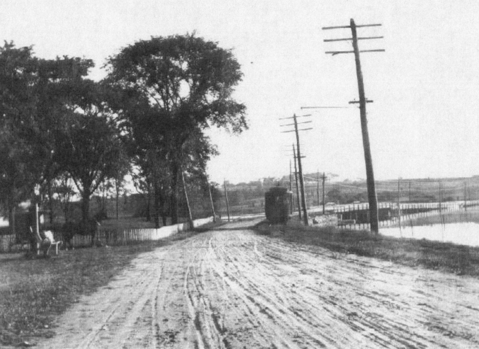
|
of Cove Road and (old) Route 1. The current intersection of Cove Road and Route 1 is slightly to the south, as Route 1 was moved when rebuilt. Old Route 1 in the foreground became what is now Wilcox Road. A complementary image appears in the Trolleys section. |
Gypsy Camp Again
From the Stonington Mirror of May 22, 1906:
A large number of gypsies are encamped at the foot of Lord's Hill near the Quiambaug bridge.
Given the mention of the Gypsies being in the valley in 1898, it seems that the encampments occurred on an ongoing basis.
Quail
1908: Game Warden Tommy O'Connell received 24 Hungarian quail for liberation in Dean's Mill area.
Continuing Bridge Problems
In 1920 the bridge at what is now Rt. 1 settled - apparently this was an ongoing problem that was noticed even at the time it was constructed. The builder had poured much fill in, only to watch it sink into the muddy bottom, a problem he addressed at the time by adding trees and brush - not the best of long-term solutions.
Rural Park Area Closed
1922 Dean's Mills Woods, favorite play area, closed to hunting, fishing, picnicking by Mystic Valley Water Company.
Barrels?
For some years there was rumored to be a barrel-making operation about to begin business in the area (one mention is Sept 25, 1932, Mystic paper) though I can find no evidence that it ever happened.
Road Name?
Mr. Wilbur ran oystering for a number of years south of Rt. 1.
Ellery Thompson
 |
|
Ellery Thompson |
Ellery Thompson was born in 1899, and spent part of his boyhood in Quiambaug, starting in about 1906. He was a fisherman, captain, and painter, and wrote his memoirs, entitled "Draggerman's Haul", in 1950.
From Draggerman's Haul1, pg. 12
Quiambaug (which had another name - Mistuxet-by-the-Sea - but no one ever called it that) is a little sea-coast village between Mystic and Stonington. Of course it's much larger now. I counted the other day and found that there were eighteen houses there. But when we came to it there were only twelve. There was no store, but Oliver Dennison drove a meat wagon. The old residents used to say you could always tell when Oliver was coming by looking for a small dark cloud moving along the road. The cloud would be gulls or flies or both, and Oliver and his wagon would be just ahead of it. Mom seldom bought meat from him, though, because of his high prices. "I simply won't pay fifteen cents a pound for sirloin steak," she said.
To the south were clam flats and pebbly beaches littered with fishing shacks, tar barrels, and drying reels for seines and traps. To the east was the cove, into which Quiambaug Creek emptied; and up from the cove was Lord's Hill, littered with more rocks and boulders per acre than any other land for miles around. As a Quiambauger would tell it, it took a lot of rocks to make New England, and the good Lord got together all he could, so he'd be sure he'd have enough. When he got through he had a lot left and dumped them on Lord's Hill. That's how it got its name.
Page 14:
Yet some of my happiest memories are connected with Quiambaug. The little village overlooks Fishers Island Sound, and on a clear day the view extends all the way to Long Island. It was the hub of the Connecticut fishing industry, profession, and art - for fishing is all three. It was Mr. Fishingtown himself. Quiambaug was dominated by fishing and by Wilcoxes, that famous New England coast family which has more members connected with fishing than any other, and of which Pop's mother was a member. There were two families of Wilcoxes, besides the Dennisons, the Clarks, the Miners, the Noyeses, the Davises, and other fishing families; and the air at all times was quite literally redolent of fish in various forms and stages. Much of the stimulating aroma drifted over the village and surrounding territory from Latimer Point across the cove (later a favorite hide-out for rum-runners). Here stood the Wilcox factory, where the small, bony, and inedible menhaden was turned into various useful oils, fertilizers, etc. It was this strong odor which the old-timers said gave the villagers so much strength and good health, and I believe there was something to it, though it would be hard to make a stranger, smelling it for the first time, understand. Certainly people believed it then, and many were the friends and relatives who came to sit on the Wilcoxes' porch for the sake of the health-giving odors that drifted up from the fertilizer factory. On Sundays and holidays it was sometimes difficult to get through the crowd to the Wilcox front door.
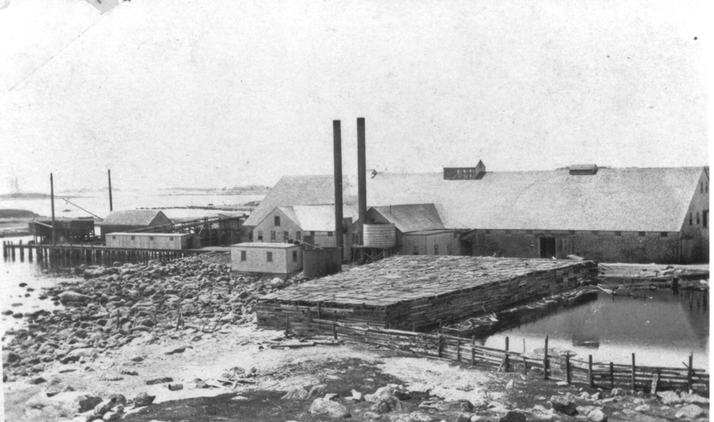 |
|
The Wilcox Fertilizer Plant on Latimer Point |
Menhaden, or "bonyfish", were among the chief prizes of the commercial fisherman. When I was a boy these fish were plentiful and schooled up and down the Atlantic Coast from Nova Scotia to Florida. They were caught in huge purse seines manipulated by men in two double-ended "seine boats," and a third rowboat called a "striker boat," working from a mother-steamer; and were brought back from the sea literally by the millions on the decks of Quiambaug fishing boats, chief among which were the white and buff Wilcox steamers, and delivered to the Wilcox processing plant. The result was the building up by one family of Quiambaug Wilcoxes of the largest fortune taken from the sea by Connecticut men of their generation, and a reputation for a fertilizer so laden with magical properties that a little of it sprinkled around a dead stump would make the stump either send forth living branches again, or get up and walk away to escape the odor.
Al Wilcox tells a story about bringing his small boat into the dock at the factory; it's in the Oral History section of this webpage.
On page 18, about Elias Wilcox:
As the younger Elias prospered, he built his white house - with a widow's walk - on a grassy knoll south of the highway [now Wilcox Rd, at latitude 41°20'21.90"N, longitude 71°56'34.68"W - Ed.], built a tower, something like twenty feet tall; and on top of it he set up an old pilothouse from a steamer, with a powerful telescope inside it, so that he could keep watch on the Wilcox fishing fleet at sea. To get the telescope into focus he often trained it on the near-by landscape, sometimes to the embarrassment of those who inhabited it. After a session up there on a clear day Elias would come down and report whether the horses of the farmer plowing on Fisher's Island, four miles out, wore blinkers or not, or whether the man he had sighted on Watch Hill, seven miles away, wore suspenders or a belt, with side comments on the fitness of these things.
 |
|
Elias Wilcox |
He also had frequent, and often acid, remarks to make on the general conduct of men working on the Wilcox steamers. He picked out unerringly those who hadn't pulled their weight, sometimes referred scathingly to the impropriety of performing certain functions on the landward side of the vessel, and at times made his men almost believe that he was a lip reader. Every man on a Wilcox steamer sighed in relief when a fog settled between ship and shore.
The pilothouse was blown off the tower in the 1938 hurricane, but the tower itself still stands, reminder of the days when Captain Elias was a mighty power in Quiambaug.
Concern for Wilcox fishing luck permeated every nook and cranny of Quiambaug life, for half the population was made up of Wilcoxes and men and women connected with Wilcox enterprises, and half the rest owned Wilcox stock; even Pop had a little of it. One Wednesday evening, so a story goes, the voice of a Wilcox steamer came right into prayer meeting and, for a few minutes, stopped the proceedings cold.
For several weeks fishing had been very poor. The fertilizer plant had been running at less than half capacity. There was illness in the village, too, and one of the most active fishermen lay in bed with a leg broken by a nasty fall on shipboard. It was a sad and discouraged-looking folk who gathered that Wednesday evening in the little white church near Quiambaug to lift their hearts in prayer to an almighty and merciful God, who traditionally had a special sort of interest in fishermen. A Wilcox steamer had gone out that morning, provisioned for a three-day trip. Perhaps if they got their prayers in early enough, God would be kind.
The meeting settled down as usual, and the minister began his prayer. "O Lord," he said, "we are gathered in Thy house, a humble people. Like Lazarus, we are bowed down and afflicted. Our burdens -"
Just then there drifted in from the Sound an unmistakable toot from the whistle on the Wilcox steamer which had left port that morning, and one of the deacons, who owned some little Wilcox stock, held up his hand, stopping the minister in his tracks. There was nothing unusual in a Wilcox steamer blowing its whistle as it approached the shore. It was a custom which had been established to let the factory and the village in general know what the catch was like. Each toot stood for twenty-five thousand fish. What was unusual was for one of the large steamers to come in the day she went out. Usually two or three days passed before her hold was filled with fish or she ran out of provisions. So surprised glances ran around the meeting, and everyone listened, minds at least momentarily diverted form the minister's melancholy prayer.
At the second toot, the minister, who also owned some stock in the Wilcox factory, looked at the deacon, his face showing appreciation. Fifty thousand fish! Not too bad! The minister sighed happily and bowed his head, about to begin again, when a third toot came joyfully over the water and into the house of prayer. A slow smile lightened the stern features of the deacon. The lines about the minister's mouth softened also, and looks of satisfaction spread throughout the congregation. You could almost tell who owned stock in the Wilcox factory and who didn't by the looks of relish and of envy on different faces. Everyone waited, almost holding his breath. And then a fourth toot came, and a fifth, and a sixth! By then everyone in the place would have believed anything, and so there was no real surprise as the tooting went on - ten toots in all! And even after that the minister waited a long time in silence. So did everyone else. But there were no more toots, and finally the minister bowed his head again, scarcely able to abandon his broad smile and force his face into a serious mien proper for prayer. Two hundred and fifty thousand fish! A quarter of a million! Truly the bounty of the Lord was great.
Some paintings of Ellery Thompson may be seen here on the web: (auto-search).
I'll present a few tidbits concerning activities in the Valley during prohibition.
The first was told to me by Charles A. Lathrop, born in 1925, who grew up on Lord's Point. He told me that as a kid he used to go lobstering with his father. One time during prohibition they pulled up a number of their pots, and found what was then termed "hams" - burlap bags filled with whiskey bottles.
Apparently at night booze smugglers would come inshore, lift pots of 'friendly' lobstermen, and leave the liquor to be picked up and handled by them. If you're not familiar with the trade, it's important to know that each lobsterman's pots were painted in distinctive colors. Well, in the dark, his father's pots were mistaken for those of someone who was expecting the liquor. They never got it.
When I interviewed Alfred Wilcox in 2007, he told me this about when he was young, events likely in 1922 or 1923:
A. Wilcox on smuggling boats:
Interview Excerpt
These are mentioned in the above audio:

|

|
| Wilcox Cove, on the west side of Wilcox Road |
The large spool he refers to, on Latimer Point You can see the Wilcox Rd. curve houses in the background to the right. |
He also told me how some smugglers visited the house next to the former Wilcox Marine Store - I don't recall if it were his father or grandfather who lived there at the time. Because there was a (private) road then that crossed the tracks, they wanted to use the site. The reply was "Well, my wife likes to go to the movies on Sunday evenings; you can use it then. Just leave a bottle under the porch."
In November 22, 1940, a newspaper article appeared that Hobart W. Thompson, Jr would run one of the three War Department civilian volunteer listening posts, his being in Quiambaug Cove; he would have the aid of Nathaniel Culver.
In October of that year, another article mentions that the post is at the residence of Hobart W. Thompson, JR, on Cove Road, and that there were airplane maneuvers under way. The volunteers included Mrs. Helen Joy Lee, Mrs. Thompson, Mrs. Thomas Wilcox, Mrs. Sherman Hammond, Mr.s Robert Ramsbotham, Mrs. Edward Adler, Mrs. Alan Banister, and August Holly, Jr.
On December 12, 1941 men where urged to volunteer at the post, which was now open 24 hours per day. An article three days later said that improvements had been made to the small outbuilding being used as HQ by airplane spotters assigned to the post.
Holger Dahlgren and Herman Anderson have provided the lumber and labor respectively. The door, formerly a one-piece affair, has been reconstructed into a Dutch door type; a floor has been laid on the inside of the booth; a table built to facilitate the making of notes; and a platform built on the outside of the building to better protect the volunteer listeners, serving 24 hours a day from the frozen ground.
An article in January 1942 mentions that the post is run by Mr. Yngve Soderberg, and that it is situated on Major Isaac Bromley's mink farm on Cove Road [at what is now 52 Cove Road - where I grew up - Ed.] There were 135 volunteer plane-spotters. Another 35 volunteers would be added.
The post was at some later point in time moved to a location now inside Mystic Seaport.
In the last 700 years 7 major hurricanes have struck the area; sediments show evidence of hurricane strikes in 1635, 1638, 1815, 1938, 1954. Radiocarbon dating indicate 2 other major hurricanes, one between 1295 and 1407, the other between 1404 and 1446.8Much of the data on pre-written-history hurricanes is from the paper "700 yr Sedimentary Record of Intense Hurricane Landfalls in Southern New England", by Donnelly, Bryant, Butler, et al, published in GSA Bulletin, Vol 113 no. 6, pages 714-727, June 2001. The paper indicates that there have been 7 category 5 hurricanes to hit the coast in 700 years.
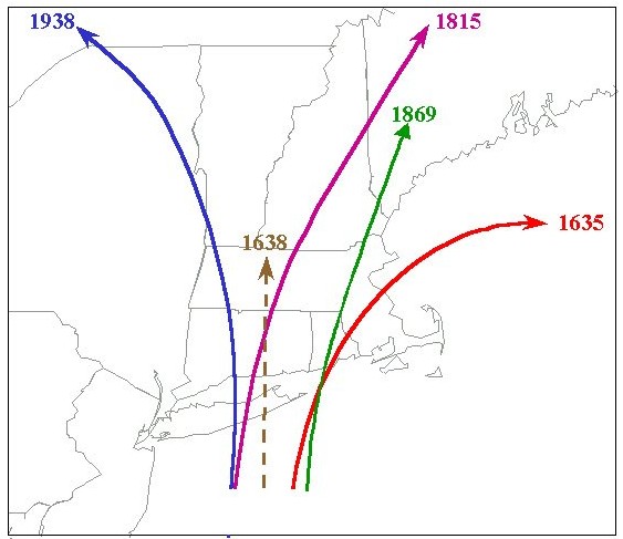 |
|
Intense historic hurricane strikes in New
England. |
When possible I've included the Saffir-Simpson Hurricane Scale category; this is what these numbers mean:
| Category | Wind Speed (mph) | Storm Surge (feet) |
| 1 | 74 to 95 | 4 to 5 |
| 2 | 96 to 110 | 6 to 8 |
| 3 | 111 to 130 | 9 to 12 |
| 4 | 131 to 155 | 13 to 18 |
| 5 | 156 and greater | 19 and greater |
Made landfall near Rhode Island. The strange date range is due to the vagaries of carbon dating; the samples used were from a salt marsh in East Matunuck, Rhode Island.
Made landfall near Rhode Island.
The worst hurricane we know of to have hit the area was on August 26, 1635; from "Storm Tides in Twelve Tropical Cyclones", by Brian R. Jarvinen
The 1635 hurricane was a category 3.5 on the Saffir/Simpson scale. The central pressure was 938 mb near eastern Long Island and 939 mb to 941 mb as it passed through southern New England moving northeast at 40 mph. The RMW was 35 st. mi. Maximum observed storm surges were 14.0 feet at Providence, RI, above 20.0 feet at the head of Buzzards Bay, MA. SLOSH calculated storm surge values give 14.0 feet at Providence, above 20 feet at the head of Buzzards Bay and 2 to 4 feet along the eastern coast of Massachusetts. This was probably the most intense hurricane in New England history.
This hurricane killed 46+ people. View this Wikipedia article for more information.
This text was found in an old Bible which had belonged to the grandmother of Miss Moredock, a teacher at the Quiambaug School:
Sept. 23d, 1815 - The wind at 6 o'clock in the morning at N.E. and heavy Shower of rain; at 7 o'clock the wind at East the wind and rain and tide increasing very Rapidly; at 8 o'clock the wind halled (sic) S.E. and increasing and Sweaping (sic) away houses, and Barns, and Cribs and all kinds of Buildings, and Blowing Down trees of all kinds, fences, and almost all the hay stacks was Blown Down and Swept away with the tide. The tide was said to rise 17 feet from Low water mark, and it was said the Salt water was carried 20 miles Back in the Woods By the Winds. At 10 o'clock the Wind hauled to the South, and abating at 11 o'clock, the Wind at S.W. and a moderate Breeze. Their was many lives lost in the Blow. This is William Miner's account that he saw - Stonington, Sept. 23d, 1815.
Oliver Wendell Holmes was 6 years old when the storm occurred, and later wrote about it in his poem "The September Gale".
The storm crossed Long Island and came ashore near Saybrook, CT.
There is a brief account of this hurricane in "Stonington By The Sea", on page 86. David S. Hart recorded his impressions after that storm:
"We traversed every portion of the village, explored the shore on both the bay and harbor sides, for some distance beyond the borough limits. Such a scene of devastation I have never beheld. Not only a portion of Water street, but many of the cross streets and pent-ways were filled with the ruins of wharves and buildings, in some places ten feet high. Confused heaps of stones were all that remained to show where the wharves had been. ... There were two points in the central and lower parts of the village where the waters of the bay and harbor came near meeting. Had the hurricane continued an hour or two longer, two islands would have been formed; thus completely cutting off the inhabitants of these sections of the village from the northern portion.
Came ashore near the CT/RI border.
Storm passed over eastern CT, Rhode Island, and eastern Massachusetts with a path about 60 miles wide.
Hurricane crossed eastern Pennsylvania and southeastern New York state, then turned to the northeast and east across New England. Much damage was reported in New York City, Brooklyn, the Hudson Valley, and Long Island Sound. Several vessels were sunk along the Connecticut coast.
Storm passed over New York City, then northeast into New England.
Highly destructive in the Connecticut Valley and coastal shipping.
Prior to this hurricane, Connecticut received between 14 and 17 inches of rain, which weakened the grip tree root systems had upon the soil. While a Category 3 hurricane, this factor led to much greater damage due to downed trees. Also, as a very fast-moving hurricane, it struck with very little warning, and close to high tide - it hit Long Island at 3:30 PM, Even the normal high tide was significantly higher than usual because of the Autumnal Equinox and new moon.
This hurricane was first reported by radio on the evening of September 17, when it was centered about 500 miles NE of the Leeward Islands. On September 21 it passed over Long Island and into Connecticut near New Haven. Loss of life was estimated at 600.
Winds: 115 to 120 mph, gusts possibly to 150 mph
Storm moving at ~ 50 mph
Storm surge: ~17 feet feet
In terms of fatalities and property damage - the 1938 hurricane stands as one of the worst disasters in North American history. In a matter of hours, 688 people were killed, 4500 were injured, and more than 75,000 buildings were damaged. The states of New York, Connecticut, and Rhode Island, suffered their worst natural disaster in recorded history. The tidal wave like storm-surge that hit Long Island and Rhode Island was so severe - that earthquake instruments 3,000-miles away recorded it on seismographs. As a final cruelty - the residents of the North Atlantic states had little or no warning that this extreme meteorological event was unfolding before them.
...Several survivors along the coast of Rhode Island, stated that at the height of the hurricane, they saw a 40-foot fog bank rolling toward the beach, when the bank got closer, they realized it wasn't fog - it was water (Whipple - 1940).
One reason the 1938 hurricane was such a shock was that nothing like it had happened since 1815, so there was no living memory of how bad it might be.
A train that had just left the Quiambaug Valley heading east was caught on the trestle and embankment leading into Stonington Borough, across the north end of the harbor. Here is a photo.
One casualty occurred at the point opposite Lord's Point, sometimes referred to as Wilcox Point (this is between Trestle Beach and Latimer Point). There was a house there which was washed away, and the occupant died. The foundation of the house is still there
 |
| The foundation of Earl Stinson's house, here: stinson.kmz |
The local paper reported it as follows:
Earle Stinson Drowned
William Earle Stinson, a resident of Quiambaug, was another of the victims of the storm, his body being found Wednesday at Lords Point. He lived in a small cottage at the Quiambaug shore and his home was destroyed in the storm.
The remains were taken to the Shea Mortuary Chapel in Mystic, and burial was made yesterday at the family plot in Union cemetery at North Stonington.
Here is an image of railroad workers straightening the tracks shortly after the storm (NOTE: verify this isn't '54, don't think it is due to tracks):
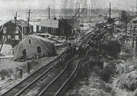
|
|
|
Looking across the Quiambaug Valley from the Lord's Point bridge during the 1954 hurricane |
On old newspaper clipping (paper unknown) reported the day after the hurricane that
The most severely damaged sections, Groton Long Point and Lords Point in this section are under strict guard by Battery A, 238th AAA gun battalion, National Guard and Connecticut state police. Visitors who have no business other than sightseeing have been barred from these locations entirely.
Hurricane Donna - category 2/3 with peak gust of 140 mph at Blue Hill, Massachusetts, 135 Block Island. Peak wind gust at hourly read at anemometer at New Bedford Airport (Massachusetts) recorded 110 mph from south-southwest in a sheltered area. Airport is located in a landscape depression and sheltered from southerly and easterly winds,despite this very high 5 pm gust. Heavy tree,utility and structural damage in southeastern Massachusetts,coastal New Hampshire and Maine. Sixth hurricane hit in southern New England in thirty years, fifth major storm in 22 years. Hourly wind speed reading at City Hall in downtown New Bedford, Ma. recorded 80+ mph.
Hurricane's rather slow movement enabled weakening to set in as storm approached Long Island, NY and then moved into Connecticut, MA, nd transversed the Vermont/NH border. Wind gusts to 90 mph in southern Connecticut, 60+mph Providence RI and 75 mph Newport RI. Considered minor storm.
|
|
|
Preparing for a hurricane - the author in the second boat, a Jet 14 |
Widespread wind damage reported in Conn, RI, and MA, later into coastal NH and Maine. Tree damage in Conn. worst since 1938 and wind losses in RI and eastern Massachusetts considerable to trees, utilities and roofs. New Bedford, MA reported wind gusts over 90 mph, inland Rehobet, MA state police barracks reported 120 mph and also later reported a tornado in vicinity. Winds at airport in Warwick, RI gusted to 85 mph at top of the hour reading. Winds on East Side of Providence near Brown University clocked at 100 mph. Winds in New London,Conn clocked at 110-112 mph. Widespread forest damage in Maine. Storm still had hurricane force wind gusts into New Brunswick, Canada.
Cat 2 with category 3 wind gusts in southeastern Massachusetts. One of the smallest in area and yet most intense hurricanes to hit southern New England since 1938. Comparable to Hurricane Carol in Buzzards Bay area of Massachusetts and worst storm on Martha's Vineyard MA since 1944. In top 25 storms of 20th century of US hurricanes in terms of dollar loss. (1938, 1944, 1954 Carol, 1960 Donna and Bob are all on list). Tidal surge of 10 feet above normal in upper reaches of Buzzards Bay. 135 mph at Block Island before anemometer blew away. 125 mph at Newport RI,sustained 5 minute speed of 111 mph,gust 144 mph at Westport Harbor on coastal southern MA/RI border. 120 mph at MA Maritime Academy on Buzzards Bay, 120 Truro,MA. One minute sustained speed of 110 mph on Chappaquiddick Island MA. Several private anemometers in Falmouth, MA on Cape Cod reported unofficial gusts of 150 mph. New Bedford fishing boat off Cuttyhunk Island MA reported peak gust of 162 mph.
After paralleling much of the U.S. East Coast, Tropical Storm Floyd moves into Connecticut, and tracks northward through Maine. Floyd causes large power outages and flood damage across the region, with over five inches (130 mm) of rain falling over most of the area. Danbury, Connecticut received up to 15 inches (380 mm) of rain from the storm, resulting in extensive flooding in the city and surrounding areas. Mudslides were reported in theBerkshire Mountains of western Massachusetts. Several major highways and a countless number of local roads in Connecticut and Massachusetts were closed for several days due to flooding, and downed trees and power lines. Hurricane force wind gusts were observed in southern Rhode Island: North Kingston unofficially 90 mph.Wind gusts to 76 mph at New Bedford Hurricane Dike in New Bedford, MA and 73 mph in Hyannis, MA.
A. Wilcox on QB Fire Dept. beginnings in 1961: Interview Excerpt
The firehouse, shown below, is on what used to be Route 1, but which is now just a loop off of the new road. It is at latitude 41°20'32.67"N, longitude 71°56'47.53"W.
Here are two external links, one to the facebook page and one to the fire department's web page.
The Denison Pequotsepos Nature Center has been one of my favorite places since I was a kid. It's a wildlife sanctuary, small museum and shop, and educational facility. It is at latitude 41°21'45.14"N, longitude 71°56'48.63"W.
They maintain a number of hiking trails - here's a map:

The Denison Homestead is right across the street from the Nature Center; it was built in 1717, and has exhibits spanning the first three centuries of colonial life. There is a photo a brief description above as well; it is at latitude 41°21'47.29"N, longitude 71°56'51.08"W.
The Avalonia Land Conservancy has (among their many properties) the Knox Preserve adjacent to the Miner Cemetery and Quiambaug Cove, on the "morning" side of the valley.
It is at latitude 41°20'21.55"N, longitude 71°56'18.58"W.
At latitude 41°21'28.94"N, longitude 71°56'15.85"W.
From the Mystic Press, for the week ending Thursday, June 3, 1886:
Mr. William Archie, who last winter bought the Quiambaug granite quarry of Messrs. Williams and Allyn, is getting out a good many pavers and is now piling up a cargo at the Williams dock for shipment to New York.
At latitude 41°21'8.27"N, longitude 71°56'4.97"W. I was told it was used for military training, but I have no idea when that might have been. Later on, the large flat area also hosted horse racing.
At latitude 41°20'26.37"N, longitude 71°56'7.39"W. This is part of the lower cove, between the Rt. 1 bridge and the railroad bridge. It got it's name because it's easy to go right by in a boat and not see the entrance to the small round pond-like harbor. For many years there was a road down to it from what was Kellems, no Zachry, but I think that's been overgrown. When Kellems was there, they'd use the area to tack up boards of outdoor fittings to see how they would weather over time.

At latitude 41°20'40.95"N, longitude 71°56'32.89"W. This area was geologically very interesting, with one very large boulder nearby, and a large flat stone area with a few fissures. The old "Mystic Road" went right by it on it's west side. I can't be absolutely sure that this is the area referred to by various sources, as I'm going mainly by memory of what it looked like in the 1970's, but it fits all descriptions. Now what's left of it is either part of or next to a house on Lamb's Way.

There are some in the valley, but residents seem reluctant to point them out, possibly fearful of tribes stepping in to take control of the land. I don't know. One is referenced above as the burial spot of indian 'queen' Ester Benedict.
At the north end of the valley, and feeding into it, is Copps Brook. The Avalonia land trust has done a lot of work there, here is a 2023 summary: Copps Brook 2023.
Just to the west of Copps Brook, and just north of Pequot trail, was the Copp house. It's shown on some older maps, and an overlay using google earth shows its precise location. It's on Aquarion land, so to look for the foundation I'd have to request permission again:

Here is an 1854 map with the house labeled "Copp", just above and a little to the right of the "O" in STONINGTON. Again it would be easy to do an overlay in Google Earth to find the current location, assuming the initial map was accurate:

Click here for a full-sized version - still not as good as a printed copy, but useful nevertheless.
This is a major section, one which I've split off due to its size. It is well worth visiting.
I felt it had grown to the point where it threatened to overwhelm the page, or the reader's patience when trying to reach other sections, so I've moved it to a separate page. You should definitely visit it, as it has a map of all cemeteries in the Valley, a list of everyone known to be in each cemetery, photographs of the locations, and when possible I've included stories about the individuals.
To visit it, click here:
Lord's Point really does deserve special mention, as it is a separate, well-defined community, and is a chartered submunicipality in the state of Connecticut. It basically covers the area where the east side ridge of the valley meets the sea. It has its own page, here:
This community and the history of the point is described here: .
Farmer's Markets - there are two of note, one at the Dennison homestead on Sunday afternoons, the other at the Quiambaug Volunteer Fire Department (on Tuesdays).
 |
|
The Farmer's Market at the Quiambaug Fire House |
 |
|
Mrs. Gertrude Murray |
In 1942 Gertrude Murray of purchased the Jennings home on Quiambaug Cove, and after a year of alterations had converted it into an inn (known as the Seabrook Inn, then Seaport Manor). The furnishings, picked to complement the interior woodwork and English architecture, were purchased from the former Heublein Hotel in Hartford. G. Fox & Co. was commissioned to construct a circular bar, matching the original Honduras mahogany paneling. An outdoor arbor was constructed for garden weddings, and much landscaping was done by a nursery that Murray had purchased for that purpose. For an addition to the structure, the cobblestones used in the original foundation were matched.

A former head chef of the Mohican Hotel came to run the kitchen. The dining room featured white linen, fine crystal, first-class service, and a gourmet menu. It became a well-known restaurant - Harry Truman dined there, as well as other famous people of the era. The actor Ted Knight held a special function there, and then arranged for Murray to appear on the Betty Crocker show, where she demonstrated her specialty, Lobster Thermidor.
Here are some menu examples:
|
HAPPY NEW YEAR APPETIZER Fresh Fruit Cup au Sorbet Parisienne SOUP New England Clam Chowder au Persey SALAD Tossed Green Salad Bowl - Real Roquefort Dressing RELISHES Assorted Olives Rosebud Radishes Chilled Stuffed Celery MAIN COURSES Roast Native Young Tom Turkey - Raisin
Dressing - Giblet Gravy Broiled Double Spring Lamb Chops - Mint Jelly VEGETABLES Fresh Buttered Garden
Peas Corn Fritters - Southern Style DESSERT Frozen Tom and Jerry Parfait BEVERAGES Tea Milk Coffee Nuts
Favors Noise Makers
Candy Orchestra Dancing $5.00 Per Person 20% Amusement Tax |
Here is an example of the 'everyday' menu; it is a large enough image that I did not want to include it inline. And here is a placemat.
Gertrude Murray sold Edgemere to the Pine Point School in 1954, later saying that "I wanted the restaurant and its reputation to stop when I did."
Incorporated by the General Assembly on April 13, 1887 to provide fresh water for Stonington Borough, the Mystics, and Noank, the company began business in the summer of 1887. It was acquired by the Atlantic Public Service Company in 1928, and the SEC ordered that it and other subsidiary companies be divested in 1942. By 1958 the company was a wholly owned subsidiary of the Northeastern Water Company, and by 1969 was owned by Greenwich Water Systems, Inc. The Mystic Water Company as a legal identity was merged into the Greenwich company in 1997 to form the Connecticut American Water Company, which was bought by Aquarion in 2000.
The engineers and contractors were Wheeler and Parks of Boston, MA. The main source of water from Copps brook, the reservoir would hold in toto about 2,000,000 gallons at an elevation of 185 ft. (seems high to me), with an initial plan of 14 miles of pipe and 42 hydrants. [From "The Manual of American Water-Works", 1888.] At this point in time (2026) the storage capacity is about 114,000,000 gallons.
From the web I find tidbits:
latitude 41°20'54.36"N, longitude 71°56'18.70"W. I can find no online references to this business, or any further descriptions anywhere, so I will describe it from memory. The Johnsons lived at 99 Cove Rd; I was their paperboy for a while. He ran a machine shop in a largish outbuilding.
I wouldn't have known much about it, but when I was a sophomore in high school I stayed after school a number of days to machine a (working) replica of a British 24-pounder cannon - it's about 8 inches long. I recall talking with Mr. Johnson about it, that I wasn't sure how to drill the bore properly, and he offered to help. He took me over to the outbuilding to show me around.
It was like stepping into a different and entirely unexpected world. Various nearly floor-to-ceiling machines were crammed into the space, to the point where there were a few distinct paths in the building to get through it. Many were running, with at least one other person working there.
Mr. Johnson explained that he was now in the business of making precision gears - of various shapes. We talked quite a bit. He'd gotten his start as a young man, during WWII, when he answered an RFP to make a specific kind of small steel plate (with various holes, etc.). He won that contract, which got him started, and he built the business from there.
A week or so later I came back with the cannon, and he set it up on a lathe, with a number of 'indicators' to make sure it was aligned properly; then he used a long drill to cut the bore, and we finished it off with a touchhole to fire it.
I essentially moved away to Boston for nearly 20 years, and when I came back they were gone, and the business was no longer there - I have no idea whether he sold it and retired, or what happened. When I find out more I'll edit this.
All in all it was fascinating to see essentially a high-tech, precision gear factory in little more than a large garage!
Location: latitude 41°20'27.09"N, longitude 71°55'56.75"W
Anna Vivien Kellems founded the Kellems Company in New York in 1928, to manufacture cable grips invented by her older brother Edgar. She moved the company to Westport CT, then finally in 1948 to Stonington. She sold it in 1962.
"Cable grips" are like "Chinese finger puzzles" - the end of a cable goes into one, and when one pulls on the grip, it tightens on the cable. Her products were used in the construction of the George Washington Bridge, the Chrysler Building, and also in artillery shell production.
[Note: I worked in the machine shop there during at least one summer, it paid for a chunk of my MIT tuition.]
The company was acquired by Harvey Hubbell inc., and a description may be found here.
This site has been a restaurant for many years, first as the Clark Chowder House, then under other names. Here's an obituary of Capt. Clark, who began that business:
Friday, November 12, 1937
It is with sincere regret that we are called upon to record the death of Capt. Elisha D. Clark, which occurred at the home of his daughter, Mrs. Harry O. Chapman, in Quiambaug, quite suddenly on Thursday Morning.
Capt. Clark was born in Avondale October 30, 1864, the son of Joshua and Harriet Clark. For many years he was a familiar figure on the streets of the borough, as he came from his home in Quiambaug in the morning and returned at night, after a day's occupation out on the waters engaged in fishing.
After many years of this life, and following the passing of his wife, who was Miss Luella Strickland, he erected a building at Quiambaug and opened the "Clark Chowder House", which has become an eating place of enviable reputation. This, with the aid of other members of his family, he conducted each summer, and made it his home during the winter months for a greater part of the time.
Sailor Ed's
latitude 41°20'34.54"N, longitude71°56'46.99"W)
This was a popular seafood restaurant when I was growing up here (1960's, '70's). It was on what was Route 1, the main highway, until that road route was changed in 1962. It still was highly popular for quite some time. One longtime owner was Chet Godomsky.
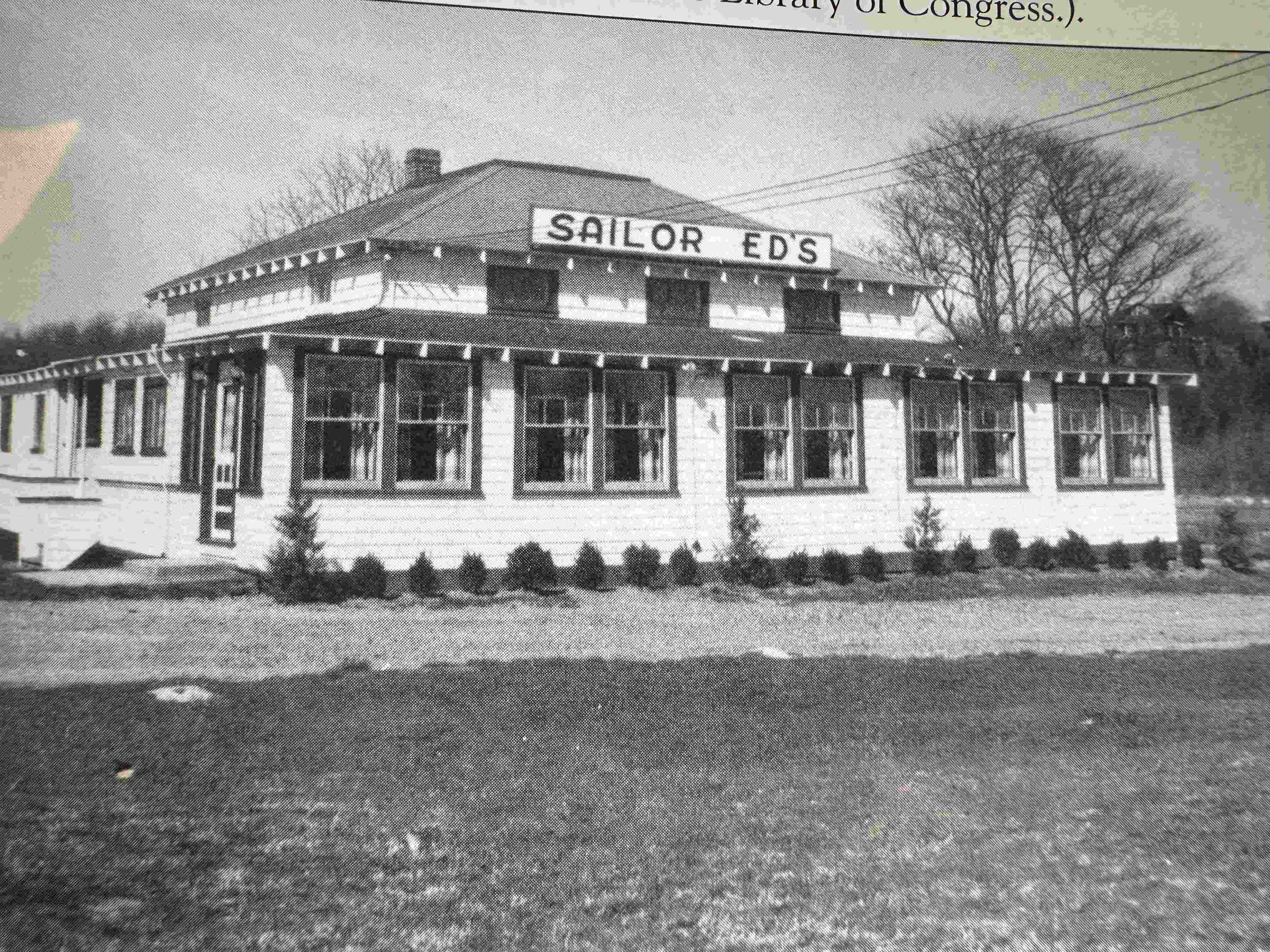
|

|
The menu pages here will give you a sense of what dining there was like. It was in general basic seafood. Here's a brief description of its history: The Life and Times of a Defunct Restaurant.
Menu Pages: Cover, Page2, Page3
For a while an extended structure on the spot was the restaurant Quiambaug House (see, for instance, this article in the Hartford Courant: Taste the Sea at Quiambaug House in Mystic).
A modified version of this building is now the excellent restaurant Go Fish: Go Fish Website, which will be described more fully in the active businesses section below.
latitude 41°20'21.84"N, longitude 71°56'41.29"W
, at the sharp curve of Wilcox Rd.This store began in this location, was there for many years, and towards the end of its time moved across from the Dogwatch Mystic restaurant.
One of the main elements of the business was fishing net manufacture and repair. (My first job was there, repairing nets). There was a substantial commercial side to the business, which gradually declined as the fishing fleet in Stonington Harbor did.
It also sold marine hardware for those of us with boats - they had a wide variety of fittings, fasteners, various chain and ropes, fiberglass resins - basically anything you might need.
I believe this image is from its second location, but can't be sure:
latitude 41°20'36.04"N, longitude 71°56'55.72"W, 20 Old Stonington Rd.
When I worked there in the mid-1970's, the Cove Fish Market had a seafood market on the left side of the building as you faced it, and on the right was take-out fried and other seafood, burgers, and such. Here's an archived website.
Later on the longtime owner sold it, and it struggled. It was eventually sold, and turned into Dogwatch Mystic, described in the active business section below.
latitude 41°21'54.29"N, longitude 71°56'6.61"W Jonquil Farm is the last piece of land left from the homestead that was
originally farmed by proprietor Stephen Palmer’s great-great-great grandfather, Captain Alexander Palmer, a descendant of Walter Palmer, who was one of the original settlers of I somewhat intentionally am not adding a lot of detail about current businesses; their own websites and such tell a better story, and I list them here mainly to provide a sense of ongoing commercial activity. latitude 41°20'36.04"N, longitude 71°56'55.72"W, 20 Old Stonington Rd.
On the site of (and includes part of) the old Cove Fish Market (described above) is now the restaurant
Dogwatch Mystic. There is a sister restaurant in Stonington Borough.
It's a very nice place; the website has the menu and other information, that's the best way to get an overview.
latitude 41°20'34.54"N,
longitude71°56'46.99"W, 29 Old Stonington Rd.
Go Fish Restaurant is restaurateur Jon Kadama's
most recent restaurant. It's website says more about it than I can here; the first phrase on the site is "Inspired by the Pacific Rim". I've used the larger banquet room there on occasion.
Here is an article about it:
Day Article from 2024.
latitude 41°20'26.65"N, longitude 71°55'57.69"W
Zachry Nuclear is in the old Kellems factory, just
north of Lord's Point. From their website:
Zachry Nuclear is a full-service engineering firm providing engineering, design, and analysis services. We offer skilled mechanical, electrical, controls, civil and structural engineering professionals and designers who are knowledgeable and experienced in both existing nuclear plants and new small modular reactor designs.
Our staff has performed all phases of power plant projects from studies and option evaluations through conceptual and detailed design to construction and start-up testing.
Latitude 41°21'59.99"N, Longitude 71°56'2.80"W Aquarion Water is a large company, currently a subsidiary of Eversource. They serve
more than 780,000 people in 73 cities and towns in Connecticut,
Massachusetts and New Hampshire.
This particular facility manages water above the dam right at the intersection of
Jerry Browne Rd and Mistuxet Ave. This is the
third and most southern dam of Copp's Brook. The water that they release over the dam
flows down into Quiambaug Cove.
It looks as if there was another sort of structure here, with a different purpose.
There is a "tail race" to the west of Mistuxet Ave heading south - it merges with the
main output of the dam further south perhaps 150 yards. I was likely a more traditional
mill, perhaps for the production of flour - further research should clarify this.
They were as I recall on the back side of Quoketaug hill. They may no longer be active; at least their website says they don't sell to the public, but they may well sell to local restaurants. 325 Mistuxet Ave, Stonington This business initially was dedicated to teaching dance, it seems to have morphed into providing performances and/or apprenticeships. Their website is mysticballet.org.
107 Wilcox Rd, Stonington This office building may or may not be in transition. The website is Quiambaug Cove Professional Center. I have known doctors and lawyers with offices in the building. When I was a kid and had a paper route here, it was the Connecticut Light and Power building. I used to walk in through the front door, hand of papers to the office people, then back out where the linemen were, and out by what you'd take as a loading dock, where the service trucks were. Upon return to the area it was Yankee Gas; then it later got converted to office space. 79 Stonington Rd, Mystic (It's worth noting that the postal delivery is different between "Stonington" and "Mystic", though much of Mystic lies inside the town of Stonington.) 47 Stonington Rd, Stonington This is a car dealership; here is there website: Brustolon 25 Stonington Rd., Mystic They do sales and repairs:
Mystic Cycle Center
The first description of a murder I owe to Detective Cody Floyd of the
Stonington Police Department, who came upon a letter in the Yale "New
England Indian Papers Series", about a murder in 1671. It was
available on the web, but now seems to be missing, both as a digital image and with a scholarly transcription (which I will paraphrase below, primarily modernizing spelling, for readability). Here is a transcription of the letter, from Thomas Stanton and Thomas Minor to John Allyn, dated December 29, 1671: Honored Sir "Darling Hill" is on the east ridge of the valley, not far north
from the entrance to Lord's Point. Now that Route 1 cuts through
the top of the hill, the driveway to the farm is on the right as one heads
west. The house where this murder occurred burned down in 1930, and was
replaced with the current "Darling Hill Farm" house. On their return home, Mr. Henry Langworthy and his wife Maria
returned home in the evening, to find their son Irvin murdered in
their kitchen, and that their other son Courtland had been seriously
injured while asleep. For a description of the investigation into this
murder mystery, and its results, look for the upcoming book "The Stonington Tragedy / Murder at Darling Hill" by Judith Gildersleeve DuPont, from the Stonington Historical Society (Historic Stonington). (This is an approximate excerpt from the Washington Post of April 28, 1992, an article by Brett D. Fromson).
Money, Mayhem, Murder; PaineWebber Sued Over Broker's Deed
This tale of money and murder began with a
two-sentence note that the PaineWebber Inc. brokerage firm sent to
Ronald W. Hiiri, a customer of its New Haven, Conn., branch office, in
May 1988.
The note informed Hiiri that his broker, Frank Vandever, was no longer with PaineWebber. Hiiri, who had suspected for months that Vandever had been embezzling money from his account, telephoned Vandever and demanded that he come over and explain himself. Unfortunately for Hiiri, Vandever did show up. He shot and killed his customer and then placed transvestite literature and a sexual device in the house From an AP report of Thursday, January 2, 1992 HARTFORD, Conn.:
Escapees Traveling As A Couple
Authorities could have a tough time finding the killer who escaped from
the state's maximum security prison New Year's Eve: The man, a former
stockbroker convicted of killing a client, is a transvestite adept at dressing as a woman.
Frank Vandever and another inmate sawed through bars in a trash room at
Somers State Prison, then cut through a chain link fence surrounding the
prison, authorities said. "They could be traveling as a couple, as a man and a woman, we just don't know," said Lt. Eugene Sullivan of the Connecticut State Police. "The trail is cold." Vandever, 37, of Guilford was serving a 40-year sentence for the 1988 murder of a client who discovered he was tapping into his investment funds. The other escapee, Ronald Rutan, 34, of Old Saybrook, had served more than a year of a 19-year sentence for burglary and larceny. Both were working as recyclers in a trash room adjacent to the kitchen.
After leaving the prison ground, they broke into an office building
three miles west and tied up a couple who came to clean
the building Wednesday morning. They fled in the couple's tan pickup
truck. The couple was unhurt and told police Vandever and Rutan apologized for tying them up and taking their truck. Vandever, who had no prior criminal record, admitted
planting transvestite literature and a sexual aid in Ron Hiiri's
Stonington apartment to make it appear his death was a sex crime. Investigators also discovered that on the day Hiiri was shot to death, Vandever used the victim's credit card to buy himself a $164 outfit at a boutique that caters to transvestites.
Stonington Detective Barbara Richard, who arrested Vandever, said she doubted Vandever was still in Connecticut. "He's too cunning, too
intelligent to be around here," she said. "I know he's a very smooth
operator who can con his way out of just about anything." Warden
Lawrence Tilghman said he was trying to figure out how Vandever and Rutan were able to breach security at the state's toughest prison. "Somebody was lax, there's no doubt about it," he said. The warden said he thought Vandever was wearing the standard blue and white prison uniform when he escaped.
It didn't work out for Vandever, however. Frank Vandever, the former stockbroker and convicted murderer who broke out of a Connecticut prison New Year's Eve, was ordered back to Connecticut by a Federal magistrate today. Mr. Vandever, a 37-year-old transvestite, was captured in a Paramus shopping mall on Saturday. He and another convict, Ronald Rutan, escaped from Somers State Prison. Mr. Rutan was caught Thursday in New York. Mr. Vandever appeared at a brief hearing in Federal District Court, wearing an orange prison jumpsuit, handcuffs and leg irons. Magistrate Stanley Chesler issued the order. The former stockbroker, from Guilford, Conn., was serving a 40-year sentence for killing a client who caught him dipping into his investment accounts. Mr. Rutan, of Old Saybrook, Conn., is a former heroin addict who was doing 19 years for a string of burglaries along coastal Connecticut. They apparently financed their days as fugitives by staging a series ofconvenience store robberies in Bergen County. The warden of Somers State Prison later resigned, as summarized in this
Hartford Courant article.
Here is
Another article summarizing events and the status of Vandever in 2021.
Leslie Buck was a second-grade teacher at Dean's Mill School, and her husband Charlie was President of the Quiambaug Volunteer Fire Department. [This author knew them both - Ed.] On May 2, 2002 Mrs. Leslie attended a meeting of teachers; she left
after the meeting ended at about 8:15 PM, but didn't actually arrive until about 11 PM, and described being kidnapped by a friend and sometime
employee of her husband Charlie, named Russell Kirby. As she told
the police: "Hello, I just, I came home and this person, a friend of my
husband’s was in the garage, I think he had a stun gun, he grabbed me
by the neck, he kept pulling me, he pushed me down, then he finally, he tied my hands & feet when he took me to his house on where is it? . . . Lantern Hill?... He punched me in the stomach, and I tried to pull away and finally we’ve been driving around in the car and he just stopped on [Interstate] 95 and he had the keys with him, he has our house keys! She described how Kirby had taken her to his house, and after a
while there but her back in the car to drive her around. Before leaving Mrs. Buck asked him to get her purse which was still in the house; he did.
She got him to loosen the ropes on her hands by telling him her hands
hurt. While driving, Kirby said he wanted $2,000, $3,000, finally $10,000. She told him her husband would give him the money. She said that Kirby had stopped the car on the Allyn Street exit to
check something (apparently he thought he'd hit something), and that she shut the door and used a spare key to drive away. After she arrived home and spoke with police, Russell Kirby was arrested. The next day Leslie went to work, and worked a full day at school. That
evening, after the police had stopped to check on her, she died -
apparently as the result of a fall down a full flight of stairs. She was found in the evening by her husband; she was 57. At this time Russell Kirby was still in jail. As the news of these events spread, other possibly related elements
began to surface. Carol Perez, age 33, a local barmaid, at the Draw Bridge Inne on
West Main St. in Mystic, told police that her husband Charlie had asked her to run away with him. Employees at the restaurant where she worked said he had been giving her expensive gifts and cash for several months. She also told police "that he said he would have to mourn for a year for appearances' sake and they would 'have to stick to their story and make sure it's the same'"17. Employees at the Draw Bridge
Inne said that the day after Mrs. Buck said she was kidnapped, Charlie told Carol that he had liquidated all his assets and that now was the time for them to run away. Ralph Hill, one of the employees, said that he told police that Mr.
Buck had asked him several times about finding someone to hire who would kill the ex-boyfriend of Ms. Perez, and indeed had offered him $4,000 to do so18. At times Charlie Buck has denied having anything to do with his
wife's death, or pled the 5th Amendment's right to avoid self-incrimination (he did not testify at Russell Kirby's trial on this basis). Russell Kirby was found guilty of the kidnapping, but in October
2006 the state Supreme Court overturned his convictions and ordered a new
trial. The reason was that they said Leslie Buck's statements to the police dispatcher and a police officer should not have been admitted as evidence, as he had no way to cross examine his accuser. (While I see some rationale for this, I find this particularly bizarre in a case in which the accused's actions may have led directly to the death of the accuser - if, for instance, Leslie tripped due to the after-effects of her head injuries.) In October 2007 Russell Kirby again rejected a plea deal, which would have sent him to jail for 12 years on lesser charges - so there may well be a second trial. Some few years later, Charlie Buck died by sliding off of his roof. There are a number of fascinating people who have lived or now live
in the Quiambaug Valley - I wish to pick only a few to highlight here.
My first consideration is that, for reasons of privacy, they no longer be
living. My second is that they be at least modestly famous - mainly so that they'll be interesting to a wider audience. This is of course guaranteed to ignore many fine people, but I am open to suggestions. Grand-uncle of Nathan Hale. The Rev. James Noyes came from Massachusetts to Stonington; he
married Dorothy Stanton. His sister Sarah (married to Rev. John Hale of
Beverly) was accused of witchcraft in the Salem frenzy of accusations.
James's cousin Nicholas was pastor at Salem. James and other clergymen
met in 1701 and established the Collegiate School of Connecticut, later known as Yale College. He became one of the founders and was chosen to be its senior trustee; he is reported to have given the largest number of books towards the college library at that time. He's buried in Wequetequock Cemetery. The Fanning family lived in Stonington Borough, but for a period of time the family lived in a house in the QB valley. Nathaniel Fanning was born and lived his early life in the Gilbert
Fanning house, somewhat south of the current Aquarion water works (the
foundation location was described to me by Steve Palmer III, who lives in the Elisha Gallup house nearby).. From Wikipedia's
entry on him: Nathaniel Fanning (31 May 1755 – 30 September 1805) was an
officer in the Continental Navy and later the United States Navy, who
served on board Bonhomme Richard during its 1779 battle with HMS
Serapis.Fanning was born in Stonington, Connecticut, and was the eldest
son of Gilbert Fanning and Huldah Palmer. His father was a sea merchant
who was one of the largest provisioners of General George Washington's
army during the American Revolution. On May 26, 1778, Fanning embarked from Boston, Massachusetts aboard
the brig Angelica as a prizemaster under the command of Captain William
Denison in a cruise against the British. On May 31, Angelica was
captured by the British man-of-war Andromeda and blown up, with Fanning
being made a prisoner. Aboard Andromeda was General William Howe, who
was returning to England. By orders of General Howe, the Americans were
confined to the hold and treated severely, being allowed but a
half-pint of water per day per man, even though the heat was so
unbearable that the men were obliged to strip off all their clothes. On June 30, 1778, Andromeda reached Portsmouth, England, and Fanning
was incarcerated at Forton prison. On July 2, 1779, Fanning was
included in a prisoner exchange. He was marched to Gosport, then taken
by cartel to Nantes, France. From there, he traveled to L'Orient,
where, under the command of John Paul Jones, he agreed to serve as
midshipman and private secretary aboard Bonhomme Richard. On August 14, 1779, Bonhomme Richard set sail, and over the next
month captured or destroyed at least 29 enemy vessels. On September 23,
Bonhomme Richard famously fought the British frigate Serapis. During
this engagement, Fanning served as captain of the main top. Most of his
original group of men were killed, but he took a fresh party aloft and
with them cleared Serapis' tops. When their yards locked the ships
together, he led his men across to the British ship, where with hand
grenades and mortars, they drove the British seamen from their
stations. In recommending that Fanning be promoted, Jones said of him
". . . he was one cause among the prominent in obtaining the victory".
Bonhomme Richard was destroyed during this battle, but the Americans
sailed to Holland aboard
Serapis. Fanning continued to serve under Jones aboard his new ship Alliance
and later Ariel. Fanning then served as second-in-command aboard the
privateer Count de Guichen. On March 23, 1781 they set sail from
Morlaix and for many weeks ransomed or sunk numerous enemy vessels. But
on May 4, the privateer was captured by Aurora and Fanning was again
made prisoner, but paroled after six weeks. On December 3, 1781, Fanning sailed from Ostend aboard Eclipse and
had another productive cruise, returning to Dunkirk on March 6, 1782.
While Eclipse was being refitted, Fanning made two trips to London,
once as a spy and once to deliver peace proposals from the Court of
France. On June 6, Eclipse left for the coast of Scotland under the
command of Fanning. On August 11, Eclipse was chased by Jupiter, said
to be the fastest ship in the British Navy. To escape Jupiter, Fanning
ordered Eclipse to pass directly through the middle of the British
Channel Fleet in broad daylight. To evade capture, he hoisted English
colors and when hailed, answered that the ship was His Majesty's cutter
Surprise. Two days later, Fanning was wounded in the left leg by a musketball
while capturing Lord Howe. He sailed for Dunkirk and spent several
weeks recovering. In October 1782, he was commissioned as lieutenant in
the French Navy. On October 23, he sailed from Dunkirk in command of
the privateer Ranger, but it was captured by an English cutter. Fanning
was promptly exchanged, but his crew members, being Irish, were all
executed as traitors. Returning to Dunkirk, Fanning set sail again on November 14, but was
captured a fourth time by the British frigate Belle Poole. Fanning was
placed in chains, and abused by the crew. He was rescued when his
captors' ship was, in turn, captured by the French Navy. Learning that
a peace treaty was imminent, Fanning attempted to launch yet another
expedition against the British, but was unable to set sail before
further privateering was prohibited. Fanning returned to the United States and, on December 5, 1804 was
commissioned a lieutenant in the US Navy. While stationed in
Charleston, South Carolina, Lieutenant Fanning died of yellow fever on
September 30, 1805 while commanding Gunboat Number 1. During the American Revolution, two of Fanning's brothers, Gilbert
and Thomas, were captured aboard a privateer and held prisoner on HMS
Jersey, where Gilbert died. Fanning was also the brother of explorer
Edmund Fanning and a first cousin of celebrated attorney John
Wickham. Three ships in the United States Navy have been named USS Fanning
for him. Edmund Fanning (July 16, 1769 – April 23, 1841), brother of
Nathaniel above, was an American explorer and sea captain, known as the
"Pathfinder of the Pacific." Born in Stonington, Connecticut, he went to sea as a cabin boy at the age of 13, and by the age of 24 was captain of a West Indian brig in which he visited the South Pacific for the first time. A highly successful trader, Fanning made a fortune in the China
trade, killing seals in the South Pacific and exchanging their skins in China for silks, spices, and tea, which he in turn sold in New York City. As master of the Betsey in 1797-1798, he discovered three South Pacific Islands —
Fanning,
Washington,
and
Palmyra
— which are collectively known as the Fanning Islands. (Fanning Island,
today
known as Tabuaeran,
is today part of Kiribati,
while Palmyra, claimed by the Hawaiian
Government in 1862 and owned for many years by a Hawaiian family,
was purchased in 2000 by the Nature
Conservancy for an ongoing study of global warming and its effect
on coral reefs.) When he discovered Palmyra Atoll, many believe it to be a paranormal
occurrence that lends to the atoll's mysticism. Fanning's ship was in
command of the first mate at night while Fanning slept. Fanning awoke three times in the middle of the night, each time awaking out of bed. On the third time Fanning took this as a premonition and ordered the first mate to heave to. In the morning the ship resumed its travel, but only traveled a mile before reaching the reef of Palmyra. Had the ship continued its course at night, the entire crew
might have perished. [1] Acting for American investors, Fanning acted as agent for more than
70 commercial expeditions and voyages. In 1829 he was instrumental in
sending out the first American naval exploring expedition, and was greatly
responsible for Congress's authorizing of the Wilkes
Expedition. Fanning's memoirs, Voyages Around the World,
were
published in 1833. He died in New York City.
Lovelock Holm lived on Lord's Point, at the end of Lindberg Rd; there is a small shack there, currently painted turquose, owned by his descendants.
He was born on the island of Saba in the Dutch West Indies, and went to sea at an early age. What follows is largely from a document of (to date) unknown provenance.
The Holm families of St. Eustatius, and Saba, have no problem in tracing where their ancestor came from. There have been those who went to the USA and Bermuda, who through lack of knowledge changed their name to Holmes. Some even came up with fanciful stories as to who their ancestors were. One even claimed that his ancestor was Eldad Holmes who had built the
aqueduct leading to New York City. No need to try and tell him differently, so I let well enoughalone.
The ancestor from whom the Holm family of Statia (and later Saba) is descended was, Lawrens Jurgensen Holm born in Copenhagen, Denmark on January 10%, 1756. On the Rodney roll of 1781 he is listed as living on Statia. He married Rebecca Darcey of Saba. He died on Statia on July 5th 1833. His wife had already died. He was 77 years, five months and 25 days old when he died. All of the Holm’s born on Statia and Saba after that descended from this Danish man. So i you went ahead and changed your name to please other people, too bad for you.
One of the great-great grandson's of Lawrens was Lovelock Holm son of Act. Governor of Saba Thomas Holm.
His obituary of August 1978 has the following information about him.
“Manchester — Lovelock Holm, 91, a veteran of World War 1 and chief engineer at Federal Paperboard for 43 years, died Friday at the Meadows Convalescent Home in Manchester.
He was born April 22, 1887, in Saba, Dutch West Indies, the son of Mr. and Mrs. Thomas Holm. He was married in Norwich on September 21, 1920, to Helen L. Holm, who survives him.
Holm, a graduate of the Howley School of Engineering in Boston, Mass., served as master engineer in the U.S. Army and was machinist mate in the naval battalion. Serving on the executive committee as secretary-treasurer of the American Society of Mechanical Engineers, he organized the Norwich chapter of the engineering society.
Holm was active in the Boy Scouts and Junior Midshipmen Sea Scouts for many years, served on the Norwich Republican Town Committee, and was the second vice commander of Robert Fletcher Post 4, of Norwich American Legion. Until his death he was the oldest living member of the Haverhill Merrimac Masonic Lodge in Haverhill, Mass.
Surviving besides his widow are one son, George Holm of Canterbury; two daughters, Ethel Paton of Pasadena, Cal., and Virginia Butterfield of Bolton; one sister Ida Holm of Saba, Dutch West Indies; 13 grandchildren, several great grandchildren and great-great grandchildren, and several nieces and nephews.”
Someone wrote below the announcement “Also a son, Roland of Cove Junction, Oregon.” Lovelock left Saba for the USA around 1907 to live but had been sailing on large schooners from there for a number of years already. He was one of seven siblings of the couple Thomas James Benjamin Holm (1850-1913) and Ann Catherine Hassell (1853 -1927). Lovelock was married twice. His first wife was Ruth Evangeline Hunt whose parents were from Derbyshire England by whom he had two children, Ethel and Roland. His first wife died young and later he married Helen Little Corriguex and had two children by her, Helen Virginia (1925-1998) and George B.Holm.
In his younger days, like so many of our Saba men back then, he sailed on a number of the old four master schooners. An article written in the Yankee of March 1963 prompted him to write a letter to the author. (I cannot find that particular Magazine issue on e-Bay. If anyone can get me a copy I would appreciate it). The most intriguing thing is that he sailed on a schooner with Lizzie Borden. Remember her? “Lizzie Borden, took an axe, and gave her mother 40 whacks, when he mother hit the floor she gave her father 40 more.”
The letter is dated March 15, 1963 and is from Lovelock Holm living in Norwich, Connecticut to Mr. Loren E. Haskell of Yankee Magazine in Dublin, New Hampshire.
“Dear Sir:
Your write-up in the YANKEE of March, 1963, “Ladies of the Sea”, was a fine description of those beautiful ships. I, too, spent several years on the Palmer fleet.
I left the ocean in 1908. We took a load of coal to San Juan, Puerto Rico under Capt. Sumpter from Tennents Harbor, Maine. I was on the “Elizabeth Palmer” under Capt. Smith, of Norwood, Mass. He was a fine captain! I also was with Capt. Potter on the “Rebecca Palmer” which was built in Rockland, Maine. Capt. Potter was from Connecticut.
Jonquil Farm
17.2 Current Businesses
Dogwatch Mystic
Go Fish Restaurant
Zachry Nuclear
Dean's Mill/Aquarion
Footsteps Farm
Mystic Ballet
Quiambaug Cove bldg/CL&P/Yankee Gas
Big Y
Brustolon Buick GMC
Mystic Bicycle center
18. Historic Structures
19. Murders
19.1 Quoketaug
after all due respects presented to your self & the rest of our honored Magistrates at Hart forde, Sir the occasion of these Lines at present are to inform you that there hath been a murder Committed amongst the Indians at qwaquatack within the bounds of Stonington: whereby an Indian girl, was murdered by a young fellow an Indian & Strong
probabilities it was for the Coat she wore which was a piece of New red Cotton: we went amongst the Indians to assist and inquire and Examine those that were deemed by the Indians suspicious persons, and having spent, two whole days in the pursuit of the above said matter inquiring after blood we found an Indian Called Mowewenne: who owned he had the Coat which the murdered Child wore, and had made, part of it in to Stockings & part in a pair of Indian breeches which he now wears: his Examination
you may see here enclosed = and with great diligent and pains: we find him
Strongly suspicious of murder and do deem it our duty to send him with a guard to Hartford to be more slowly Examined and dealt with according to his demerits, or Committed to the Common Jail there to retire until the Court of assistants: where his accusers will appear to prosecute him and what may seem to your understandings to be dark in this his Examination his
accusers will be able we doubt not to give you the right understanding of the whole matter, the Case of any darkness in the Examination was by reason of our taking it in a Crowd of many Indians where were many speakers, and sometimes disorder Lie which Causes it not to be in so good a method as we Could wish, yet what is in it is also lwtlie true in Every particular, but to give you a taste of the meaning of some particulars, as followeth, first when the scull was brought before the supposed murderer
it had too fractures in it on the side of the scull near the temple, he Mowewenne was demanded if he killed it not nor knew who did it he utterly denied of being privy to the death of it, yet in the Night to the Indians did Confess he was privy to the death of the girl, and accused Otongquenimen for killing it and burying it in a swamp under the root of a tree and Covering it with moss & stones and said he saw him wash his hands of the blood and said he after he was gone from the place I went down to the swamp and saw the blood and returning back I met Odonquenimin in the way who deſied me not to discover him and forthwith gave me the piece of Cotton the murdered Child wore and promised me 10 fathom of peage & said I have a hog which I will sell for the peage to pay you, so said he I took this piece of Cotton and hid it in a hollow tree
and there Left it so he not paying me the peage I went to the tree and fetched the Cotton, and 2 days after I fetched the Cotton , to make me Stockings the bones and scull was found being torn up by some dogs as we Consaive, what he accuses Odonquenimin he Could make no Legal proof of any particular to our understanding nor to the understanding of the bodu of Indians present with us, so having not farther at present to trouble you
we Commend you with all your weighty Consiernments to the protection and Guidance of the God of heaven, & rest, Sir
yours
to serve
as god shall enable us: Stonington this 29th
of December: 1671
Tho: Stanton
Tho: minor: Comrs19.2 Darling Hill: The Irvin Langworthy Murder, April 19, 1847
19.3 Old Quiambaug Schoolhouse (as private home)
Source: Boston Globe | Date: Jan
18, 1992 | By: Judith Gaines, Globe Staff
Source: Boston Globe | Date: Jan 3,
1992 | By: Jack Sullivan, CONTRIBUTING REPORTER
19.4 Leslie Buck
20. Notable People
Reverend James Noyes
Nathaniel Fanning, Sailor, Privateer, Naval
Officer
Edmund Fanning, Sailor, Captain, Explorer
Lovelock Holm
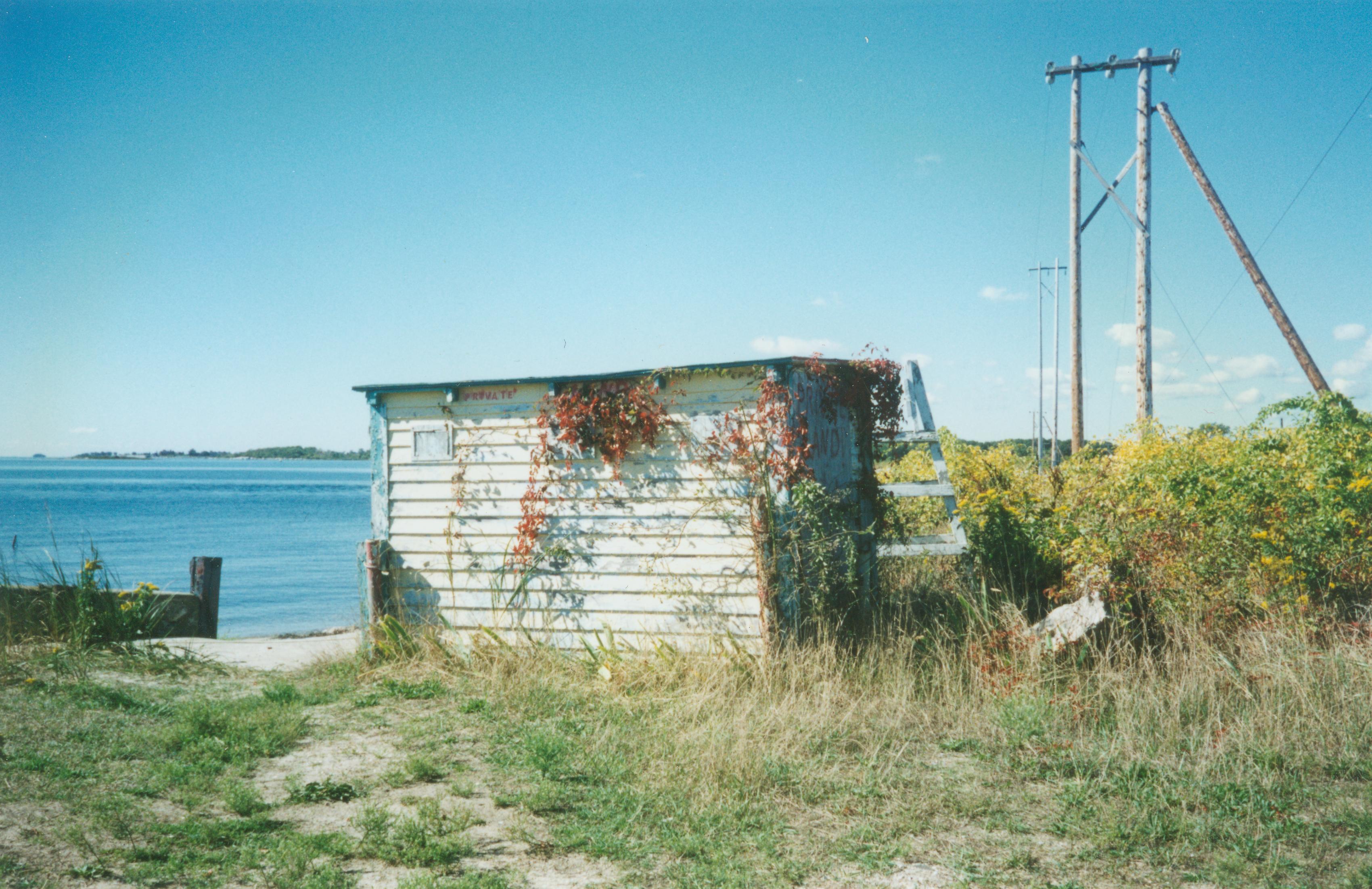 The shack a few years ago
LOVELOCK HOLM
By: Will Johnson
Lovelock Holm to the left
Lovelock Holm as a young man
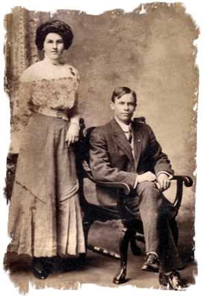
Lovelock Holm and his first wife Ruth
Schooner Rebecca Palmer on which many Saba men sailed.
Most of my sailing was on the “Fred A. Davenport” with Capt. Freemont Kimball of Booth Bay Harbor. I am sure your dad used to know our captain. I remember the “Cora F. Cressy”. She was a beautiful ship! Did you know Capt. Kimball, or Elery MacCauley, who was first mate? MacCauley’s brother was steward on the “Fred A. Davenport”. Was the “Cora F.Cressy” owned by the Winslow's from Portland, Maine?
I was also on the “Edith Folwell” under a captain from Connecticut.
Did you know a Mr. Steer from Deer Island? He was first mate with Capt. Sumner on the “Singleton Palmer”. Did you know Capt. Tullock? I made a trip with him. I believe the ship’s name was “Lizzie Borden.” On board was the Borden girl who killed her step-mother. She was a beautiful girl and very polite. There was no mention in the trial of her taking the trip with Capt. Tulleck and his wife.
The Kimball's had a jewelry store in Bath, Maine. There were two children, a boy and a girl. The boy had a limp in one leg. They were wonderful folks. Check and see if you can remember some of the names which I have listed. We used to haul coal to the Maine central yard in Portland; also to the Bangor and Roosti terminal at Searsport, Maine, as well as, to the Mystic docks in Boston. I wonder how many of these brave men are still living. Is your father still living? Did you know the foreman of the sail loft at Portland? It was operated by the Winslow’s. Many times I visited at their works for sails.
It was nice for you to write the article on those ships. Hoping to hear from you, I remain. Yours truly,
Lovelock Holm
P.S. Did you know any Capt. Simmons* of New York; or Blakes from Pleasantville, N.J.? They were connected with the “Bull Line” from Baltimore Maryland. L.H.
*The Capt. Simmons referred to was Capt. Thomas Simmons of Saba who was a captain on several of the “Bull Line” ships. Also the “Rebecca Palmer” had at least one Saba captain which was Capt. Lockland Heyliger. Many men from Saba, sailed on this great five master.
Mr. Holm received a reply to his letter on March 22" 1963 from Mr. Haskell:
“Dear Sir,
I was delighted to receive your letter of the 15th which was forwarded to me by YANKEE. Your letter was very interesting and you have quite a background in connection with the great schooners. You have sailed on some fine vessels.
As you suggested I have checked some of the names you mentioned in your letter and I certainly do remember them. Such as, Capt. Dan Smith of the “Elizabeth Palmer”, and Capt.Dave Sumner of the “Rebecca Palmer”. Also, Capt. William Totter of the “Singleton Palmer”. I realize of course that these captains changed around and were on different vessels as you and I came in contact with them I have heard my father mention the name of Captain Freemont Kimball of Boothbay Harbor, when he was captain of the “Fred A. Davenport”. My father was captain of the “Alice May Davenport” at one time or another. Yes I recall making trips to those ports you mentioned. Yes the “Sara Cressy” was owned by the J.S. Winslow's of Portland at one time. She was originally owned by Percy and Small of Bath, Maine. My father was a large owner during her early career. She went under in 1917. He had taken the 5 master “Mary W. Bowen” to Buenos Aires, Argentina with a load of coal and on the return passage north to New York a cargo of quebracho wood, which is used for medicinal purposes. He was 60 years old at the time and it was a hazardous trip and he was a sick man and died about two months later in a hospital in Boston.
You must have had many anxious moments in various storms at sea. There were the hurricane, snow storms, and fog to contend with. I guess we are both lucky to be alive today. My last trip was with my father on the 5 master "Governor Brooks" in 1913. I do not think there are many of us left today. One had to be courageous, skillfull, and daring, and reliable.
I thank you again for your splendid letter. We may run across each other some way in the future. We would have a lot to talk about. Write again when you have time. Cordially Yours,
Loren E. Haskell
P.S. Yes I remember the sail loft of Winslow's at Portland, and their ship chandler's store.
---Mr. Haskell avoided the question about Lizzie Borden for whatever reason.
Lovelock Holm also had a brother Benjamin who was a chemist of note in the United States as well. The correspondence between these two gentlemen confirm much of what I have written about Sabans working on the large four and five masted schooners of the Palmer fleet and many other lovely four master schooners build in Bath Main, Cloucester, Mass, And in Nova Scotia.
Lovelock lived an interesting life and never forgot Saba. I have other interesting documents relating to him but cannot put my hand on them to contribute to this article. May his memory be blessed.

Mary Louise Comingore, b. August 24, 1913, d. December 30, 1971, was known professionally as Dorothy Comingore, and was a film actress. She starred as Susan Alexander Kane in the movie Citizen Kane (1941). In earlier films she was credited as Linda Winters, and on stage as Kay Winters.
She was born in Los Angeles, was in Oakland briefly, and attended UC Berkeley.
She was 'discovered' by Charlie Chaplin when she was acting in Carmel, CA - though she later denied that he had assisted her career.
She did bit parts in movies until Orson Welles cast her in Citizen Kane. She received very positive reviews for her performance.
She married John W. Crowe of Lord's Point in 1962, they remained married until her death on December 30, 1971, at the age of 58.
 |
| L. Patrick Gray |
Louis Patrick Gray III was born in St. Louis, Missouri, on July 18, 1916. He attended schools in St. Louis and Houston, Texas. After attending Rice University for a period, Mr. Gray enrolled at the United States Naval Academy and received a Bachelor of Science degree in 1940. The Navy commissioned Mr. Gray as a line officer and he served throughout World War II, eventually leading the submarine Steelhead on five combat patrols in the Pacific, and in the Korean War.
In 1949, between his two tours of duty, Mr. Gray received a J.D. degree from George Washington University Law School. He was admitted to practice before the Washington D.C. Bar in 1949; later he was admitted to practice law by the Connecticut State Bar, the United States Military Court of Appeals, the United States Court of Appeals, the United States Court of Claims, and the United States Supreme Court. After retiring from the Navy in 1960 with the rank of Captain, Mr. Gray served as Military Assistant to the Chairman of the Joint Chiefs of Staff. In 1961, he entered private practice.
In the late 1960s, Mr. Gray returned to the federal government and worked in the Nixon administration in several different positions. In 1970, President Nixon appointed Mr. Gray as Assistant Attorney General for the Civil Division in the Department of Justice. In 1972, Mr. Gray was appointed Deputy Attorney General but before he could be confirmed by the full Senate, his nomination was withdrawn. Instead, President Nixon designated him as Acting Director of the FBI. Gray served in this position for less than a year. At this time he lived on the eastern ridge of the Quiambaug Valley.
It was during this time that the Watergate break-in and the ensuing scandal that led to President Nixon’s resignation occurred. Gray ended 32 years of silence about his role in the Watergate scandal in 2005, telling ABC’s “This Week” that he had reacted with “total shock, total disbelief” to the revelation that his former deputy, W. Mark Felt, was the secret Watergate source known as Deep Throat. “He fooled me,” said Gray. “It was like I was hit with a tremendous sledgehammer.” Critics alleged he tried to thwart the Watergate investigation — a charge he denied — even as Felt was secretly feeding information to Washington Post reporter Bob Woodward. When Felt was unmasked as Woodward’s source more than 30 years later, Gray said he believed the trusted deputy had been unhappy at being passed over for the top job and had talked to the Post in order to sabotage him.
“I think there was a sense of revenge in his heart, and a sense of dumping my candidacy, if you will,” he told ABC.
He died on July 6, 2005.
 |
| Vivien Kellems |
Vivien Kellems, (born in Des Moines, Iowa, June 7, 1896; died 1975) was a Connecticut industrialist who fought the U.S. federal government for over 25 years over withholding under 26 USC §3402, and other aspects of income tax in the United States. She was also a fervent supporter of voting reform and the Equal Rights Amendment.
Kellems received a BA from the University of Oregon in 1918, where she becamethe only woman on the debate team. She went on to earn a masters degree in economics, and worked towards a PhD at Columbia University and the University of Edinburgh.
In 1927, she founded Kellems Cable Grips, Inc., in the Quiambaug Valley, based on a patent for an invention in the area by her brother. She didn't live in the valley, though she was nearby on Mason's Island.
From Devvy Kidd (www.devvy.com):
On April 2, 2003, one year and one day after I filed my FOIA for Ms. Kellems' FBI file, lo and behold, it arrived - all 403 pages. Here's a teaser of what you will read:
Vivien sends old J. Edgar a letter asking to see him when she's in DC. Hoover writes back that will be fine if he's available. She writes back and thanks him. But, an inter office memo says that when Vivien arrives, she's to be told he isn't there and fob her off to an assistant.
Then the fireworks begin. It seems our Vivien had a tendre for one Count Frederic Karl von Zedlitz. This was in 1942 - WWII time. She wanted to marry the guy. Also, at this time she was going to run for Congress against the infamous Claire Luce Booth.
Guess what? A "rumor" began that old Von Zedlitz was a Nazi sympathizer. Her letters to the Count were intercepted under the Office of Censorship before Frederic got them. Very detailed stuff she wrote from her heart to the Count. Pet names, I love you stuff.
Someone leaked these letters because some members of Congress (Democrats) read juicy parts of her love letters to the Count on the house floor and the smear began big time. The media followed. Vivien didn't take it lying down and demanded an investigation. She was cleared as was the Count, but the damage was done. Vivien withdrew her name for nomination at the Republican Convention.
Already a prominent industrialist in Connecticut, she waded into the fight for the Equal Rights Amendment. In stating her case, she put forward her own brand of individualist feminism. By contrast, many “social feminists” at the time such as Eleanor Roosevelt opposed the ERA because it would strike down “protective legislation” for women. In 1943, Kellems asked “what are you going to do with all these women in industry? If we're good enough to go into these factories and turn out munitions in order to win this war, we're good enough to hold those jobs after the war and to sit at a table to determine the kind of peace that shall be made, and the kind of world we and our children are going to have in the future."
In 1948, she refused to collect withholding taxes from her employees on behalf of the government, stating, "if they wanted me to be their agent, they'd have to pay me, and I want a badge." She was interviewed about her tax opposition on "Meet the Press" on September 26, 1948 at a time when women rarely appeared on the show. She surrendered her case when continued pursuit of it threatened to bankrupt her company, but continued to challenge that and other aspects of the income tax for the rest of her life, saying in a 1975 Los Angeles Times interview that "[o]ur tax law is a 1,598-page hydra-headed monster and I’m going to attack and attack and attack until I have ironed out every fault in it." From 1965 until her death, Kellems reportedly only sent blank returns to the IRS. Her stands against the income tax system have made Kellems a mother figure to the tax protester movement.
 |
|
| A rough panorama of the Kellems factory on the east ridge | A view from near the front door of the factory, looking over the Quiambaug Valley mouth |
In 1962, Harvey Hubbell (Hubbell Lighting) bought the Kellems Company, and still runs it as the Kellems Division.
She died in 1975, of pneumonia, in Santa Monica, CA.
Here is a bit more information about her, UCONN Special Collections site.
April 26, 1923 ~ April 21, 2007
Donald Charles Kent, physician, aged 83, died
on April 21, 2007 due to complications from a chronic illness. Dr. Kent served as Medical Director of Electric Boat from 1982 through retirement in 1988. He continued working there as consulting staff physician and at Pequot Health Center in Groton and Health Services at Pfizer Central Research.
Born in Bonesteel, South Dakota in April 1923, son of Charles Alfred
and Thelma Wilson Kent. He graduated from the University of Nebraska in 1945, entered the Army as an enlisted soldier during World War II and completed his medical degree at the University of Nebraska in 1947. After the war, he was as a private practice physician in Michigan and Nebraska, and then served as a medical officer in the Navy in the Korean War, followed by a variety of posts including the Mediterranean during the Suez crisis, in Egypt during the Egypt–Israel conflict, and chief of medical services at various naval hospitals during the Vietnam War. Decorations include Legion of Merit, Bronze Star, Purple Heart and recipient of various meritorious awards for distinguished services. He retired
from the Navy as a Captain in 1971 after 25 years of service.
He served as Medical Director of American Lung
Association and Life Extension Institute in New York City and
concurrently taught clinical medicine at NYU Bellevue and Downstate Medical School from 1971 - 1982. Active in medical research and medical writing with 225 published articles in various publications. His specialty was in Pulmonary Disease, Infectious Disease, Occupational Health and Safety programs and a certified Fellow of the American College of Physicians, the American College of Chest Physicians, and the American Occupational Medicine Association.
Devoted Husband and traveling companion of Anna Marshall Kent of Woburn
MA. During the course of their marriage, they have lived in Massachusetts,
New York, Maryland, California, New Jersey and overseas in France, Ethiopia, Egypt, and lastly in Stonington, CT for the past 25 years. Anna Kent died in July
2006.
In his 1947 profile, Mitchell characterized Thompson as a "sad-eyed, easygoing Connecticut Yankee" and as a member of a family that had "fished and clammed and crabbed and attended to lobster traps" in Stonington waters for three hundred years. Thompson is "the most-highly respected captain in the Stonington fishing fleet," Mitchell wrote. Thompson himself fished the waters around Stonington for more than 50 years. What's more, he told wonderful stories, played the trumpet and painted for fun until it began to make him money, too. Born in Mystic in 1899, he retired from fishing in 1958 and died at the age of 88, eighteen years ago.
“It is one of Life’s most unfair Cruel Truths that happiness is some kind of more or less major component of virtue. It even seems to me sometimes…that happiness may be almost the ultimate virtue – in that it’s the hardest one to attain and (especially) to maintain.” --L. Rust Hills
L. Rust Hills, November 9, 1924 - August 12, 2008 . Hills was fiction editor for Esquire magazine from 1956-1963. While there he arranged a series of symposiums on "The Role of the Writer in America." He continued as a fiction editor with Saturday Evening Post (1963-1965) and then Audience magazine (1969-1972). He returned to Esquire as the book review columnist in 1973 and in 1977 became fiction editor there once again. He has also taught writing or literature at Carlton College, Columbia University, New School for Social Research, New York University, and University of Maryland Overseas Program. He has written several books and edited anthologies of writings from Esquire and Saturday Evening Post.
Books:
 Walter J. Pond, died Dec. 21 1941 on Lord's
Point. During WW I was a well-known composer of war, patriotic, and popular songs and marches.
Walter J. Pond, died Dec. 21 1941 on Lord's
Point. During WW I was a well-known composer of war, patriotic, and popular songs and marches.
Works:
 |
|
Dean's Mill School |
Dean's Mill School - grades 1 through 5.
 |
|
Mystic Middle School/Stonington Middle School, |
Mystic Middle School - grades 6 through 9.
This school when I attended was known as Mystic Junior High School. Then it became Mystic Middle School, and then Stonington Middle School (serving the entire town). It's now largely closed pending renovation.
In many parts of the world, early footpaths eventually turned into roads, and so the traces of early patterns of movement may still be found. The Quiambaug Valley is unusual in that many of the early roads have almost entirely disappeared. One reason, perhaps the most significant one, is that there were no bridges for quite some time, so that east-west travel involved heading north until one could cross whatever body of water stood in the way. Without bridges, the land seems finger-like, extending south to Wamphassuc Point, Lord's Point, Quiambaug Pt (the village area), Latimer Point, and the rise of land extending towards Mason's Island. This division of the land by different coves and inlets led to roads which led north to crossing points; with the coming of bridges, these roads fell into disuse.
For the same geographic reasons, east-west roads were generally to
the north - the Post Road ran across the northern parts of the feeder streams, and even Major Mason's road was north enough to avoid the requirement of bridges. Some of these roads remain, others don't.
From Wheeler's "History"16, page 114-115, sometime after Major Mason was granted an additional 100 acres by New London on November 15, 1651, that town gave him
...a right of way to the then contemplated meeting-house in Stonington, which was afterwards erected on the west slope of Palmer's Hill. This right of way was laid out to Major Mason sixteen rods wide, beginning at Pequotsepos Brook, a little way below the old county road, east of the village of Mystic, thence easterly along the south side of Capt. George Denison's second grant of land in Stonington, now known as the south boundary line of the farm that belonged to the late Mr. Oliver Denison, deceased; through the field next north of Mr. Jefferson Wilcox's dwelling-house, following the south line of said Denison land to Mistuxet Brook above where it falls into Quiambaug Cove, thence still further east over Palmer's Hill, leaving south of it one hundred and two acres of the late Deacon Noyes Palmer and other lands, passing just south of the Palmer burial place, and on east to Blackmore's Head (a rock so called), a short distance southerly of the junction of the Flanders with the old Stonington and Mystic road.
This sixteen-pole right of way was bequeathed by Major Mason to his sons, Hon. Samuel Mason and Lieut. Daniel Mason. That part of it between Pequotsepos Brook and the land of the emigrant, Thomas Miner, was held by Mr. Samuel Mason, his heirs and assigns. That part of said way, from the west side of the said Thomas Miner land to Blackmore's Head, was held by Lieut. Daniel Mason, his heirs and assigns.
It has hitherto been claimed that this sixteen-pole highway, with slight variations, furnished a tract for the highway now leading from the village of Mystic to the Road meeting-house, but such a claim is a wild guess, for the only place where said highways ran along together was a short distance between the Pequotsepos Brook and a point a few rods east of the old school-house site. Nor did the sixteen-pole highway extend west of this brook into the village of Mystic. The present highway from Mystic to the old meeting-house at the Road, with slight variations made therein by the town of Stonington, is a county highway, laid from Pistol Point to the old Road meeting-house, which stood at the time a few feet west of the present church edifice there.
It has taken me some time to trace this road, and it is still a work in progress. Below is an aerial picture showing the road from the top of Quiambaug Cove heading West:
|
|
|
Major Mason's road from the west (to the
left) to the top of Quiambaug Cove - route sketched in red. |
The road continues to the right towards Montauk Avenue:
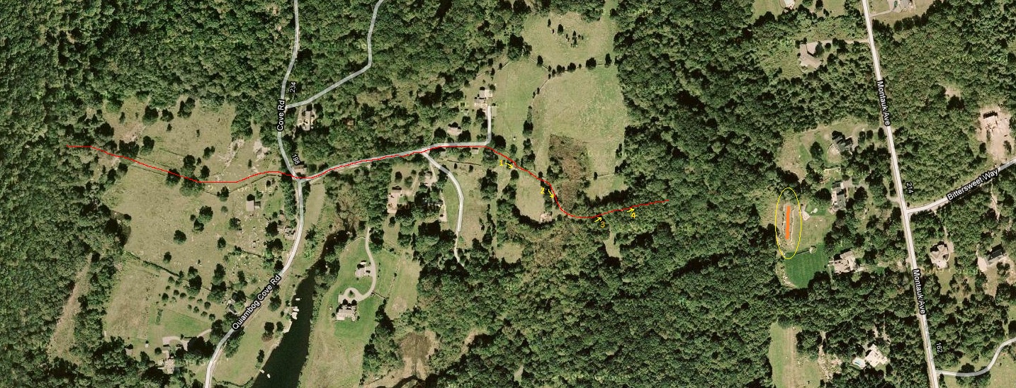 |
|
Major Mason's road as it cross the top of
the cove and heads to the right (west) up to Montauk Ave. |
My daughter Julia Bentz and I walked the road to the east of the cove
as far as we could in April 2010; the pictures below show what the road looks like at the points numbered in yellow in the above image (if you can't see these clearly, click on the image for a larger view). To the right of point 4 the road continues up the hill, but is more and more overgrown, until we could no longer follow it clearly (the track was also extremely muddy - it seems as if the road is now acting as a sort of drainage channel as well). The orange line in the above image (surrounded by a yellow oval) looks like it might be part of the road, but we came out a bit further to the north of that location.
|
|
||||
|
|
This road is in quite good condition, and clearly is in some use, at least near the floor of the valley. Further up the Montauk ridge the going gets difficult, and it was quite muddy, until the road disappears into nearly impassable brush (complete with prickers). At that point we circled around to the north, and ended up in a back yard on Montauk Ave.; where the road hit it exactly was possible to ascertain on this trip.
Before we got to the impassable brush we could see a level clearing, slightly downhill from the road as it heads north for a bit before continuing to climb the hill. It's possible that is where the first meeting house was - we will have to return and investigate.
The old Mystic Road used to run from the 'village of Quiambaug', essentially the loop of Wilcox Road today, to Mystic (possibly overlapping with the current Mistuxet Ave. near PequotSepos Road. In the 1970's I walked it frequently; it was in use by some vehicles as well, at least for part of its length. The development at Bishop's Cove obliterated much of it; recent development (Lamb's Way) has taken more - though with care one may still find some of its route. Fortunately it appears on older nautical charts and topographical maps, so its route is at least unambiguous.
 |
|
The old Mystic Road, from a 1932 chart of
Fisher's Island |
The story of the Post Road through the area is a bit surprising, and required a little detective work. Because of the need to include maps, photos, etc., I've moved information about it to a ; be sure to take a look.
Route 1 now runs through Quiambaug, but it was built in two segments, one running from Mystic to the village of Quiambaug, the other running across the cove to the Borough of Stonington.
The western part, that to Mystic, was begun in 1867. From the newspaper "Mystic Pioneer" of June 15, 1867:
The Quiambog Road. On Thursday, the 13th instant, the Honorable Board of Selectmen of the Town of Stonington, together with Mr. Daboll, County Surveyor, and some of the parties interested, met and surveyed the road which has for some time been under contemplation between this village [Mystic - ed.] and the romantic hamlet of Quiambog. The road as rayed out, commences in this village at Broadway, follows the lines of Washington Street and Denison Avenue, as designated on Gallup and Adam's map, to the old Denison Burying ground, through the northern part of which it passes; thence easterly across Griswold Cove [PequotSepos now - ed.] ... until it meets the southern end of the present highway near Quiambog Gove. The whole extent of the road is nearly one and two third miles... The land is given and fenced by parties along the route.
The road is remarkably strait [sic] and will form one of the pleasantest drives in the vicinity of Mystic and will open the resources of a part of the town hitherto much neglected, although there is already a large capital invested in the several Fish-oil mills... It is hoped that it may be opened to travel sometime next autumn.
On Thursday the Board of Selectmen were as jovial and alder manic around Mr. Noyes hospitable table, as any municipal board could be; and if the party lingered under Uncle Nathan's apple trees after dinner, it was because the sun shone down hot, because the chicken pie was not digested, because Hall wouldn't stop telling stories, and Crandall wouldn't cease to joke.
The current Route 1, and before it what was known as Old Route 1, has changed; it used to loop around the hills (Lord's Hill, and that of the Village). These loops were 'cut off' by a straightening of the road in the 1960's that cut through the hills. These cutoffs left loops of the old road, which are still in use.
That hill cut-through circa 1962 was part of a federal effort to improve Route 1, which was the main route along the shoreline, running from Maine to Florida. In Stonington various improvements were made, until the I-95 construction and extension to the RI border brought them to a halt, essentially at the Greenhaven road light in Wequetequock.
The portion running from Quiambaug to the Borough of Stonington seems to have been constructed after 1870. From the Stonington Mirror of November 5, 1870:
The Board of Selectmen met at Borough Hall, on Saturday last, for the purpose of receiving proposals for building the new road between this village and Quiambaug. This road, when completed, will be the most delightful drive in this vicinity, as it runs close by the shore almost the entire distance. A bridge 225 feet long will be built across Noyes' cove, and one 488 feet over the cove at Quiambaug. Quite a large number of proposals were handed in, and the bids, by sections, ranged as follows:
First
Section $200 to $900
Second Section $1300 to $1800
Third Section
$2,800 to
$4,000
One man thought he could build the whole thing for $20,000, and put in a bid to that effect. He didn't get the job. The contracts for the three sections were awarded to the following persons, who have already filed their bonds with the proper authorities, and will commence work immediately:
First Section - Nathan
Barnes and
Joseph S. Williams, Jr., $200
Second Section - Benajah (?) Davis,
$1,300
Third Section - Michael Rafferty,
$2,800
In 1870 Henry D. Langworthy, Samuel Langworthy, and Franklin Hancox signed an agreement to give the town a right-of-way through their lands for the original road from the cove to the intersection with Flanders Road. They received no money for this. (Town of Stonington Land Records, vol.40, p. 529)21, page 14.
Wilbur Road, running north from Route 1 along the eastern shore of Quiambaug Cove, is now a dead end road. It originally continued north to the cove crossing where Major Mason's road crossed. (It may have been named for a local oysterman known as Capt. Wilbur, but I haven't been able to confirm this).
I believe this was named after a Judge Collins who lived on the road.
Named due to the fact that, heading south on it, you have a good view of Montauk point on Long Island.
Named after the first two mills on the part of the road heading to Pequot Trail.
Named after the Wilcox family, many members of which resided here.
Named after Jerry Holmes Browne (or Brown, as others in has family have spelled it), a local farmer who died January 14, 1916. He was born October 17, 1841, the son of Randall and Mary (Holmes) Browne. He learned the machinist trade in Westerly, and fought in the Civil War with the 1st Rhode Island Cavalry, returning home to his farm after the war. (See the Randall Brown farm description above).
His mother, born Nov. 14, 1815, was the daughter of Jeremiah Holmes and Mrs. Ann B. Denison. Her father was a hero of the Battle of Stonington.
Jerry Browne is buried in the Elm Grove Cemetery along the Mystic River.
The first railroad in Connecticut, chartered in 1832, ran from Providence to the docks in Stonington - passengers traveling to New York took passage on steamboats there.

The New London and Stonington Railroad was chartered in 1852, with the aim of linking the Thames River to the New York, Providence, and Boston Railroad in Stonington. It took years to build this, during which time the railroad was merged with the New Haven and New London Railroad Company in 1856, with the new name of the New Haven, New London, and Stonington Railroad Company.
After a series of problems, bankruptcies, mergers, etc., this eventually became part of the New Haven Railroad (mroe fully, the New York, New Haven, and Hartford Railroad Company), then Penn Central, now Amtrak.
In the summer of 1857, Henry Langworthy and his brother Samuel sold stips of land to the New Haven, New London, and Stonington Railroad. From "Murder at Darling Hill"21, page 12:
Henry Langworthy received $315 for his portion, 99 feet wide and almost a quarter of a mile long. This piece cut through his land in the area between the Alexander Palmer farm on Wamphassuc Point and Cedar (Lord's) Point. Samuel's portion ran almost a half-mile from Henry's line to Quiambog Cove with provisions for two stone culverts, and the elder Langworthy brother was paid $750 for this larger piece of land. Both deeds allowed for "convenient crossings with cattle guards "at certain strategic spots to provide access to land south of the tracks13."
13Town of Stonington Land Records, vol. 28, pp. 174, 175
So it is likely that the original bridge over Quiambaug Cove was built shortly after these land transactions in 1857. Below is a photo of the bridge damaged in the '38 hurricane; it looks like the tracks have been pushed off of the bridge to the north, and it shows what some of the original stone construction probably looked like:

Eventually, when the railroad bridge over the Thames River in New London was complete (as well as that over the Connecticut River, and others), trains could travel directly to New York City. Here's one passing the Wilcox Rd loop:

The Groton and Stonington Street Railway ran through the valley, as did the Norwich and Westerly Railway - though that was a bit further north and not covered by this history. The G & S was founded in 1904, and went out of business in 1928.
|
| This is a picture of a trolley car heading west just after it has
crossed Quiambaug Cove; it is following the route of the original Route 1. You can see the bridge over the cove behind the trolley car; this bridge was just north of the current Route 1 bridge - the approaches are still there. The current Route 1 bridge is raised a bit; when driving over it if you look to the north you can see where the old bridge was. The road in the immediate foreground is now Wilcox Road; when the new Route 1 went in in 1962 the Wilcox Rd. loop was bypassed by a direct cut through the valley's western ridge. At left you can see a horse and carriage heading south on Cove Road, and the post and bench of the trolley stop are visible. |
 |
| This is looking in the other direction, from a point a bit further along Wilcox Rd. |
Grace Wheeler wrote about taking a trip along the line in 1907; the full text is here: http://www.mystichistory.org/digital_publications/trolley_ride.pdf
Below is an excerpt describing her travel across the valley; I think it worth quoting at some length as it gives a feel of the area at one point in time (along with quite a bit of history):
As you cross the present bridge you will see at the left “Wamphassett,” or “Wampossett,’ as it
was called when, in 1653, it was owned by Hugh Calkins, the name signifying a white land or
land frequented !by white birds. In 1776 Major Israel Hewitt of “Bear’s Den” fame gave in his
will to his two granddaughters, Amy Stanton and Anne Ledyard (wife of Col. William Ledyard),
a part of this same land, lying near to Capt. Israel Wordin’s house Quanaduct lies north of this
bridge, and at the right, almost hidden among tall trees, is the Day Place or Walnut grove, in
earlier times known as the Gershom Lambert estate. Making the curve, you pass the Grandison
Chesebrough homestead (now a barn), where the late Rev. Amos Chesebrough of New Hartford
lived in his youth. Now on past the Catholic cemetery and the little school house –
“ Those words contain a secret spring
That memory’s floodgates swing.
And recollections to us bring
Of happy days of yore.”
To be a schoolmaster in the olden time was to be an oracle of wisdom for young and old. Read
the agreement between John Stoyell of Voluntown and John Stanton and Nathaniel Gallup,
gentlemen undertakers of a school in the southwesterly part of Stonington, which shows how
instruction in reading, writing, and arithmetic for six months was compensated by finding said
Stoyell in meat, drink, washing, and lodging, keeping his horse, and sixty pounds in old tenor
money at the end of the term of six months school. At Harborside station a road from
Wamphassett crosses right, leading past the old Richardson estate (now occupied summers by
Judge Gilbert Collins’ family). This place was noted as the hiding place of Capt. Kidd’s “ninety
pieces of eight” in 1699.
Now up the hill, past Montauk avenue, which stretches away to the north by beautiful homes,
with a view of Lantern hill in the dim distance, we make a bend in the road and get a glorious
view of the Sound, “the Point,” Watch Hill, and many islands, with old ocean showing its best
as a background, gray and misty. Here at the right is Darling hill, where stood for years “the
Farmers’ Palace,” but where now are several summer homes. Let your eye rest for a moment in
the next door yard.
"On the sweet old fashioned posies,
Quaint in form and bright in hue
Marigolds with coats of yellow,
Morning glories, pink and blue.”
As we go swiftly around the curve, Cedar Point is in view at the right, with its summer colony, and in the distance the buildings of the Wilcox industry. Crossing the bridge, we come to Latham’s “neck,” and the Thomas Miner homestead, facing the water of Quiambaug cove. Here in 1635, dwelt one of the pioneers of Stonington, and now the ninth generation, with the same name, occupies the house. Could you stop and read the epitaphs on the old stones in the little graveyard at the left, you would be both amused and instructed.
Up the hill and through Wilcoxville, past the site of the old Green homestead, which is nearly
opposite one of modern architecture, you go on over the marshland, which in early days was a
great incentive to the pioneers to settle here that they might have the salt marsh grass for their
cattle. Now up the hill we see where, in 1700, stood the old “Williams house, in “Que-an-te-quahood’s field,” just north of the present home of Deacon B. F. Williams, vice-president of this
road. Opposite the house is the path to the Old Riding Way, which was the fording place
between Mason’s Island and the mainland; then past Williams cove, where, in 1814, the English
soldiers, attempting to destroy the village of Mystic, entered by mistake east of Mason’s Island
and ran their vessels, in the thick darkness, into this cove. The soldiers scrambled overboard to
get their barge into better water, but only sank their red coats and royal gilt buttons to their
waists in mud.
There are a number of points in the above that deserve comment.
This first example is a bit silly to be in this category, but I couldn't see where else to put it - it's an article from the Mystic River Historical Society newsletter that describes this website a bit. The URLs are out-of-date, but it does touch on the 'image fading' software a little: MRHS article
These are for the most part just passing mentions. There are (relatively) a lot of references in various historical works, mainly I think because the area was settled so early, and was in play between Massachusetts and Connecticut, and was in the midst of various struggles with the indians (the Pequot War, King Philip's War). I'm restricting this list to fiction. However, let me begin with a comment by a local literary figure, L. Rust Hills, mentioned above:
In March of 1965 I bought a place in the country and six months later quite work. I could have done it the other way around, of course - a lot of people do. Quitting work and buying houses in the country seem to go together somewhat like Sloth and Melancholy; you can't tell which one causes the other.
We started calling the place "Coveside", at first as a joke, but the name stuck. It is on the Connecticut coast, very near Rhode Island, halfway between two interesting towns, Stonington and Mystic. It is on the east side of an inlet called Quiambaug Cove, and at twilight with the sun setting behind the hills on the far shore, there is a quality of light that I know I have never seen anywhere else. It once belonged to an oysterman, one Captain Wilbur, and my deed specifies riparian rights in four acres of oyster beds right out in front of the house. They are now in eel grass, but I have a blueprint map (dated 1888) that shows how they were laid out.
This is from "How to Do Things Right: The Revelations of a Fussy Man" (David R. Godine, publisher, 1993). You can now find this online here at Google Books.
Other mentions:
Lord's Point appears as a location in Sanctuary by David Lewis.
In a rather unusual short story, "An Hour After Westerly" by Robert Coates, the main character stumbles into an area between Westerly and New London - actually he loses an hour or so of travel (driving on the old Post Road) and later on figures out where this must have been. On later exploration of the area he finds much that is familiar - to the point that it seems he's touching on an alternative life he might have lived. While not specific to the valley, the description of the area fits well; less so than it does other regions of the coast.
In an article in the New England Magazine (Vol. 24, 1901) entitled "Where Connecticut Has a Glimpse of the Sea", the author (Odell D. Tompkins) begins by describing the coast and then the Quiambaug valley:
The cover of the book below is a drawing of the Perkins Farm; the book is fiction, and while set in the area is not particularly tied to the valley:
According to the Mystic Press, a reunion was held in August, 1890, and an original poem about the Quiambaug/Mistuxet valley was recited by Prof. John K. Bucklyn:
Where the waves of the Atlantic
Beat against the granite rocks
Piling sea-weed thick upon them,
Like the crown of hoary locks;
Where the hills extend to ocean,
Like the fingers of a hand,
Shutting in the sunny valleys
By the billows of the land.
Where of old the Pequot warrior
Loved and wooed the dusky maid,
Bringing prize from land and ocean
That he won by bow or blade;
Where the poor, much dammed Mistuxet
Sought a cradle in the sea;
Where the winds might charm its slumbers,
Ever blowing wild and free;
There the pale-face Wilcox settled,
Building wigwams here and there,
Raising sons of manly beauty,
Raising daughters wondrous fair.
And the Davis tribe cast anchor
Where the water rippled near,
Making music very charming
Which the Wilcox came to hear.
And the Miner places his hearthstone
Nearer the complaining shore,
Where he heard the rising south wind
Make the billows seethe and roar.
This same Miner raised fat oxen,
And he taught them so to run
That they beat the fastest horses,
Not for money, but for fun.
In this vale of sun and shadow,
Where the lovely wild flowers grow,
Pale-face built a little school-house,
Where his children love to go.
When many youth had seen it,
Learning taste of birch and book,
Yearning off to wanter further
And on other lands to look,
There arose a girl named Moredock,
Who had herself learned to roam,
Who declared she'd have a picnic
And invite the wanderers home.
Then they came in goodly numbers,
Filled the woods along the shore,
And indeed, they filled their waistcoats
Till they could not fill them more.
Then they rose to make orations,
But such speeches ne'er were read,
For the overcrowded stomach
Wrought its influence on the head.
And some thought to write the verses
That should rival Homer's Greek,
But the lines were ever halting,
And the rhythm far to seek.
But they laughed beneath the oak tree,
Pledging friendship's mighty power,
And their lives seemed all the brighter
For the restful, social hour.
Here is a collection of images of the area:
Here's a brief composition by X, "Rainy day on Quiambaug Cove, tooling harmonics with Tim, and trying to capture the drizzle and mist":
When researching the valley I began to think about other music related to valleys; this is a rather tenuous connection, but it is interesting to see some of the common themes (often a longing for an idealized home). I thought I'd include a few links for your enjoyment:
Valley Winter Song,
by Fountains of Wayne
Copperline, by James
Taylor
The River, by Geoffrey
Oryema
Green River, Creedence
Clearwater Revival
I knew Mary Johnson and her husband Clifford, primarily as their paperboy in the ~1973 time frame. The interview mentioned here was done by my mother, Anne Bentz, probably around 1974. The acoustics aren't great - it was recorded on a portable cassette recorder - but if you turn up the volume a bit it's reasonably clear. Over the years I heard quite a bit of local history from Mary Johnson, much of which isn't in the interview; I will include it elsewhere and reference it as I can.
The interview is in two parts because the cassette tape had to be flipped; one part is one side, one part the other.
Just recently I've run it through some AI acoustic cleanup software. In the Part 2 section, the clock chimed, and the AI tool just attenuated the sound. I've included a "chimes" mp3 with that part, in the original form:
Mary Johnson Interview (2 parts):
Part 1
Part 2
Chimes section from Part 2
(For completeness, here are the original files: Original Part 1, Original Part 2)
She mentions her parents worked for Charles P. Williams. From "Murder at Darling Hill"21, page 125:
Charles Phelps Williams, Jr. owned 20 to thirty horses and a four-in -hand couch. In her Recollections of Old Stonington, Anne Atwood Dodge described him as "a large florid, rather imposing looking man, always very well turned out and excessively horsey", p. 15. In 1925 Williams moved to Newport, Rhode Island. He sold Stoneridge [the name of his house - Ed.], which then became a casino and speakeasy and burned to the ground in 1933.
This next excerpt is from an interview I did in 2007 with Alfred Wilcox (b. 9/11/1916, d. 9/11/2008), about the time he brought his small powerboat into the dock at the fertilizer factory on Latimer Point. He was between two vessels, and the forward one started up in reverse:
Al Wilcox boat story
Grokipedia article on Quiambaug
1 "Draggerman's Haul", by Ellery F. Thompson, Macmillan Co., 1950
2 "Under the Black Flag", by David Cordingly, Harcourt Brace & Co., 1996
3 "Stonington Chronology", by William Haynes, Pequot Press, 1949
4 "Historic Glimpses", by Carol W. Kimball, Flat Hammock Press, 2005
5 "Briefe and True Relation of the Discoverie of the
North
Part of Virginia in 1602", by John Brereton; see
the American
Journeys
repository.
6 "The East Coast Explorations of Giovanni Verrazano (1524)", Athena Review, Vol. 3, no.2: Peopling of the Americas
7 "Stonington Graveyards / A Guide", Stonington Historical Society, 1980
8 "700 yr sedimentary record of intense hurricane landfalls in southern New England", Jeffrey P. Donnelly et lots o' co-authors, Dept. of Geological Sciences, Brown University; at http://www.whoi.edu/science/GG/coastal/publications/pdfs/Donnelly-GSABull.pdf. Published in the Geological Society of America Bulletin, Volume 113, Issue 6 (June 2001), pp. 714-727
10. "Old Homes In Stonington", by Grace Denison Wheeler, 1903 (reprinted 1930), The Mystic Standard. Available from the Stonington Historical Society (Higginson Book Company reprint).
11. A letter from Joyce Lord Fontaine Knapke, great granddaughter of Mary Emeline Hill Lord, dated October 13, 2003, in the files of the Stonington Historical Society.
12. "Long Island Sound: An Atlas of Natural Resources", booklet prepared under the supervision of the Coastal Area Management Program of the Connecticut Department of Environmental Protection, November 1977, "1. Glacial History" section, page 4
13. "A Moveable Shore" by Peter C. Patton and James M. Kent, 1992. Duke University Press
14. "Stonington By The Sea", by Henry Robinson Palmer; first published in 1913; references here are from the Second Printing, June 1967.
15. "American Indian Languages: The historical linguistics of Native America", by Lyle Campbell (1997). ISBN 0-19-509427-1
16. "History of the Town of Stonington, County of New London, Connecticut, from its First Settlement in 1649 to 1900, with a Genealogical Register of Stonington Families", by Richard Anson Wheeler. Originally printing in 1900; my copy was reprinted by the Higginson Book Company, Salem, MA
17. The New York Times, December 28, 2003
18. The New York Times, May 19, 2002
19. "A History of Old Mystic 1600-1999", by Kathleen Greenhalgh, published by herself in 1999
20. "Little Bombardier and Pocket Gunner", by R. W. Adye, London; 1802
21. "Murder at Darling Hill", by Judith G. duPont, published by the Stonington Historical Society, 2007
22. "Westerly (Rhode Island) and Its Witnesses, for Two Hundred and Fifty Years, 1626-1876", Rev. Frederick Denison; Providence: J.A. & R. A. Reid, 1878, reprint, Higginson Book Co., 1994
23. "Watch Hill Through Time", Chaplin Bradford Barnes, 2005, The Watch Hill Conservancy
24. Caulkin's excerpt quoted from http://files.usgwarchives.org/ct/newlondn/history/families/richardson-amos.txt
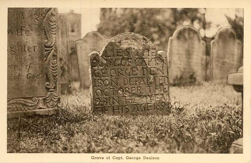
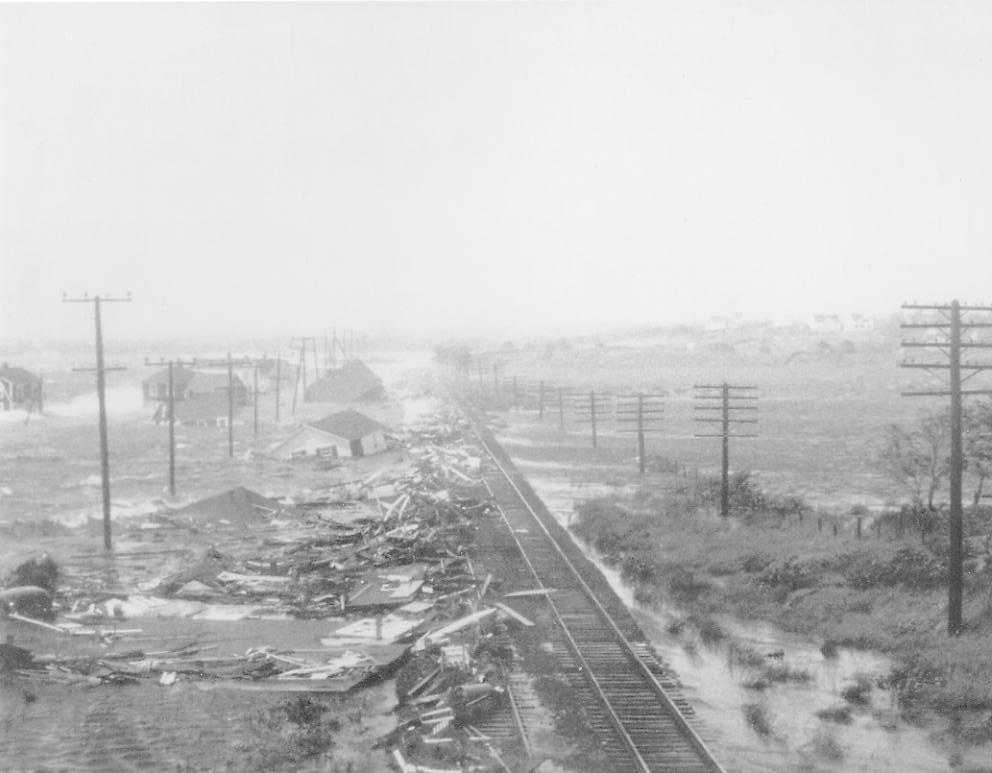
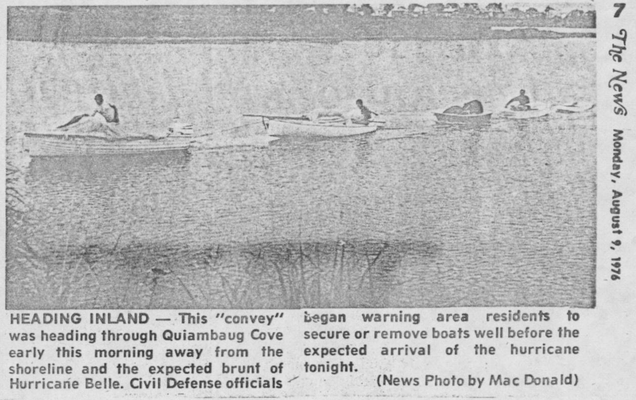

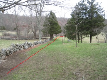
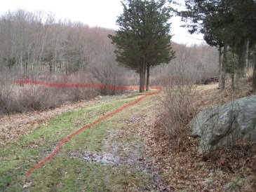
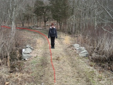
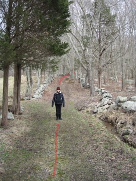
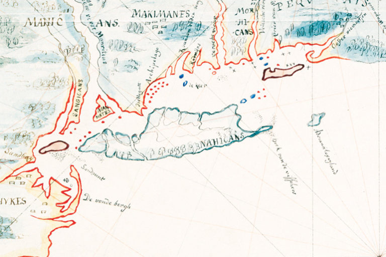