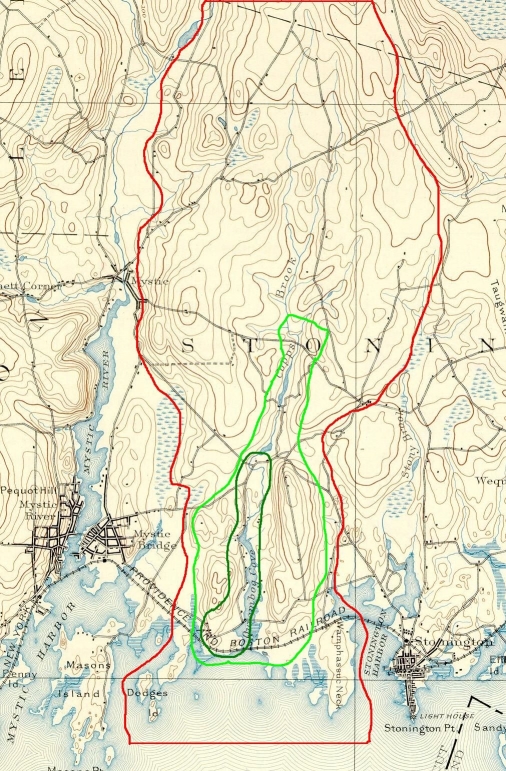
Below is an excerpt from an 1893 topographic map of the Quiambaug, Stonington area, marked up to show various ways of thinking about the Quiambaug valley:
The more northern part is a bit harder to make sense of, as the ridges aren't particularly clearly defined. It would be possible to trace the glacial cut that created the valley further to the north, but this sparsely-populated area likely had no unique connection to the more densely-settled valley to the south. And I have to 'draw a line' somewhere.
The red-bordered area is about 4 miles long in the north-south direction, and between 1 and 2 miles wide in the east-west direction. A reasonable estimate is that it contains about 6 square miles.