 |
|
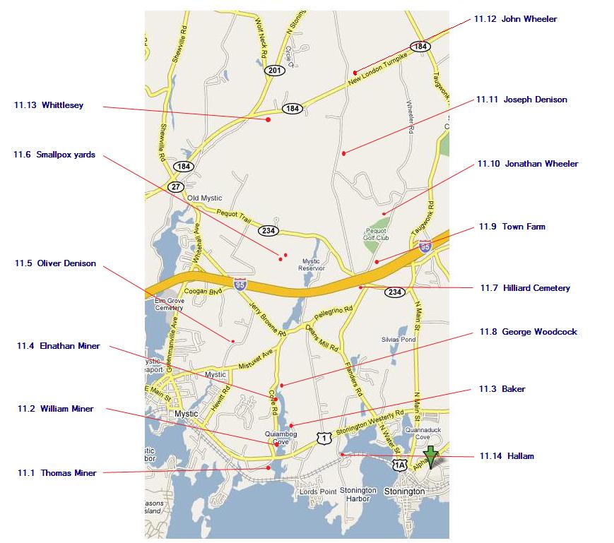
The locations of cemeteries in Quiambaug territory;
detailed latitude and |
Much of this information is from "Stonington Graveyards / A Guide" by the Stonington Historical Society. I highly recommend that book if you are interested in visiting any of these locations. (I give the latitude and longitude for each of them; these have hyperlinks to a KML (Keyhole Markup Language) file, usually ending in ".kmz" meaning that it is a compressed version, which will take you to an overhead view if you have an appropriate viewer installed, for example the free Google Earth.)
The tables listing the names of the people in each cemetery are from the Charles R. Hale Collection. This background on the Hale Collection is largely from the Connecticut State Library.
The Hale Collection is the legacy of an extraordinarily dedicated and persistent individual. He began his unusual vocation in 1916, when he made a chart of veterans' graves in a Rocky Hill cemetery for the Sons of Union Veterans of the Civil War, of which he was a member. Soon he was to do the same in Wethersfield and Newington and decided to expand his efforts to include all of Hartford County. At this point his work came to the attention of George S. Godard, State Librarian. Mr. Godard asked his aid in locating graves of Revolutionary veterans, as he had received many inquiries about them. With the outbreak of World War I, the Connecticut General Assembly appropriated funds to continue the project under the auspices of the State Library. But now Mr. Hale was to begin a project unique in the United States: the location and charting of all Connecticut veterans' graves from the original settling of the colony to the present. He also received the unique title of State Military Necrologist. In 1934 the project received federal relief funds to provide jobs for the unemployed. Later it became a W.P.A. project employing over 80 people.
Vital information from headstone inscriptions in over 2,000 Connecticut cemeteries was recorded in this W.P.A. project directed by Charles R. Hale ca. 1932-5. These records are bound in volumes for each town and are indexed on slips in a single alphabetical file. Many cemeteries had been abandoned and long-forgotten when Mr. Hale began his research. For example, the town clerk in North Stonington knew of only nine cemeteries in the town; Mr. Hale found 95. He made house-to-house inquiries about old vaguely remembered plots, and then crawled through the woods to find them. He even located a cemetery under Route 9 in Middletown and several that had been flooded by reservoirs. In total 2,269 cemeteries came to light.
The Hale Collection includes the Hale Collection of Connecticut Cemetery Inscriptions, the Hale Collection of Newspaper Marriage and Death Notices, ca. 1750-1865, a collection of Newspaper Abstract Volumes, and the Veterans' Deaths Index.
 |
|
The locations of cemeteries in Quiambaug territory;
detailed latitude and |
The Cemetery is at latitude 41°20'26.12"N, longitude 71°56'21.69"W.
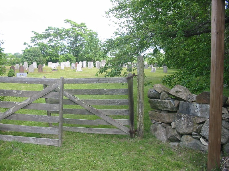
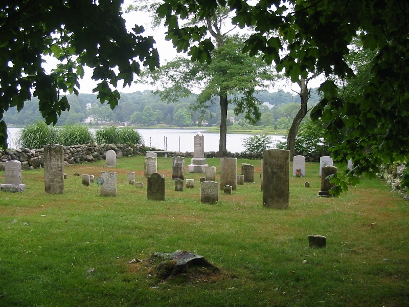
This is a burial ground on the south side of Route 1, adjacent to Quiambaug Cove, with roughly 100 or so graves. Most of the gravestones are of the Miner family, including a memorial stone to Thomas Miner, who died in 1760. Others buried here include Wilcoxes, Sheppards, and Cottrells. The stone of Nancy Willcocks is said to have been made by Charles Dolph, a noted stonecutter; there are also two stones cut by John Stevens of Newport.
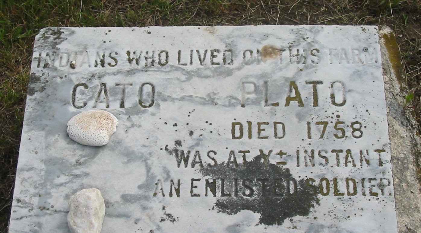
Two Indians, Cato and Plato, are buried here - they lived and worked on the Miner farm.
At the head of Quiambaug Cove was once another Minor graveyard, the Elnathan Miner yard. When the Elnathan Miner farmhouse burned down before World War I, all eight of the graves were moved to the Miner cemetery, where they now lie in a row near the entrance. One of them is a memorial stone to the three wives of Elnathan.
The Hale Collection does not list Cato or Plato, which is surprising.
The Town of Stonington did receive a grant from the estate of Pauline Miner Anderson of $5,000 for the perpetual upkeep of this cemetery.
|
Thomas Miner Cemetery #17 |
Miner, Jesse, died May 2, 1833, age 56 |
 |
 |
|
The entrance to the Miner Burial Ground |
About midway in, looking over Quiambaug Cove |
 |
 |
|
Cato & Plato, Indians who worked and lived on the farm. |
Leonard Wilcox: one of the Wilcox graves, from the Civil War |
|
In Grace Wheeler's book "Old Homes of Stonington", page
24, describes a house somewhat south of the Road Church as follows:
This wood-colored house with its old stone chimney, showing on the outside the entire length, as you come up the hill from the west, is still standing in a fair state of preservation and owned by the Palmer family. It is now known as Cato's house, having been occupied by one of Mr. Palmer's slaves, who was also a negro soldier of the Revolutionary War. He and his wife Flora occupied this house till their death [sic]. The story is told of Cato that when he was married, Rev. Mr. Hart was called in to perform the ceremony, and after its conclusion, and refreshments had been served, Cato said to him, "Mr. Hart, I want to see you round behind this door a minute?" Following him, Mr. Hart said, "What do you want, Cato?" "Why I want to know how much you are going to ax me for this job?" "Oh!" said Mr. Hart, "I guess about a dollar." "Cheap enough, Marsa Hart," Cato replied, "I'll give you all my custom."
|
This cemetery is at latitude 41°20'40.45"N, longitude 71°56'15.18"W.
This cemetery is off of Cove Road, just north of Edgemere Manor, perhaps 1/4 mile north of Route 1. There are about 2 dozen stones in good condition. William Miner, who died in 1833 at age 81, was a soldier of the American Revolution.
Veterans (before 1860) in the cemetery:
|
William Minor Cemetery, # 49 |
|
Brown, Desire W., wife of Elisha, died Jan. 1, 1871, age 83 |
 |
|
The William Miner Cemetery |
On the west bank of Quiambaug Cove there is a small burial place, containing the graves of Elisha Baker and his widow, Henrietta, Betsey Denison, Etherlinda Langworthy and Hannah Hedden. While Grace Wheeler transcribed these inscriptions, there are now no standing gravestones, only the broken base of one and another flat and partly buried in the ground.
|
Quambaug Cove Cemetery # 51 |
|
Langworthy, Etherlinda, wife of Samuel, died Nov. 20, 1835, age 68 |
This cemetery was at latitude 41°21'11.69"N, longitude 71°56'16.80"W.
This graveyard was where the (Freye's) summer house was built, but was moved in 1913 by Mr. Frank Miner of New Jersey to the Thomas Miner cemetery.
|
Elnathan Miner Cemetery # 50 |
|
|
This graveyard has been abandoned. From Grace Wheeler's book on page 315:
This small yard situated not far from the Denison Homestead, on land owned by Oliver Denison in 1873, formerly the property of his great-great-great grandfather, Capt. George Denison. It was only a small yard with nine graves, several of them have been taken up and carried to Elm Grove Cemetery at Mystic.
The grave of Ann Borodell Denison was among those. The remaining graves have been moved to the Denison Yard (near where Route 27 meets Route 1) where they may be found in the southwest corner.
|
Oliver Denison Cemetery # 48 |
|
Stones and bodies removed to Denison and Elm Grove Cemeteries |
Dean's Mill Farm, whose driveway is entered between two posts on the south side of Pequot Trail on the west ridge, was the site of two small yards near the farmhouse, which had been used as a smallpox hospital or "pest house" during the American Revolution. There are a few unmarked footstones left, but all else has disappeared from this small yard in a field, except for a headstone now in private hands. The inscription on that stone reads "In Memory of Mr. Samuel Packer who died July 22d 1777 with ye Smallpox in ye 45th year of his age. Time was when I, like thee did life possess But time is gone and I am turned to dust."
At the time the Hale collection was made, in 1933, there was also a stone inscribed "John Brown, died July 25th, 1777, aged 55."
The other small yard included (again in 1933) two footstones "M. S." and "B. F. S."
Small Pox Cemetery # 47 |
Brown, John, died July 25, 1777, age 55 |
|
Private Cemetery # 52 |
|
Foot Stone M. S. |
This cemetery is at latitude 41°22'21.44"N, longitude 71°55'0.08"W.
This is a large, well kept, shady yard on Flanders Road just south of Pequot Trail. The stones are all standing and in good condition. John Hilliard gave the yard by deed to the First Congregational Church, the present "Road Church", first built in 1674, which stands a short distance to the east on Pequot Trail. One of the stones marks the grave of Ebenezer Searle, who left five pounds in his will to purchase a Communion Service, which is still used to this day in the Road Church.
An unusual stone here, depicting an angel head, is the signed work of John Bull, a well-known Newport stonecutter.
Captain John Hilliard (d. 1786) and David Hilliard (d. 1776) are buried here.
|
Hillard Cemetery # 23 |
|
Collins Vault: |
|
George Woodcock's grave at the head of the cove, on the east side. |
|
George Woodcock's stone, 'George Woodcock 1712 -1767' |
This solitary grave is at the head of Quiambaug Cove, on the east side, near the Olmstead house. The stone stands alone in a wire enclosure, a short way south of the house.
George Woodcock, born in England, lived here by himself in the middle of the 18th century. The records say "He was a Sean [net]-maker and in 1749 he bought of Edward and Bridget Short for L235, in current money of New England, of the old tenor, two acres of land with dwelling house thereon standing; this being all the land Short bought of Thomas Miner, Samuel Mason and William Denison of Stonington". Mr. Woodcock's will was a singular one - he left a swarm of bees to a friend and the rowan trees on his meadows to a man to whom he owed a debt in hopes it would cancel the bill. He directed that a minister from Groton preach at his funeral, for which he was to be given a good meal and have his horse fed.
This small burying ground is on a wooded knoll just southeast of the sixth green of the Pequot Golf Club, and close to I-95. No walls enclose it, and the markers are natural unmarked field stones placed on edge, except for the fallen marble stone of Bridget Riley, wife of Asah Lamphere, who died in 1862. Because of the date of this one stone and its proximity to the Town Farm (now the Pequot Golf Club and adjacent land) many have assumed that the unmarked stones are those of Town Farm residents. Old timers, however, believe the plot was an old Indian burying ground; the type of stone seems to confirm this.
|
Town Farm Cemetery # 42 |
|
Lamphere, Bridget Riles, wife of Asa, died Jan. 18, 1880, age 62 |
This yard was situated a little southwest of the house built by Jonathan Wheeler. In his will dated 1785, he says, "I sequester one quarter of an acre of land at ye southward of a ledge of rocks for a burying place for my family and their heirs and successors forever." His house no longer stands, and the Yard is inaccessible from Wheeler Road because of growth (it may be reached from the Pequot Golf Club).
One stone reads "In memory of Joshua Wheeler who died Dec. 1st, 1861, aged 71 years and 8 months. How pleasant it is at the close of day, not to have to repent, to reflect on the past and be able to say - My time has been properly spent."
|
Jonathan Wheeler Cemetery # 24 |
|
Wheeler, Sanford, born Nov. 10, 1809, died Oct. 31, 1892 Other10, page 288: "In memory of Mr. Jonathan Wheeler, who
departed this life Oct. 8, 1790, in ye 82nd year of his "In memory of Mrs. Esther Wheeler, relict of
Mr. Jonathan Wheeler, who died March 18th, 1799, "In memory of Miss Thankfull, daughter to Mr.
Jonathan and Mrs. Esther Wheeler, who died |
This cemetery is in the woods east of Al Harvey Road (on the eastern ridge, to the north). The stones are mostly 18th century and their condition varies.
|
Joseph Dennison Cemetery # 53 |
|
Whipple, Mercy, relict of William, died Feb. 1811, age 86 |
This yard is deep in the woods, in the northeast quadrant formed by the intersection of Route 184 and Al Harvey Road. There is no enclosure, only eight gravestones all standing with inscriptions legible. One is "Ann B. Wheeler, relict of Capt. John Wheeler who died April 17, 1842 aged 72 years. I know that my Redeemer liveth."
|
John Wheeler Cemetery # 38 |
|
Wheeler, John, died Jan. 27, 1795, age 51 |
This cemetery is off of Route 184, on private property. There are only three gravestones, surrounded by a stone wall. One is a granite monument about four feet square inscribed to Maria and Joseph Tift; the other two are marble stones for Thomas and Polly Whittlesey. There is also an unmarked grave of Daniel Tift, son of Joseph and Maria.
|
Whittlesey Cemetery # 37 |
|
Whittlesey, Thomas, died Aug. 8, 1846, age 76 |
This cemetery is at latitude 41°20'34.58"N, longitude 71°55'9.97"W.
This cemetery is on the northwest shore of Stonington Harbor, just north of the Amtrak tracks. Half the stones are upright, some are fallen, some broken. One quarter of the yard is a Palmer family enclosure.
|
Hallam Cemetery #32 |
|
Burdick, Mary A., wife of Anderson, died Dec. 2, 1834, age 26 |
When I was about 12 I heard about some quite old Indian graves at the head of Quiambaug Cove. They were described to me as mounds of smallish stones, and I believe there were two of them. I never did find them, though I was only sporadically looking. I spoke with Sam Knox about them, and he had seen them.
The motifs, styles, and materials of tombstones have allowed the stonecarving work of individuals (or families) to be traced with some degree of accuracy.
Back to the main Quiambaug Valley page